Maps of Szombathely
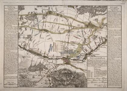
Situations Plan Der Gegend um Steinamanger, wo das adelich Hugarische Insurgenten Corps unter Comando Seiner Königlichen Hoheit des Erzherrzogs Joseph Palatinus vom 6ten Augusti bis 13ten September 1797 im Lager gestanden und im Manoeuvriren geübet worden
Ponheimer, Kilian
Guns.
from Spezialkarte der osterreichisch-ungarischen Monarchie.
Štajnamanger
1 : 200000 Szombathely (Maďarsko) Kartografska radionica
Comitat Eisenburg
1 : 290000
[Steinamanger und Umgebung]
1 : 144000 K. u. k. Militärgeographisches Institut
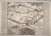
Steinamanager und Kormend.
from Spezialkarte der osterreichisch-ungarischen Monarchie.
Szombathely
1 : 75000 Steinamanger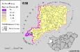
Slowenen im Komitat Vas 1980
Komitat Vas Slowenen, Siedlung Bottlik, Zsolt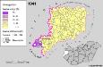
A szlovének arány és száma Vas megyében 1941-ben
Komitat Vas Slowenen, Siedlung Bottlik, Zsolt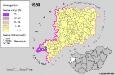
A szlovének arány és száma Vas megyében 1980-ban
Komitat Vas Slowenen, Siedlung Bottlik, Zsolt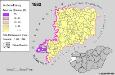
Slowenen im Komitat Vas 1880
Komitat Vas Slowenen, Siedlung Bottlik, Zsolt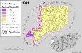
Slowenen im Komitat Vas 1941
Komitat Vas Slowenen, Siedlung Bottlik, Zsolt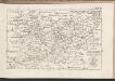
C. Castriferrei
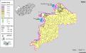
Ungarn Komitat Vas
Steinamanger 161, uit: Special-Karte von Mittel-Europa / nach amtlichen Quellen bearbeitet von W. Liebenow
1 : 300000 titelvariant: W. Liebenow's Mittel-Europa; Annotatie: Titel boven de bladen: W. Liebenow's Mittel-Europa Johannes Wilhelm Liebenow 1822-1897 Frankfurt a. M. : Ludwig Ravenstein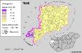
A szlovének arány és száma Vas megyében 1880-ban
Komitat Vas Slowenen, Siedlung Bottlik, Zsolt
Vas vármegye
1 : 450000 Kenedics, József Görög, Demeter Görög
Comitatus Castri Ferrei
1 : 110000 Maďarsko Kenedics, Joseph Mansfeld, Johann Ernst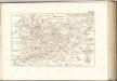

Sbírka map a diagramů použitých na mírových konferencích v Paříži v letech 1919 - 1920
Siedlungsgebiet der Deutschen nach dem Nachbarschaftsindex für Westungarn 1941
Ungarn, Transdanubien, Deutsche, Siedlung Bottlik, Zsolt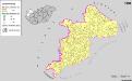
Siedlungsgebiet der Deutschen nach dem Nachbarschaftsindex für Westungarn 1980
Ungarn, Transdanubien, Deutsche, Siedlung Bottlik, Zsolt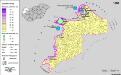
Siedlungsgebiet der Deutschen nach dem Nachbarschaftsindex für Westungarn 1880
Ungarn, Transdanubien, Deutsche, Siedlung Bottlik, Zsolt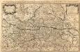
Partie du Cercle d'Austriche Scavoir l'Archiduché d'Austriche Divisé en Haute et Basse
1 : 510000 Mollova mapová sbírka Sanson, Guillaume Jaillot, Alexis Hubert
Kroaten in West-Ungarn 1941
Transdanubien Kroaten, Siedlung Bottlik, Zsolt
Kroaten in West-Ungarn 1880
Transdanubien Kroaten, Siedlung Bottlik, Zsolt
A horvátok aránya és száma Nyugat-Magyarországon 1980-ban
Transdanubien Kroaten, Siedlung Bottlik, Zsolt
Kroaten in West-Ungarn 1980
Transdanubien Kroaten, Siedlung Bottlik, Zsolt
A horvátok aránya és száma Nyugat-Magyarországon 1941-ben
Transdanubien Kroaten, Siedlung Bottlik, Zsolt
A horvátok aránya és száma Nyugat-Magyarországon 1880-ban
Transdanubien Kroaten, Siedlung Bottlik, Zsolt