Maps of Poland


Nr. 12. Die Hussitenkämpfe
Böhmische Länder, Mitteleuropa, Hussitenkriege
Reichstags Wahlkarte des Deutschen Reiches

Charte des Preussischen Staats
Neuester Schul-Atlas Walch, Johann im Verlag bei Joh. Walch
Eisenbahnen im Deutschen Zollverein 31.12.1836
Deutschland Eisenbahnnetz, Deutscher Zollverein Kunz, Andreas ; Moeschl, Joachim Robert
Atlas für Handel und Industrie: Für Kaufleute, Fabrikante u. Gewerbetreibende, Handlungs- u. Gewerbe-Schulen

Thüringen im Deutschen Reich 1919
Thüringen, Deutschland Kunz, Andreas ; Moeschl, Joachim Robert
Eisenbahn- und Reise-Karte vom Deutschen Reiche
1 : 1750000 Německo E. Heckendorff's Verlag
Regni Borussiae et Electoratus Brandenburgici, Ceterarum que, Quae Fridirici Reg. Bor. sceptro reguntur nec non finitimarum Prov. Delineatio
1 : 2000000 Mollova mapová sbírka Schenk, Pieter Schenk, Peter I
Regni Borussiae et Electoratus Brandeburgici, Ceterarumque Quae Friderici Regis Boruss. sceptro reguntur nec non finitimarum Provinciarum Delineatio
1 : 2000000 Mollova mapová sbírka Halma, François Halma, Franciscus
Deutschland nach dem Zweiten Weltkrieg 1.9.1945
Deutschland Kunz, Andreas ; Moeschl, Joachim Robert
Thüringen im Deutschen Reich 1928
Thüringen, Deutschland Kunz, Andreas ; Moeschl, Joachim Robert
Eisenbahnen im Deutschen Zollverein 31.12.1864
Deutschland Eisenbahnnetz, Deutscher Zollverein Kunz, Andreas ; Röss, Wolf ; Moeschl, Joachim Robert
Länder im Deutschen Reich 1930
Deutschland Kunz, Andreas ; Moeschl, Joachim Robert
Länder im Deutschen Reich 1923
Deutschland Kunz, Andreas ; Moeschl, Joachim Robert
Thüringische Staaten im Deutschen Reich 1909
Thüringen, Deutschland Kunz, Andreas ; Moeschl, Joachim Robert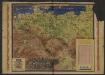
L'occupation de l'Allemagne
1 : 1724000 Jacques Mercier; Je cherche... Lyon : Je cherche...
General-Karte von Preussen
Grosser Hand-Atlas über alle Theile der Erde in 170 Karten Meyer, J. Verlag des Bibliographischen Instituts
Europe Centrale (Partie Centrale).
1 : 1750000 Jouvet et Cie.

Germany : International frontiers 1937 : internal boundaries 1944
1 : 1600000 [London] : [War Office]
States of the Late Germanic Confederation.
1 : 2344320 Fullarton, A. & Co.
Kriminalistiche Karten
Francie Meyer, Joseph Bibliographisches Institut
Verbreitung einiger Krankheiten in Deutschland
Německo Meyer, Joseph Bibliographisches Institut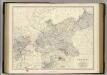
Prussia.
1 : 2032000 Johnston, Alexander Keith, 1804-1871
Kaart van het oostelijk front
1 : 1900000 [S.l. : s.n.]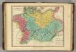
Germania Antiqua. (1826)
1 : 4400000 Tanner, Henry S.
Carte de la monarchie prussienne, a l'orient du Weser
1 : 2300000 Prusko Mentelle, Edme Tardieu, Pierre François
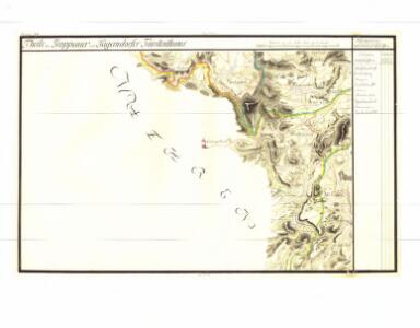
Polen u. Nachbarländer 963 bis 992
1 : 12000000 Polen