Maps of Germany


States of the Late Germanic Confederation.
1 : 2344320 Fullarton, A. & Co.
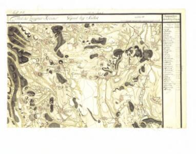
Nr. 12. Die Hussitenkämpfe
Böhmische Länder, Mitteleuropa, Hussitenkriege
Germany.
1 : 4200000 Greenleaf, Jeremiah
Germany.
1 : 4200000 Greenleaf, Jeremiah
Germany.
1 : 4308480 Burr, David H., 1803-1875
Bibliopolische Charte von Deutschland
1 : 2420000 Evropa střední Herder, Bartholomä J.J. Weber
Deutsches Reich nebts Deutsch-Österreich und Schweiz
1 : 1825000 Evropa střední Handtke, Friedrich Carl Flemming
Deutschland
1 : 4500000 Německo Grimm, Johann Ludwig Scharrer Simon Schropp
Deutscher Sprachtatlas
Map 10 from a 1926 linguistic atlas of Germany: Deutscher Sprachatlas, auf Grund des von Georg Wenker begründeten Sprachatlas des Dentschen Reichs ... bearbeitet bei der Zentralstelle für den Sprachatlas des Deutschen Reichs und deutsche Mundartenforschung under Leitung von Ferdinand Wrede. Marburg
Deutschland
1 : 2350000 Evropa střední Weiland, Karl Ferdinand Geographisches Institut
Deutschland
1 : 2350000 Evropa střední Weiland, Karl Ferdinand Geographisches Institut
Deutschland
1 : 2350000 Evropa střední Weiland, Karl Ferdinand Geographisches Institut
Germany.
1 : 5400000 Lucas, Fielding Jr.
Map of Germany.
1 : 5100000 Bowen, Emanuel
Deutschland
Hypsometrischer Atlas Ziegler, Jakob Melchior Topogr. Anstalt v. J. Wurster u. Comp.
Deutschland.
1 : 2300000 Weiland, C. F. (Carl Ferdinand), d. 1847
Germany, Switzerland, N. Italy.
1 : 5300000 Mitchell, Samuel Augustus
Thüringische Staaten im Deutschen Bund 1820
Thüringen, Deutschland Kunz, Andreas ; Moeschl, Joachim Robert
Fürstentum Reuß-Lobenstein-Ebersdorf im Deutschen Bund 1824
Reuß-Lobenstein-Ebersdorf, Deutschland Kunz, Andreas ; Moeschl, Joachim Robert
Staaten im Deutschen Bund 1848
Deutschland Kunz, Andreas ; Moeschl, Joachim Robert
Herzogtum Sachsen-Altenburg im Deutschen Bund 1826
Sachsen-Altenburg, Deutschland Kunz, Andreas ; Moeschl, Joachim Robert
Deutschland
1 : 3500000 Evropa střední Handtke, Friedrich Carl Flemming
Herzogtum Sachsen-Hildburghausen im Deutschen Bund 1820
Sachsen-Hildburghausen, Deutschland Kunz, Andreas ; Moeschl, Joachim Robert
Fürstentum Schwarzburg-Sondershausen im Deutschen Bund 1820
Schwarzburg-Sondershausen, Deutschland Kunz, Andreas ; Moeschl, Joachim Robert
Deutschland
[Allgemeiner Atlas über alle Theile der Erde in 29 Blättern] Ziegler, Jakob Melchior Top. Anstalt v. J. Wurster u. Comp.
Herzogtum Sachsen-Coburg-Saalfeld im Deutschen Bund 1820
Sachsen-Coburg-Saalfeld, Deutschland Kunz, Andreas ; Moeschl, Joachim Robert
Fürstentum Reuß-Lobenstein im Deutschen Bund 1820
Reuß-Lobenstein, Deutschland Kunz, Andreas ; Moeschl, Joachim Robert