Maps of Barstow

Map showing a part of the Palomas Mining District and the Piru creek ditch, situated in Los Angles [sic] and Ventura Cs. California
1 : 147520 Shows mining claims including "Patented Gold Gravel" claim by Jenkins, townships and ranges, creeks and rivers, residences, and local features. De Laveaux, Gustave. Manuscript Map
Los Angeles
1 : 250000
Los Angeles
1 : 250000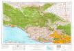
Los Angeles
1 : 250000
Los Angeles
1 : 250000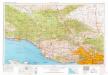
Los Angeles
1 : 250000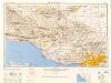
Los Angeles
1 : 250000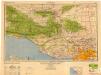
Los Angeles
1 : 250000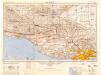
Los Angeles
1 : 250000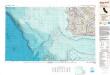
Santa Maria
1 : 250000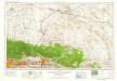
San Bernardino
1 : 250000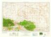
San Bernardino
1 : 250000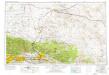
San Bernardino
1 : 250000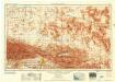
San Bernardino
1 : 250000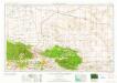
San Bernardino
1 : 250000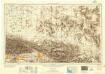
San Bernardino
1 : 250000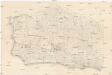
[Santa Barbara County]
Kalifornie
Santa Maria
1 : 100000
Santa Maria
1 : 100000
Victorville
1 : 100000
Cuyama
1 : 100000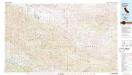
Cuyama
1 : 100000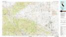
Lancaster
1 : 100000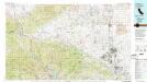
Lancaster
1 : 100000
73C. Land Classification Map Of Part Of S.W. California.
1 : 253440 Wheeler, G.M.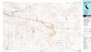
Newberry Springs
1 : 100000
Barstow
1 : 125000
Barstow
1 : 125000
Barstow
1 : 125000
Barstow
1 : 125000
Elizabeth Lake
1 : 125000
Elizabeth Lake
1 : 125000
Elizabeth Lake
1 : 125000
Elizabeth Lake
1 : 125000
Elizabeth Lake
1 : 96000
Elizabeth Lake
1 : 125000
Mt. Pinos quadrangle showing San Andreas Rift.
1 : 125000 U.S. Geological Survey
Tejon quadrangle showing San Andreas Rift.
1 : 125000 U.S. Geological Survey
Palmdale quadrangle showing San Andreas Rift.
1 : 125000 U.S. Geological Survey
Guadalupe
1 : 125000
Guadalupe
1 : 125000
Guadalupe
1 : 125000
Guadalupe
1 : 125000
Guadalupe
1 : 125000
Guadalupe
1 : 125000
Lompoc
1 : 125000
Lompoc
1 : 125000
Lompoc
1 : 125000
Lompoc
1 : 125000
Lompoc
1 : 125000
Santa Ynez
1 : 125000
Santa Ynez
1 : 125000
Santa Ynez
1 : 125000
Santa Ynez
1 : 125000
Santa Ynez
1 : 125000
Tejon
1 : 125000
Tejon
1 : 125000
Tejon
1 : 125000
Tejon
1 : 125000
Tejon
1 : 125000
Tejon
1 : 125000
![Map showing a part of the Palomas Mining District and the Piru creek ditch, situated in Los Angles [sic] and Ventura Cs. California](https://images-2.georeferencer.com/images/iiif/435338339017/full/,300/0/native.jpg)

