Maps of Los Angeles County

Map of a part of Southern California, showing gaging stations
1 : 1250000 Relief shown by contours and spot heights. Map is plate 1 and 2 from the U.S. Geological Survey's Water- supply paper 447. Includes index. Geologic Survey (U.S.) [Washington, D.C.] : U.S. Geological Survey, 1920.
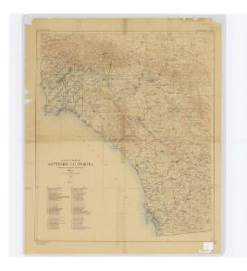
Ventura, Los Angeles, San Bernardino, Orange, and San Diego Counties.
1 : 760320 Blum, George W.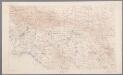
[Recto], uit: [Los Angeles-Riverside area] / R.U. Goode, geographer in charge ; comp. by J.E. Rockhold
1 : 250000 Annotatie geografische gegevens: Opname: 1893-1900 Goode, R. U.; Rockhold, J. E. [Washington, D.C. : U.S. Geological Survey]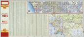
Los Angeles and Vicinity (continued from previous image).
Shell Oil Company
[Recto], uit: [Orange-San Diego area] / R.U. Goode, geographer in charge ; comp. by A.F. Hassan
1 : 250000 Annotatie geografische gegevens: Opname: 1891, 1898-1902 Goode, R. U.; Hassan, A. F. [Washington, D.C. : U.S. Geological Survey]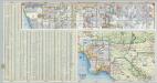
Los Angeles and Vicinity.
Shell Oil Company
California Freeway and Expressway System, January 1967.
1 : 1192107 California Department of Transportation, Division of Highways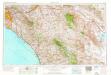
Santa Ana
1 : 250000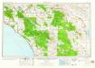
Santa Ana
1 : 250000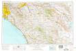
Santa Ana
1 : 250000
Santa Ana
1 : 250000
Santa Ana
1 : 250000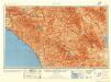
Santa Ana
1 : 250000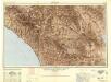
Santa Ana
1 : 250000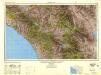
Santa Ana
1 : 250000
Existing airports & landing fields, County of Los Angeles
1 : 1250000 Includes inset of north part of Los Angeles County and index. Los Angeles County (Calif.). Regional Planning Commission [Los Angeles, Calif.] The Commission
Commutation time (at 15 minute intervals) and distribution of population, Los Angeles County, 1930.
1 : 1200000 Commuting California Los Angeles County. Hand colored. "Source: Regional Planning Commission, Los Angeles." United States. Federal Housing Administration. Division of Economics & Statistics. [Washington, D.C.?] Federal Housing Administration, Division of Economics and Statistics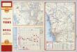
Street Map of San Diego (Eastern Section). Downtown San Diego. Metropolitan San Diego and Vicinity.
Shell Oil Company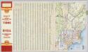
Los Angeles and Vicinity.
1 : 285120 Shell Oil Company
Verso: Los Angeles, California.
Hill, E. F.
Map of Beaches and Nearby Point of Interest, City of Los Angeles.
Security Savings Bank
San Diego
1 : 100000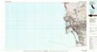
San Diego
1 : 100000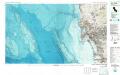
San Diego
1 : 100000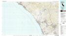
Oceanside
1 : 100000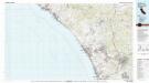
Oceanside
1 : 100000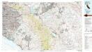
Santa Ana
1 : 100000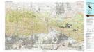
San Bernardino
1 : 100000
Map Showing State Highway System (California), 1932.
1 : 1463040 California Department of Public Works, Division of Highways