Gecatalogiseerde kaart
Carte de la Côte d'Ivoire dressée par A. Meunier. Bingerville


Volledige titel:Carte de la Côte d'Ivoire dressée par A. Meunier. Bingerville
Jaar illustratie:1904
Pubdatum:1904
Uitgever:Paris : Service Géographique des Colonies
Fysieke grootte:20 x 30 cm
Schaal kaart:1:500 000
Carte de la Côte d'Ivoire dressée par A. Meunier. Bingerville
1904
A. Meunier
1:500k
Colonie de la Côte d'Ivoire. Grand Lahou. Lagune de Lahou et rivière Bandama
1894
Pobéguin, Henri 1856-1951
1:150k
Colonie de la Côte d'Ivoire. Tiassalé. Vallées des rivières Bandama et H'Zini
1895
Pobéguin, Henri 1856-1951
1:150k
Carte des colonies de l'A.O.F. Bingerville
1924
Afrique occidentale française. Service géographique
1:500k
Colonie de la Côte d'Ivoire. Ouosso. Région sud du Baoulé
1895
Pobéguin, Henri 1856-1951
1:150k
Carte administrative de la Côte d'Ivoire. Répartition des cercles au 1er janvier 1909
1909
Afrique occidentale française. Service géographique
1:2m
Carte de l'Afrique occidentale française. Bingerville, Porto-Novo
1903
France. Service géographique des colonies
1:2m
Carte des possessions anglaises et françaises sur le Golfe de Guinée
1884
Paris : impr. de F. Menetrier
1:5m
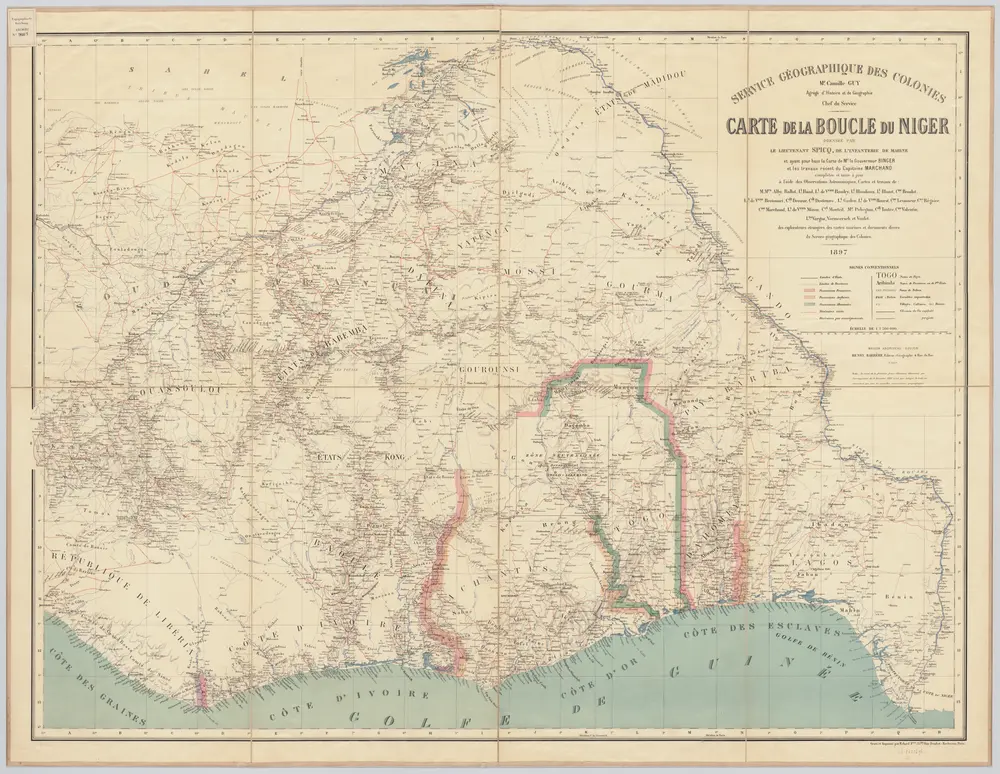
Carte de la boucle du Niger / dressée par Spicq ; Service Géographique des Colonies
1897
Henri Eugène Spicq; Service Géographique des Colonies
1:2m
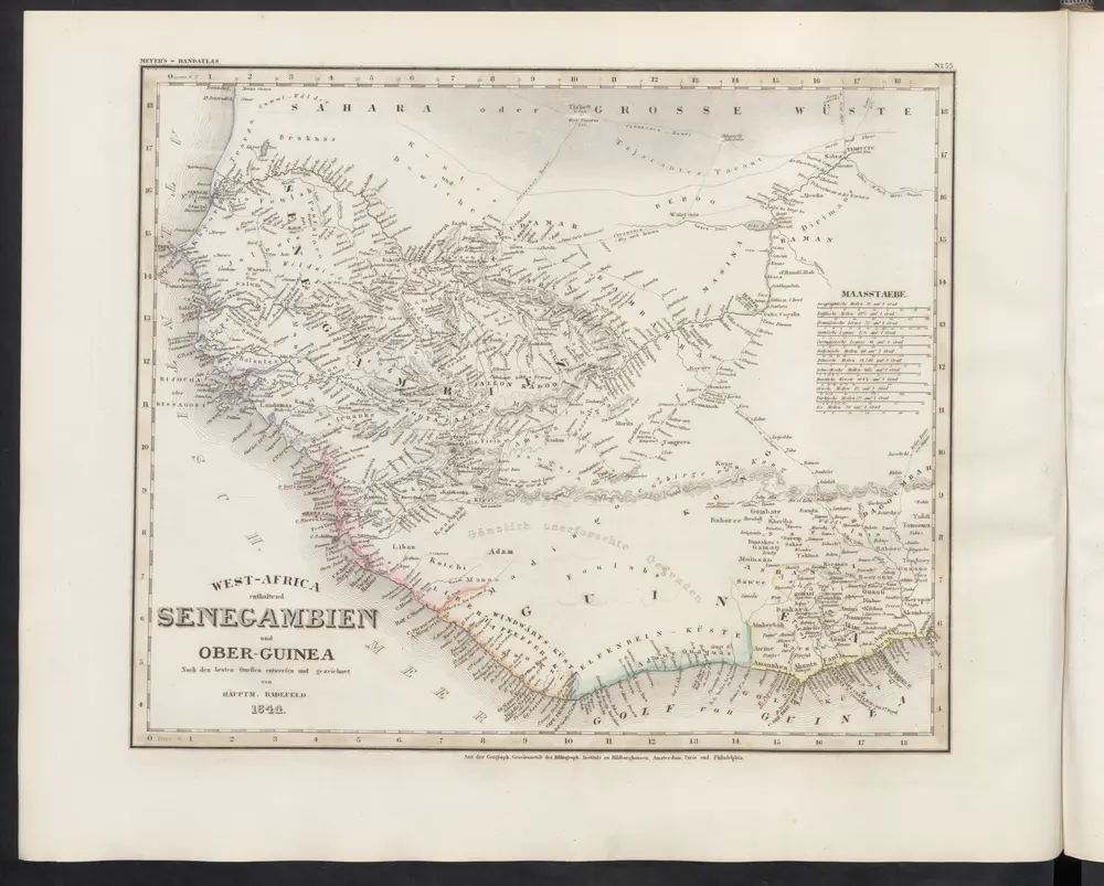
West-Africa enthaltend Senegambien und Ober-Guinea
1860
Meyer, J.