Maps of Tiaret

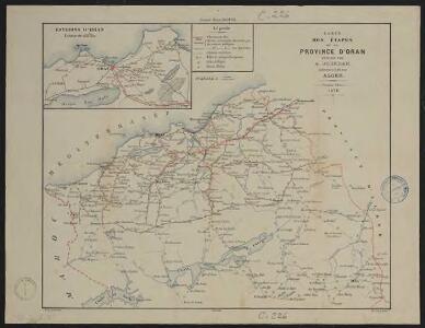
Carte des étapes de la province d'Oran
1 : 1000000 E. Corny Alger : A. Jourdan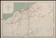
Département d'Oran. Carte des voies de communication
1 : 400000 Calléja; Algérie. Direction de l'agriculture et de la colonisation Alger : lith. Adolphe Jourdan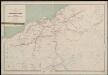
Département d'Oran. Carte des voies de communication
1 : 400000 Calléja; Algérie. Direction de l'agriculture et de la colonisation Alger : lith. Adolphe Jourdan

Oran, Constantine.
1 : 800000 Theinert, A.
Maroc (500 000 e). Oudjda
1 : 500000 France. Service géographique de l'armée Service géographique de l'Armée
Téniet-El-Had
1 : 200000 Maumias; Algérie. Service cartographique Alger : Adolphe Jourdan
Debaaij van Oran geleegen voor aen in de Middellandse Ze aen de kust van Barbarija
Algeria Gerard van Keulen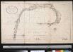
Debaij van Oran geleegen in de Middellandsche Zee aen de kust van Barbarija
Algeria Gerard van Keulen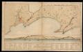
Plano de la Plaza de Oran y sus castillos, con la de Mazalquivir
1 Mapa i 1 Vista. Datació aproximada.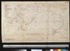
Plano de Oran en desselfs casteel en ook van Marzalquivir
Algeria Johannes van Keulen
Oujda, Morocco (1953)
Plan d'Oujda echelle 1.10 000. Institut géographique national (France). Annexe du Maroc. Rabat : Institut géographique national, Annexe du Maroc
Dépt D’ Oran carte physique
Vidal de La Blache, Paul
Dépt D’ Oran carte politique
Vidal de La Blache, Paul
Algérie
1 : 1600000 Alžírsko Dufour, A. H. Longuet
Carte des étapes de la province d'Alger
1 : 1000000 E. Corny Alger : A. Jourdan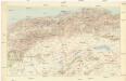
Alger
1 : 500000 Service géographique de l'armée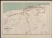
Département d'Alger. Carte des voies de communication
1 : 400000 Calléja; Algérie. Direction de l'agriculture et de la colonisation Alger : lith. Adolphe Jourdan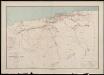
Département d'Alger. Carte des voies de communication
1 : 400000 Calléja; Algérie. Direction de l'agriculture et de la colonisation Alger : lith. Adolphe Jourdan
Boghari
1 : 200000 Maumias; Algérie. Service cartographique Alger : Adolphe Jourdan
Carte générale du Maroc à l'échelle de 1 : 500 000 e. Oudjda
1 : 500000 Maroc. Service géographique Rabat : Service géographique du Maroc
Miliana
1 : 200000 Maumias; Algérie. Service cartographique Alger : Adolphe Jourdan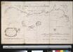
De kust van Barbaria voor aen in de Middellandse Zee tussen C. de Hone en C. de 3 Forcas, vertonende de anker plaets agter de eijlande Zafarinos
Morocco Gerard van Keulen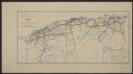
Carte des chemins de fer de l'Algérie. Projet d'un 3e emprunt
1 : 1600000 Calléja N. Paris : A. Jourdan
Carte agricole et industrielle de l'Algérie
1 : 1600000 Adolphe Jourdan Alger : Adolphe Jourdan
Carte agricole et industrielle de l'Algérie
1 : 1600000 Adolphe Jourdan Alger : Adolphe Jourdan
Chemin de fer Trans-Saharien
1 : 3470000 Alžírsko Barbier, Joseph-Victor A. Barbier
Algier
1 : 2350000 Alžírsko Weiland, Karl Ferdinand Geograph. Institut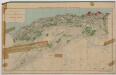
Algérie Nord. Forêts domaniales, communales et particulières
1 : 1600000 Calléja N. Paris : Erhard Fres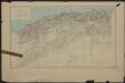
Algérie Nord
1 : 1600000 Calléja N. Paris : Erhard Fres