Maps of Marmara Region

Balkans 1 000 000e. Constantinople
1 : 1000000 France. Service géographique de l'armée [Paris] : Service géographique de l'armée
Carte de la Turquie d'Europe
1 : 1300000 Egejské moře-oblast Konrad, Al. Palma, Gaetano
Thracia Vetus
1 : 1100000 Mollova mapová sbírka Covens, Johannes Covens, Johannes I
Carte De La Mer Mediterranee. XII.
Roux, Joseph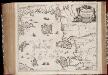
Insvlarvm Archipelagi Septentrionalis seu Maris Aegaei accurata delinatio / autore I. Laurenbergio
1 : 1100000 Annotatie: Jaar van uitg. van kaart ligt in de periode 1650-1662; Origineel is Blad 172 in atlas factice; Verso is blanco; Annotatie geografische gegevens: 4 schaalstokken op de kaart: 7 Mil. Germ., en: 10 Mil. Gall., en: 28 Mil. Ital., en 275 Stadia [Amstelodami] : [Apud Ioannem Ianssonium]
Insularum Archipelagi Septentrionalis seu Maris Aegaei Accurata Delinatio [Karte], in: Novus atlas absolutissimus, Bd. 10, S. 219.
1 Karte aus Atlas Janssonius Offizin
MARIS ÆGÆI, | quod hodie | ARCHIPELAGO | nuncupatur, | PARS SEPTENTRIONALIS.
Auctore | IOANNE LAVRENBERGIO. [Amsterdam : Joan Blaeu]
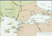
[Marmarameer]
Türkei Marmarameer Seeschlacht
90. Anatolia occidentale, Isole Egee.
1 : 1500000 Touring club italiano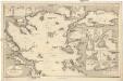
Mittelmeer
1 : 600000 Bulharsko Reichs-Marine-Amt
Übersichtskarte von Mittel - Europa
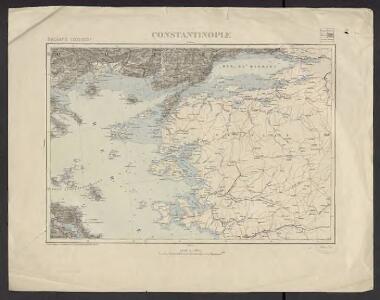
[Konstantinopel]
Istanbul
Gallipoli, Brussa
1 : 750000 Bursa (Turecko) Gstettner, G. K. u. k. Militärgeographisches Institut
Gallipoli, Brussa
1 : 750000 Bursa (Turecko) K. k. militär-geographisches Institut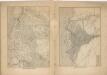
Kriegs Atlas 36 Karten von den Schauplätzen des Weltkrieges 1914/1915

Charte von der Strasse der Dardanellen oder Hellespont und dem Canal von Constantinopel (Bosporus) nebst dem Meer von Marmora
1 Karte : Kupferdruck ; 36 x 61 cm, Bildgrösse 49 x 63 cm Güssefeld; Faden; Le Chevalier bey A.G. Schneider u. Weigel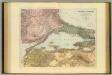
Sea of Marmara.
1 : 575300 Stanford, Edward
B2. Brussa. / bearbeitet von Richard Kiepert. 1902-1916.
From 1st Edition, 1:400,000. 1904-1907.
Schema k dějstvījam Senjavina i Grejga v Archipelagě v 1807 godu
Türkei Seeschlacht Senjavin, Dmitrij Nikolaevič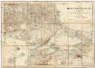
Karte vom Östlichen Rumelien
1 : 540000 Východní Rumelie Kiepert, Heinrich Dietrich Reimer
Die Dardanellen in ihrer Lage zu Konstantinopel
Dardanellen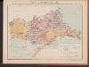
Carte des écoles et églises du vilayet d'Andrinople du sandjak de Tchataldja et de la partie européenne du vilayet de Constantinople (1908)
Türkei Vilâyet Edirne Ejalet Istanbul Sandschak Çatalca Kirchenbau Kümmerly & Frey
Ostthrakien
Ostthrakien
Charte von der Strasse der Dardanellen oder Hellespont und dem Canal Constantinopel (Bosporus) nebst dem Meer von Marmora mit den anliegenden Gegend von Europa und Asia
1 : 540000 Bospor (Turecko : průliv) Güssefeld, Franz L. Faden, W. A.G. Schneider u. Weigel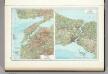
148. Dardanelles. Bosporus. The World Atlas.
1 : 500000 USSR (Union of Soviet Socialist Republics).
Bosporus, Dardanellen
Bospor (Turecko : průliv) F. A. Brouckaus' Geogr.-artist. Anstalt
Sheet 4. 1: 250,000. / dressée par Henri Kiepert d'après ses propres observations et d'autres levées pour la plupart inédites = Map of the western part of Asia Minor
From Specialkarte vom westlichen Kleinasien nach seinen eigenen Reisen und anderen grösstenteils noch unveröffentlichten Routenaufnahmen bearbeitet von Heinrich Kiepert = Carte de la partie occidentale de l 'Asie mineure
Sheet 7. 1: 250,000. / dressée par Henri Kiepert d'après ses propres observations et d'autres levées pour la plupart inédites = Map of the western part of Asia Minor
From Specialkarte vom westlichen Kleinasien nach seinen eigenen Reisen und anderen grösstenteils noch unveröffentlichten Routenaufnahmen bearbeitet von Heinrich Kiepert = Carte de la partie occidentale de l 'Asie mineure