Maps of Germany
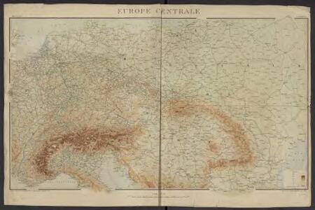
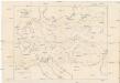
Géographie. croquis n3, Europe centrale
1 : 2500000 Molard, Jules, Commandant [Paris] : Service Géographique de l'Armée

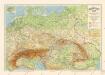
Közép-Európa
1 : 5000000 Evropa střední Állami kiadóhivatal
Sbírka map a diagramů použitých na mírových konferencích v Paříži v letech 1919 - 1920
Příruční mapa střední Evropy
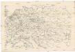
Grossdeutsches Reich und angrenzende Gebiete

Geologische Übersichtskarte von Mittel-Europa
Evropa střední F. Tempsky
Deutschlands geschichtlich geographischer Zeitraum von 158 v. Chr. bis 260 n. Chr
Evropa střední Ehrenkreutz, I. V.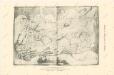
Die Ältesten Karten von Deutschland

Große Sprachenkarte von Mitteleuropa
1 : 2000000 Lange, Friedrich Reimer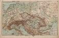
Mittel-Europa Österreich-Ungarn. Naturkarte
1 : 5000000 Mitteleuropa
Skelet zur Übersichtskarte von Mittel-Europa im Masse 1:750 000 und zur Hypsometrischen Karte der österr[isch-] ungar[ischen] Monarchie
1 : 750000 Rakousko-Uhersko R. Lechner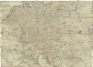
Postkarte durch ganz Deutschland, Italien, Frankreich, Niederland, Preussen, Polen und Ungarn
Florencie (Itálie) Mollo, Tranquillo T. Mollo
Übersichtskarte der Verbreitung der Deutschen in Europa
Evropa Kiepert, Heinrich Haas, František Dietrich Reimer
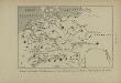
Europe Centrale.
1 : 4100000 Montemont, A.
Sbírka map a diagramů použitých na mírových konferencích v Paříži v letech 1919 - 1920
Karte der floss- und schiffbaren Flüsse von Mittel-Europa
1 : 3000000 Evropa střední Jelussig, Othmar Kiepert, Heinrich
Carte Generale D'Allemagne.
1 : 4600000 Vivien de St Martin, L.
Eisenbahn-Übersichtskarte von Mittel-Europa
Evropa R. v. Waldheim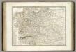
Allemagne.
1 : 3300000 Lapie, M. (Pierre), 1779-1850
Geogr.-physik.-statist. Karte von Deutschland mit Einschluss von ganz Oesterreich, Belgien, den Niederlanden, der Schweiz, Italien und einem Theile von Frankreich, England, Russland und der Türkei
1 : 4000000 Evropa střední Haurand, Theodor C. W.
Soubor němých map pro střední školy
Eisenbahnkarte von Mittel-Europa
1 : 2560000 Evropa střední
Geogr.-physik.-statist. Karte von Deutschland mit Einschluss von ganz Oesterreich, Belgien, den Niederlanden, der Schweiz, Italien und einem Theile von Frankreich, England, Russland und der Türkei
1 : 4110000 Evropa střední a východní Haurand Theobald Grieben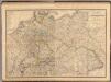
Composite: Allemagne.
1 : 2000000 Andriveau-Goujon, J.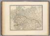
L'Allemagne, l'Europe centrale.
1 : 3460000 Andriveau-Goujon, J.
Germanie Ancienne.
1 : 3300000 Lapie, M. (Pierre), 1779-1850
Societas Iesu Germana
1 : 2600000 Mollova mapová sbírka Seutter, Matthäus Seutter, Matthäus
Neue und vollkomene Postkarte durch ganz Teutschland
Francie Artaria