Maps of Creuse
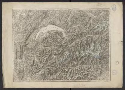
Carte relief de la Suisse occidentale et des pays limitrophes de la France (Savoie) et de l'Italie du Nord
1 : 300000 Mullhaupt, Fritz 1846-1917 Berne : Institut Géographique Mullhaupt
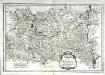
Totius Lemovici et confinium provinciarum quantum ad diocoesin Lemovicensen spectant novissima et fidissima descriptio
1 : 700000 Limoges (Francie) Fayen, Jean Schenk, Pieter G. Valk, et P. Schenk
Segusiani
1 Karte : Kupferdruck ; 35 x 52 cm Sanson; Robert de Vaugondy; Somer chés le S. Robert geographe du roy quai de l'Horloge du palais
[left] LEMOVICVM; [right] TOPOGRAPHIA | LIMANIÆ
[Left] Auctore Jo. Faiano M.L. | LYMOSIN; [right] Auctore | Gabriele Simeono. Amsterdami | Excudebat Guiljelmus Blaeuw
28) VIII.S.E. ''Clermont-Ferrand'', uit: Carte géologique de France
1 : 500000 Annotatie: Voor aanwezige bladen zie bladoverzicht [S.l : s.n.]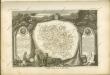
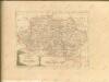
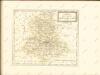
Dept. De La Creuse.
1 : 571000 Levasseur, Victor.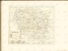

Borbonivm dvcatvs
1 : 330000 Bourbonsko (Francie) Valk, Gerhard Schenk, Pieter apud Petrum Schenk, et Gerardum Valk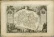
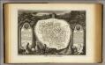
Dept. De L'Allier.
1 : 580000 Levasseur, Victor.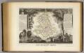
Dept. De La Hte. Vienne.
1 : 571000 Levasseur, Victor.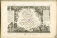

Département de l'Allier
1 Karte : Kupferdruck ; 48 x 52 cm Houdan; Dumez chez Dumez directeur de l'atlas national rue de la Harpe n.o 26
Departement de la Haute Vienne
1 Karte : Kupferdruck ; 48 x 48 cm Houdan; Dumez chez Dumez directeur de l'atlas national rue de la Harpe n.o 26
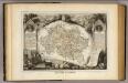
Département de la Creuse
1 Karte : Kupferdruck ; 48 x 48 cm Houdan; Dumez chez Dumez directeur de l'atlas national rue de la Harpe n.o 26
Übersichtskarte von Mitteleuropa
1 : 300000 Kartogr. Abteilung der Kgl. Preuß. Landesaufnahme
12 Evaux.
1 : 86400 Cassini family; Cassini, Cesar-Francois, 1714-1784
[Evaux]
1 Blatt : 60 x 91 cm s.n.
13 Aubusson.
1 : 86400 Cassini family; Cassini, Cesar-Francois, 1714-1784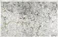
[Aubusson]
1 Blatt : 55 x 88 cm s.n.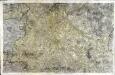
[Limoges]
1 Blatt : 56 x 89 cm s.n.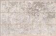
No. 11 [Indre], uit: Carte géométrique de la France dite "Carte de Cassini" ou "de l'Académie"
1 : 86400 titelvariant: Carte de Cassini; Annotatie: Incompleet; Voor aanwezige bladen zie overzichtsblad Cassini de Thury, C.-F. Paris : [s.n.]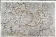
[Le Dorat]
1 Blatt : 60 x 91 cm Aldring s.n.
Département de l'Allier
1 : 260000 Allier (Francie) Houdan, François d' P. G. Chanlaire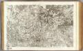
11 La Chatre.
1 : 86400 Cassini family; Cassini, Cesar-Francois, 1714-1784