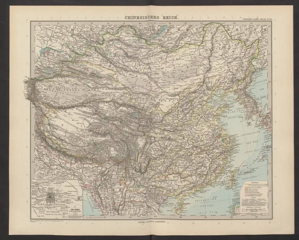
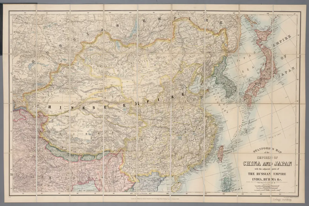
Maps of China

Maps of China

$title$

Carte des missions catholiques en Chine

1 : 5500000 Launay, Adrien 1853-1927 [Lyon : Oeuvre de la propagation de la foi]
$title$

Čínská říše

1 : 18500000 Čína Otto, Jan J. Otto
$title$

La Chine, Coree, Japon.

1 : 14300000 Clouet, J. B. L. (Jean-Baptiste Louis), b. 1730
$title$

Political Map of China showing Christian Mission Stations

$title$

Empire Chinois, Japon.

1 : 13600000 Brue, Adrien Hubert, 1786-1832
$title$

China and Japan.

1 : 13000000 Lavoisne, M.
$title$

China and Japan.

1 : 15474000 Hammond, C.S.
$title$

中華民國現勢圖

1 : 10000000 中華民國現勢圖 昭和十二年[1937]7月20日,鐵道省運輸局编纂,东京:东京朝日新聞社 增补发行 为中国省级行政区划图,由于此图系日本绘制,东北伪满洲国被绘在国界线外。图上绘制了省级争取分界线、铁路、公路和航空线路等。按照20世纪三十年代的制图水准看,此图的绘制精度较差,不论是省界还是海岸线都存在较大偏差。 插图1幅:《北平附近圖》,主要绘制冀东地区傀儡政权和卢沟桥附近地形图。另有2表:《中國國民黨及國民政府組織(附)》和《中國の陸軍及び空軍》,内容为民国党政机构架构和军力数据。 1图,彩色,日文,图幅53.8 x 71.6 cm,比例尺1:10,000,000,经纬度为E75°-140°; N18°-55°。 Harvard-YenchingManchuguo J-0817;Hollis Number:014622127 鐵道省運輸局 东京朝日新聞社
$title$

韓國輿地圖:中國

Manuscript. Imprint date from postscript. 金鴻圭
$title$

天下輿地圖:中國圖

天下輿地圖 明清时期 该图集为李氏朝鲜时期舆图,前有《天下圖》和《中國圖》各一幅,后为朝鲜八道图及日本图。封面题有“玄黓執徐腊下瀚”,可能是壬辰年十二月下旬,但具体年份待定。内容与形态基本与上图相同(005833853),《天下圖》反映中国传统天下观,中国居中,周围岛国取自《山海经》,《中國圖》绘制明朝两京十三省。 1图,彩绘,中文,图幅27.8 x 34.3 cm。 Harvard-Yenching | Rare Book | TK 3490.7 1174;Hollis Number:009140732
$title$

Mongolia and China. Pergamon World Atlas.

1 : 10000000 Polish Army Topography Service
$title$

Schauplatz der Ereignisse in Ost - Asien

$title$

108-109. China, Mongolia, Korea. The World Atlas.

1 : 10000000 USSR (Union of Soviet Socialist Republics).
$title$

East Asia.

1 : 8997000 Rand McNally and Company
$title$

Empire of China, island of Japan.

1 : 18000000 Moll, Herman, d. 1732
$title$

China. Pergamon World Atlas.

Polish Army Topography Service
$title$

Karte von China mit dessen Eintheilung in 18 Provinzen

1 : 6500000 Roost, J. B Verlag der liter. artist. Anstalt der L.G. Cotta'schen Buchhandlung
$title$

China - political.

1 : 10000000 John Bartholomew and Son
$title$

The Chinese Empire compiled from native and foreign authorities

1 : 9700000 The Chinese Empire Compiled from Native and Foreign Authorities 1882年,S. Wells Williams卫三畏 (1812-1884)绘制,Jacob Wells修订,G. Stern刻版,New York: Charles Scribner's Sons出版。 该图详细刻画了清末中国疆域、行政区划及边疆地区。卫三畏曾在1847年左右曾出版了一幅题为Map of the Chinese empire, compiled from native & foreign authorities的彩色中国地图,现藏于国会图书馆,1953年又出版了一幅题为Map of the Chinese Empire : compiled from native & foreign authorities的黑白中国地图(仅部分着黄色),而1882年的这版中国地图,是在前两版的基础上,根据新调查的数据进行修订而成。卫三畏是清末最为杰出的汉学家,对中国有着持续深入的研究,这幅地图可以代表19世纪末西方对中国疆域和政区认识的最高水平,尤其是对内陆边疆和海疆的认识。 附插图2幅:Map of the City of Canton & Adjacent Islands,描绘珠三角地形与广州城市格局;Harbor & Island of Amoy,描绘厦门岛及周边海湾。 Map of the city of Canton & adjacent islands, Harbor & island of Amoy 1图,黑白印刷,英文,图幅49 x 54 cm,比例尺约为1:9,700,000,经纬度约为E65°-140°; N18°-55°。 Harvard-Yenching | Offsite Storage (HD)|MLC-C|HY53A6,Hollis Number:008375431 S. Wells Williams New York: Charles Scribner's Sons
$title$

CARTE DE LE'EMPIRE DE LA CHINE

$title$

新東亞資源開發解說地圖

1 : 8000000 新東亞資源開發解說地圖 昭和十四年[1939]1月1日,相马基 编辑,东京:东京日日新聞社 调查编纂及发行。 主体部分以中国省级行政区为主,兼及周边日本、朝鲜、尼泊尔、不丹等地,用形象图形,标注东亚各地主要的农业、牧业、矿业资源。地图背面为中国各省简介。 1图,彩色,日文,图幅54.6 x 79.2 cm,比例尺1:8,000,000,经纬度E 68°- E148°;N 18°-53°)。 Harvard-Yenching | Manchuguo J-0825;Hollis Number:014623812 相马基 东京日日新聞社
$title$

$title$

Imperii Sinarvm nova descriptio

1 : 8000000 Annotatie: Cum privilegio Sacrae Caesareae Majestatis & Ordinum Belgicae Foederatae; Origineel is Blad 196 in atlas factice [Amsterdam : J. Blaeu]
$title$

China Veteribus Sinarum Regio nunc Incolis Tame dicta. [Karte], in: Novus Atlas, das ist, Weltbeschreibung, Bd. 2, S. 274.

1 Karte aus Atlas Blaeu, Joan Blaeu, Willem Janszoon
$title$

廣東香港明細地圖. 漢口南昌明細地圖

1 : 820000 廣東香港明細地圖•漢口南昌明細地圖 昭和十三年[1938]3月1日,淵田忠良 编辑,东京:大日本雄辯會講談社 正面为《廣東香港明細地圖》,以珠三角为中心的行政图,包括香港,绘制了铁路、公路、河网和航空线,标注了县治及部分乡镇地名。附插图3幅:《汕頭附近》,为粤东地区行政区划图;《廣東》,为广州城地形简图;《香港》为维多利亚海湾两岸等高线地形图。 背面为《漢口南昌明細地圖》,西起洞庭湖,东至太湖西侧,南抵湖南、江西中部的湘潭-抚州一线,北达南京、信阳一带,以长江中游汉口-南昌-南京为中心,包括洞庭湖、鄱阳湖、巢湖等。绘制了该区域较为详细的村镇地名和交通线。 背面的汉口图较广东图详细,应与此时日军正大举进攻长江中游,并即将发动武汉会战的战争局势密切相关。 2图,黑蓝双色,日文,图幅39.5 x 54.5 cm,比例尺分别为1:820,000和1:1,500,000,无经纬线。 Harvard-YenchingManchuguo J-0886;Hollis Number:014636952 淵田忠良 大日本雄辯會講談社
$title$

北支事變明細圖解 : 日·満·露·支·蒙·関係一覽.

北支事變明細圖解 昭和十二年[1937]8月22日 东京:東京日日新聞社 此图是在《東亜危機明細図解》(014623780)上修改而成,主图内容是1937年中国的军事形势,东北地区中苏边界上,苏联部署重兵包围了伪满洲国。华北地区沦陷并成立了冀东傀儡政权。国民党主要控制淮河以南地区。 插图1幅《北支事變要圖》。 1图,彩色,日文,图幅53.6 x 77.2 cm,无比例尺和经纬线。 Harvard-YenchingManchuguo J-0828;Hollis Number:014623845
$title$

東亜危機明細図解 : 恐るべし日満包囲馬蹄陣形 : 日満露支蒙関係一覧.

東亜危機明細図解:恐るべし日満包囲馬蹄陣形 昭和十一年[1936]10月10日,东京:东京日日新聞社 该图标示出苏联红军重兵包围东北,沿着东北中苏边界修筑防线,进而形成对东北和华北地区的马蹄形包围。同时,苏联从西北方向中国输送物质弹药,西北地区已赤化,并不断向东推进。华北地区则有多个国民党军头控制,淮河以南地区除了广西外,主要由蒋介石中央政府控制,并向北推进。该图用图画标注各地主要物产,并用贴了各地军政首脑头像。 1图,彩色,日文,图幅53.5 x 77.6 cm,无比例尺和经纬度线。 Harvard-YenchingManchuguo J-0822;Hollis Number:014623780 东京日日新聞社
$title$

萬國通鑑:中國地圖

美国传教士撰的向中国人介绍世界地理概况的著作,后有世界地图册1份,共13幅世界、大洲和区域地图,其中一幅题为《中國地圖》的清朝内地地图。 Sheffield, Devello Zelotos 謝衛樓 福州 : 美華書局
$title$

Imperii Sinarum Nova Descriptio [Karte], in: Novus atlas absolutissimus, Bd. 11, S. 14.

1 Karte aus Atlas Janssonius Offizin
$title$

China Veteribus Sinarum Regio nunc Incolis Tame dicta. [Karte], in: Novus atlas absolutissimus, Bd. 6, S. 121.

1 Karte aus Atlas Janssonius Offizin
© MapTiler © OpenStreetMap contributors
How does it work?
These instructions will show you how to find historical maps online.
Getting started
Type the place name in the search box to find the exact location. You can further adjust the search by zooming in and out.
Zoom
Zoom in and out with the buttons or use your mouse or touchpad natively.
Exact Area tool
Click here and draw a rectangle over the map to precisely define the search area.
Set filters
Narrow your search with advanced settings, such as Years (from/to), Fulltext, Publisher, etc.
Results
See the results of your search on the right side. You can scroll down to find more maps of this location.
?

Download OldMapsOnline Mobile