Cataloged map
Gobernacion del Neuquen


Full title:Gobernacion del Neuquen
Depicted:1889
Pubdate:1889
Publisher:Buenos-Aires : J. Ruland
Physical Size:20 x 30 cm
Map scale:1:1 400 000
Plano del territorio del Neuquen
1930
Oficina cartografica Ludwig
1:570k
Gobernacion del Neuquen
1889
Seelstrang, Arthur Eduard von 1838-1896
1:1m
Demarcacion de limites con Chile. Plano general de la sub-comision n°5
1905
Argentine. Oficina de Límites Internacionales
1:500k
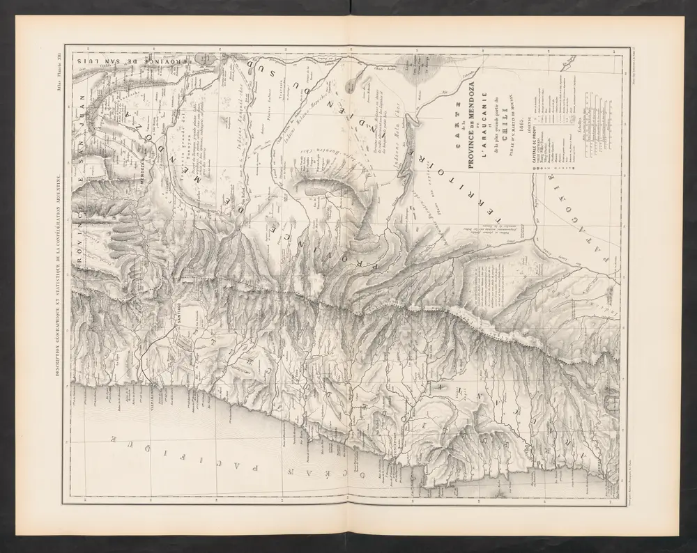
Carte de la Province de Mendoza de L'Araucanie et de la plus grande partie du Chili
1873
Martin de Moussy, Victor
1:2m
Demarcacion de limites con Chile. Plano general de la sub-comision n°4
1905
Argentine. Oficina de Límites Internacionales
1:500k
Republica de Chile [37°-39° S]
1909
(Chili) Oficina de Mensura de Tierras
1:500k
Demarcacion de limites con Chile. Plano general de la sub-comision n°3
1905
Argentine. Oficina de Límites Internacionales
1:500k
Departamento de tierras y colonizacion
1928
(Chili) Servicio de Mensura y Clasificacion de Tierras
1:1m
Ramon M. Castro
1926
Argentine. Dirección general de minas y geología
1:200k
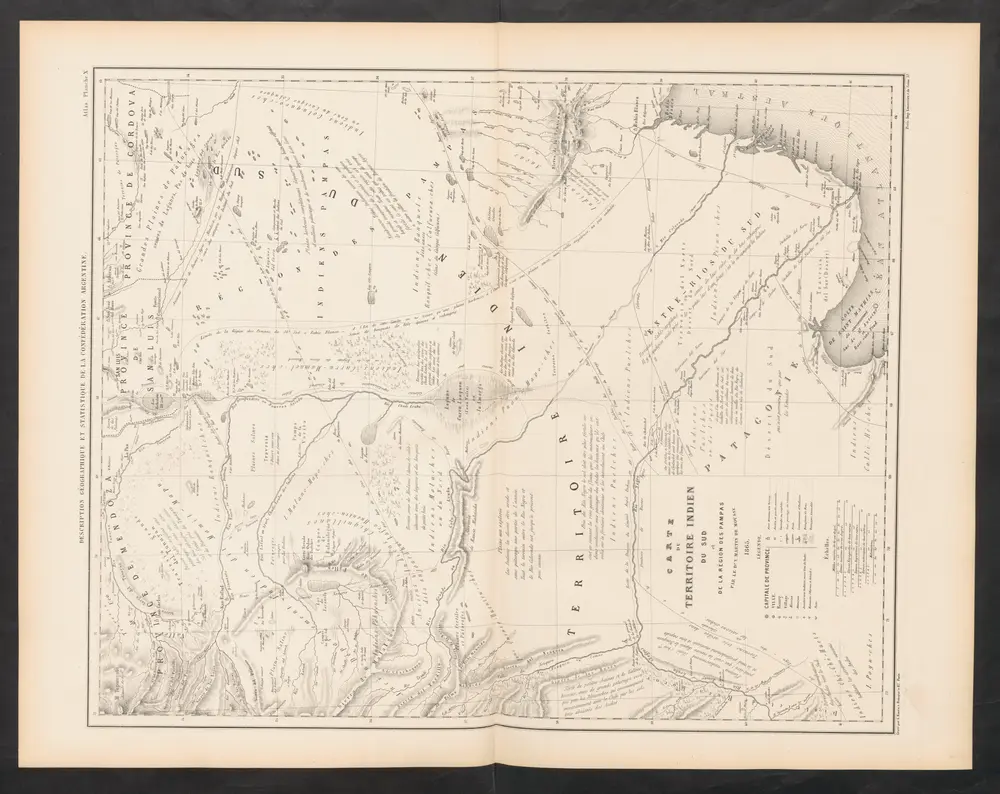
Carte du Territoire Indien du Sud et de la Région des Pampas
1873
Martin de Moussy, Victor
1:2m