Maps of Litomyšl
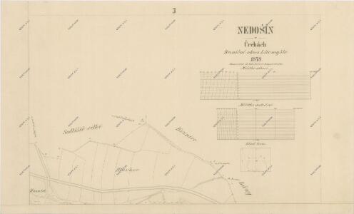
Katastrální mapa obce Nedošín 3
1 : 2880
Indikační skica mapy stabilního katastru pro obec Lány (předměstí města Litomyšle) I
1 : 2880
Indikační skica mapy stabilního katastru pro obec Lány (předměstí města Litomyšle)
1 : 2880
Mapa části polesí Chlumek
1 : 5760
Nedoschin (Nedossin) - c4997-1-002 - Kaiserpflichtexemplar der Landkarten des stabilen Katasters
1 : 2880
Nedoschin (Nedossin) - c4997-1-001 - Kaiserpflichtexemplar der Landkarten des stabilen Katasters
1 : 2880
Nedoschin (Nedossin) - c4997-1-003 - Kaiserpflichtexemplar der Landkarten des stabilen Katasters
1 : 2880
Indikační skica mapy stabilního katastru pro obec Kornice II; III
1 : 2880
Gross Sedlischt (Welko Sedlissti) - c6801-1-002 - Kaiserpflichtexemplar der Landkarten des stabilen Katasters
1 : 2880
Gross Sedlischt (Welko Sedlissti) - c6801-1-001 - Kaiserpflichtexemplar der Landkarten des stabilen Katasters
1 : 2880
Kornitz (Kornjce) - c3338-1-002 - Kaiserpflichtexemplar der Landkarten des stabilen Katasters
1 : 2880
Kornitz (Kornjce) - c3338-1-001 - Kaiserpflichtexemplar der Landkarten des stabilen Katasters
1 : 2880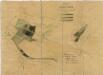
Porostní mapa revíru Chlumek (lesy Park a Řídký)
1 : 5760
Gradkartenblatt
1 : 25000 Vysoké Mýto-oblast (Česko) Hallada, Alois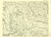
III. vojenské mapování 4056/2
1 : 25000
III. vojenské mapování 4056/2
1 : 25000
Mapa velkostatku Litomyšl
1 : 14500

8. Kraj Pardubický


III. vojenské mapování 4056/4
1 : 25000
Hejtmanství Lytomyšlské

Vys. Mýto
1 : 75000 Vysoké Mýto (Česko : oblast) Vojenský zeměpisný ústav
Hohenmauth und Leitomischl
1 : 75000 Litomyšl (Česko : oblast) Storch K. u. k. Militärgeographisches Institut
III. vojenské mapování 4056
1 : 75000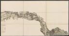
Eisenbahn Karte Wien-Dresden, Ollmütz-Trübau
1 : 72000 Blatt 8 Minarzik, Anselm J. Rauh
Vys[oké] Mýto a Litomyšl
1 : 75000 Litomyšl (Česko) Vojenský zeměpisný ústav
Choceň a okolí
1 : 75000 Choceň (Česko : oblast) Vojenský zeměpisný ústav
[Vilímkovy místopisné mapy zemí Koruny české]
1 : 100000 Litomyšl (Česko : oblast) Srp, Jan Jos. R. Vilímek