Maps of Dolany

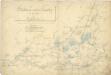
Indikační skica mapy stabilního katastru pro obec Dolany VI.
1 : 2880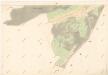
Indikační skica mapy stabilního katastru pro obec Staré Ždánice a osadu Nové Ždánice V.
1 : 2880
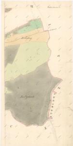
Indikační skica mapy stabilního katastru pro obec Stéblová II.
1 : 2880
Indikační skica mapy stabilního katastru pro město (Lázně) Bohdaneč VII.
1 : 2880
Dollan - c1239-1-004 - Kaiserpflichtexemplar der Landkarten des stabilen Katasters
1 : 2880
Dollan - c1239-1-003 - Kaiserpflichtexemplar der Landkarten des stabilen Katasters
1 : 2880
Dollan - c1239-1-002 - Kaiserpflichtexemplar der Landkarten des stabilen Katasters
1 : 2880
Dollan - c1239-1-001 - Kaiserpflichtexemplar der Landkarten des stabilen Katasters
1 : 2880
Zdanitz - c7283-1-002 - Kaiserpflichtexemplar der Landkarten des stabilen Katasters
1 : 2880
Zdanitz - c7283-1-003 - Kaiserpflichtexemplar der Landkarten des stabilen Katasters
1 : 2880
Zdanitz - c7283-1-004 - Kaiserpflichtexemplar der Landkarten des stabilen Katasters
1 : 2880
Zdanitz - c7283-1-001 - Kaiserpflichtexemplar der Landkarten des stabilen Katasters
1 : 2880
Mapa pozemků bývalého rybníka Oplatil
1 : 5760
Koncept mapy části Opatovického revíru, tzv. Plchovské olšiny
1 : 2600
Indikační skica mapy stabilního katastru pro obec Stéblová IV.
1 : 2880
Porostní mapa revíru Šviholec
1 : 10000
Hospodářská mapa revíru Stéblová
1 : 5000
Mapa revíru Hrádek
1 : 5000
Porostní mapa revíru Stéblová
1 : 10000
Porostní mapa revíru Stéblové
1 : 10000
Mapa polesí Stéblová
1 : 15000
Indikační skica mapy stabilního katastru pro obec Libišany I.-V.
1 : 2880
III. vojenské mapování 3955/4
1 : 25000

III. vojenské mapování 3955/4
1 : 25000
III. vojenské mapování 3955/4
1 : 25000
Gradkartenblatt
1 : 25000 Pardubice-oblast (Česko) Hallada, Alois
Geometrische Karte von der Herrschaft Chlumetz
1 : 87000 Chlumec nad Cidlinou-oblast (Česko) Langweil, Antonín