Maps of Dolní Újezd

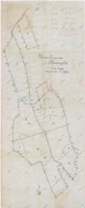
Mapa kostelního lesa v Dolním Újezdě
1 : 5760
Indikační skica mapy stabilního katastru pro obec Dolní Újezd a osady Jiříkov a Václavky II; XII
1 : 2880
Porostní mapa farního lesa v Dolním Újezdě
1 : 5760
Unter Augezd (Dolnj Augezd) - c1404-1-006 - Kaiserpflichtexemplar der Landkarten des stabilen Katasters
1 : 2880
Unter Augezd (Dolnj Augezd) - c1404-1-010 - Kaiserpflichtexemplar der Landkarten des stabilen Katasters
1 : 2880
Unter Augezd (Dolnj Augezd) - c1404-1-004 - Kaiserpflichtexemplar der Landkarten des stabilen Katasters
1 : 2880
Unter Augezd (Dolnj Augezd) - c1404-1-009 - Kaiserpflichtexemplar der Landkarten des stabilen Katasters
1 : 2880
Unter Augezd (Dolnj Augezd) - c1404-1-007 - Kaiserpflichtexemplar der Landkarten des stabilen Katasters
1 : 2880
Unter Augezd (Dolnj Augezd) - c1404-1-002 - Kaiserpflichtexemplar der Landkarten des stabilen Katasters
1 : 2880
Unter Augezd (Dolnj Augezd) - c1404-1-001 - Kaiserpflichtexemplar der Landkarten des stabilen Katasters
1 : 2880
Unter Augezd (Dolnj Augezd) - c1404-1-008 - Kaiserpflichtexemplar der Landkarten des stabilen Katasters
1 : 2880
Unter Augezd (Dolnj Augezd) - c1404-1-003 - Kaiserpflichtexemplar der Landkarten des stabilen Katasters
1 : 2880
Unter Augezd (Dolnj Augezd) - c1404-1-005 - Kaiserpflichtexemplar der Landkarten des stabilen Katasters
1 : 2880
Mapa velkostatku Litomyšl
1 : 14500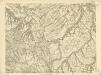
III. vojenské mapování 4056/4
1 : 25000
Gradkartenblatt
1 : 25000 Litomyšl-oblast (Česko) Hallada, Alois

III. vojenské mapování 4056/4
1 : 25000
Hejtmanství Lytomyšlské

Vys. Mýto
1 : 75000 Vysoké Mýto (Česko : oblast) Vojenský zeměpisný ústav
Hohenmauth und Leitomischl
1 : 75000 Litomyšl (Česko : oblast) Storch K. u. k. Militärgeographisches Institut
III. vojenské mapování 4056
1 : 75000
Svitava a okolí
1 : 75000 Svitavy (Česko : oblast) Vojenský zeměpisný ústav
Vys[oké] Mýto a Litomyšl
1 : 75000 Litomyšl (Česko) Vojenský zeměpisný ústav
[Vilímkovy místopisné mapy zemí Koruny české]
1 : 100000 Litomyšl (Česko : oblast) Srp, Jan Jos. R. Vilímek
Podrobná mapa Království českého
1 : 100000 Litomyšl (Česko : oblast) Srp, Jan Jos. R. Vilímek
Podrobná mapa Markrabství moravského a Vévodství slezkého
1 : 100000 Litomyšl (Česko : oblast) Srp, Jan Jos. R. Vilímek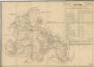
Silniční mapa zámeckého panství Litomyšl
1 : 100300
Československo v mapách