Maps of Litomyšl

Indikační skica mapy stabilního katastru pro obec Lány (předměstí města Litomyšle)
1 : 2880
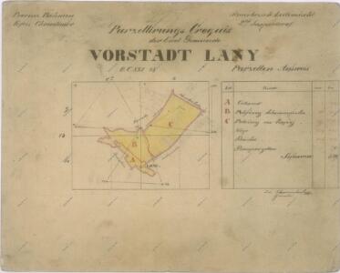
Vorstadt Lany (Lany) - c3800-1-001 - Kaiserpflichtexemplar der Landkarten des stabilen Katasters
1 : 2880
Vorstadt Lany (Lany) - c3800-1-002 - Kaiserpflichtexemplar der Landkarten des stabilen Katasters
1 : 2880
Indikační skica mapy stabilního katastru pro obec Kornice II; III
1 : 2880
Kornitz (Kornjce) - c3338-1-002 - Kaiserpflichtexemplar der Landkarten des stabilen Katasters
1 : 2880
Kornitz (Kornjce) - c3338-1-001 - Kaiserpflichtexemplar der Landkarten des stabilen Katasters
1 : 2880
Indikační skica mapy stabilního katastru pro obec Lány (předměstí města Litomyšle)
1 : 2880
Indikační skica mapy stabilního katastru pro obec Lány (předměstí města Litomyšle) II
1 : 2880
Indikační skica mapy stabilního katastru pro obec Lány (předměstí města Litomyšle) I; II; III
1 : 2880
Katastrální mapa obce Němčice 5
1 : 2880
Katastrální mapa obce Nedošín 5
1 : 2880
Indikační skica mapy stabilního katastru pro obec Němčice a osady Člupek a Pudilka II; V
1 : 2880
Mapa pozemků litomyšlského vrchnostenského dvora I
1 : 2880
Mapa části panského pozemku u vrchnostenského dvora Pernštejn v Nedošíně
1 : 2918
Indikační skica mapy stabilního katastru pro obec Lány (předměstí města Litomyšle) I
1 : 2880
Indikační skica mapy stabilního katastru pro obec Lány (předměstí města Litomyšle)
1 : 2880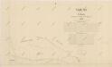
Katastrální mapa obce Nedošín 3
1 : 2880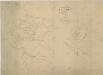
Mapa části polesí Chlumek
1 : 5760
Nedoschin (Nedossin) - c4997-1-002 - Kaiserpflichtexemplar der Landkarten des stabilen Katasters
1 : 2880
Nedoschin (Nedossin) - c4997-1-001 - Kaiserpflichtexemplar der Landkarten des stabilen Katasters
1 : 2880
Nedoschin (Nedossin) - c4997-1-003 - Kaiserpflichtexemplar der Landkarten des stabilen Katasters
1 : 2880
Zahrad (Zahradj) - c9066-1-002 - Kaiserpflichtexemplar der Landkarten des stabilen Katasters
1 : 2880
Zahrad (Zahradj) - c9066-1-001 - Kaiserpflichtexemplar der Landkarten des stabilen Katasters
1 : 2880
Plán města Litomyšle
Litomyšl (Česko) J.R. Veselík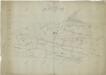
Příruční náčrt mapy pozemků litomyšlského vrchnostenského dvora
1 : 3000
Indikační skica mapy stabilního katastru pro obec Kornice I
1 : 2880
Leitomischl (Litomissle) - c4172-1-004 - Kaiserpflichtexemplar der Landkarten des stabilen Katasters
1 : 2880
Leitomischl (Litomissle) - c4172-1-001 - Kaiserpflichtexemplar der Landkarten des stabilen Katasters
1 : 2880
Leitomischl (Litomissle) - c4172-1-006 - Kaiserpflichtexemplar der Landkarten des stabilen Katasters
1 : 2880
Leitomischl (Litomissle) - c4172-1-005 - Kaiserpflichtexemplar der Landkarten des stabilen Katasters
1 : 2880
Leitomischl (Litomissle) - c4172-1-003 - Kaiserpflichtexemplar der Landkarten des stabilen Katasters
1 : 2880