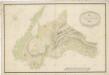
Maps of Pustá Rybná

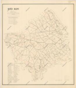
Mapa revíru Milovy
1 : 10000
Mapa vsi Pustá Rybná
1 : 3758
Brzezin - c0586-1-002 - Kaiserpflichtexemplar der Landkarten des stabilen Katasters
1 : 2880
Brzezin - c0586-1-007 - Kaiserpflichtexemplar der Landkarten des stabilen Katasters
1 : 2880
Brzezin - c0586-1-005 - Kaiserpflichtexemplar der Landkarten des stabilen Katasters
1 : 2880
Brzezin - c0586-1-006 - Kaiserpflichtexemplar der Landkarten des stabilen Katasters
1 : 2880
Brzezin - c0586-1-001 - Kaiserpflichtexemplar der Landkarten des stabilen Katasters
1 : 2880
Brzezin - c0586-1-003 - Kaiserpflichtexemplar der Landkarten des stabilen Katasters
1 : 2880
Brzezin - c0586-1-004 - Kaiserpflichtexemplar der Landkarten des stabilen Katasters
1 : 2880
Wüst Ribny (Pusty-Rybny) - c6287-1-003 - Kaiserpflichtexemplar der Landkarten des stabilen Katasters
1 : 2880
Wüst Ribny (Pusty-Rybny) - c6287-1-006 - Kaiserpflichtexemplar der Landkarten des stabilen Katasters
1 : 2880
Wüst Ribny (Pusty-Rybny) - c6287-1-005 - Kaiserpflichtexemplar der Landkarten des stabilen Katasters
1 : 2880
Wüst Ribny (Pusty-Rybny) - c6287-1-007 - Kaiserpflichtexemplar der Landkarten des stabilen Katasters
1 : 2880
Wüst Ribny (Pusty-Rybny) - c6287-1-004 - Kaiserpflichtexemplar der Landkarten des stabilen Katasters
1 : 2880
Wüst Ribny (Pusty-Rybny) - c6287-1-002 - Kaiserpflichtexemplar der Landkarten des stabilen Katasters
1 : 2880
Wüst Ribny (Pusty-Rybny) - c6287-1-001 - Kaiserpflichtexemplar der Landkarten des stabilen Katasters
1 : 2880
Mapa vsí Křižánky, Milovy a Březiny
1 : 3759
Krzižanek - c0970-1-003 - Kaiserpflichtexemplar der Landkarten des stabilen Katasters
1 : 2880
Krzižanek - c0970-1-001 - Kaiserpflichtexemplar der Landkarten des stabilen Katasters
1 : 2880
Krzižanek - c0970-1-002 - Kaiserpflichtexemplar der Landkarten des stabilen Katasters
1 : 2880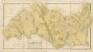
Mapa vsi Březiny
1 : 2880
Náčrt mapy dominikálních pozemků u vsi Březiny
1 : 2313
Cikanka - c0945-1-002 - Kaiserpflichtexemplar der Landkarten des stabilen Katasters
1 : 2880
Cikanka - c0945-1-001 - Kaiserpflichtexemplar der Landkarten des stabilen Katasters
1 : 2880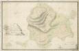
Mapa dominikální vsi České Křižánky
1 : 2341
Mapa dominikálních vsí Karlštejn a Cikánka
1 : 2880
Mapa dominikálních pozemků ve vsi České Milovy
1 : 2880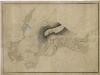
Mapa zobrazující okolí Čtyřpaličatých skal
1 : 1550
Náčrt mapy dominikálních pozemků ve vsi České Milovy
1 : 2880