Maps of Krouna

Náčrt mapy vsi Františky
1 : 3000
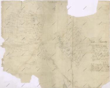
Franzensdorf (Frantissek) - c1682-1-003 - Kaiserpflichtexemplar der Landkarten des stabilen Katasters
1 : 2880
Franzensdorf (Frantissek) - c1682-1-001 - Kaiserpflichtexemplar der Landkarten des stabilen Katasters
1 : 2880
Franzensdorf (Frantissek) - c1682-1-002 - Kaiserpflichtexemplar der Landkarten des stabilen Katasters
1 : 2880
Skica projektované silnice vedoucí přes polesí Bukovina
1 : 2880
Mapa vsi Rychnov
1 : 3670
Hospodářská mapa polesí Bukovina
1 : 5000
Zaborz - c9013-1-007 - Kaiserpflichtexemplar der Landkarten des stabilen Katasters
1 : 2880
Zaborz - c9013-1-003 - Kaiserpflichtexemplar der Landkarten des stabilen Katasters
1 : 2880
Zaborz - c9013-1-001 - Kaiserpflichtexemplar der Landkarten des stabilen Katasters
1 : 2880
Zaborz - c9013-1-006 - Kaiserpflichtexemplar der Landkarten des stabilen Katasters
1 : 2880
Zaborz - c9013-1-002 - Kaiserpflichtexemplar der Landkarten des stabilen Katasters
1 : 2880
Zaborz - c9013-1-008 - Kaiserpflichtexemplar der Landkarten des stabilen Katasters
1 : 2880
Zaborz - c9013-1-004 - Kaiserpflichtexemplar der Landkarten des stabilen Katasters
1 : 2880
Zaborz - c9013-1-005 - Kaiserpflichtexemplar der Landkarten des stabilen Katasters
1 : 2880
Mapa revíru Pustá Kamenice a okrsků Františky a Lubná
1 : 10000
Wüst Kamenitz (Pusta Kamenice) - c6285-1-005 - Kaiserpflichtexemplar der Landkarten des stabilen Katasters
1 : 2880
Wüst Kamenitz (Pusta Kamenice) - c6285-1-007 - Kaiserpflichtexemplar der Landkarten des stabilen Katasters
1 : 2880
Wüst Kamenitz (Pusta Kamenice) - c6285-1-006 - Kaiserpflichtexemplar der Landkarten des stabilen Katasters
1 : 2880
Wüst Kamenitz (Pusta Kamenice) - c6285-1-001 - Kaiserpflichtexemplar der Landkarten des stabilen Katasters
1 : 2880
Wüst Kamenitz (Pusta Kamenice) - c6285-1-002 - Kaiserpflichtexemplar der Landkarten des stabilen Katasters
1 : 2880
Wüst Kamenitz (Pusta Kamenice) - c6285-1-004 - Kaiserpflichtexemplar der Landkarten des stabilen Katasters
1 : 2880
Wüst Kamenitz (Pusta Kamenice) - c6285-1-008 - Kaiserpflichtexemplar der Landkarten des stabilen Katasters
1 : 2880
Wüst Kamenitz (Pusta Kamenice) - c6285-1-003 - Kaiserpflichtexemplar der Landkarten des stabilen Katasters
1 : 2880
Richnow - c6657-1-004 - Kaiserpflichtexemplar der Landkarten des stabilen Katasters
1 : 2880
Richnow - c6657-1-002 - Kaiserpflichtexemplar der Landkarten des stabilen Katasters
1 : 2880
Richnow - c6657-1-003 - Kaiserpflichtexemplar der Landkarten des stabilen Katasters
1 : 2880
Richnow - c6657-1-001 - Kaiserpflichtexemplar der Landkarten des stabilen Katasters
1 : 2880
Přehledová mapa karlštejnských revírů
1 : 25000