Maps of Vysoká nad Labem

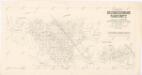
Mapa revíru Vysoká nad Labem
1 : 10000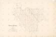
Mapa revíru Vysoká
1 : 10000
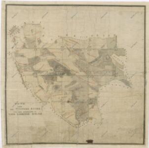
Mapa revíru Vysoká nad Labem
1 : 5000
Wisoka - c8949-1-002 - Kaiserpflichtexemplar der Landkarten des stabilen Katasters
1 : 2880
Wisoka - c8949-1-008 - Kaiserpflichtexemplar der Landkarten des stabilen Katasters
1 : 2880
Wisoka - c8949-1-005 - Kaiserpflichtexemplar der Landkarten des stabilen Katasters
1 : 2880
Wisoka - c8949-1-004 - Kaiserpflichtexemplar der Landkarten des stabilen Katasters
1 : 2880
Wisoka - c8949-1-007 - Kaiserpflichtexemplar der Landkarten des stabilen Katasters
1 : 2880
Wisoka - c8949-1-001 - Kaiserpflichtexemplar der Landkarten des stabilen Katasters
1 : 2880
Wisoka - c8949-1-003 - Kaiserpflichtexemplar der Landkarten des stabilen Katasters
1 : 2880
Wisoka - c8949-1-006 - Kaiserpflichtexemplar der Landkarten des stabilen Katasters
1 : 2880
Mapa revíru Vysoká nad Labem
1 : 5000
Indikační skica mapy stabilního katastru pro obec Vysoká nad Labem VI., X.
1 : 2880
Indikační skica mapy stabilního katastru pro obec Vysoká nad Labem V.
1 : 2880
Indikační skica mapy stabilního katastru pro obec Vysoká nad Labem IX.
1 : 2880
Indikační skica mapy stabilního katastru pro obec Borek III.
1 : 2880
Borek - c0375-1-001 - Kaiserpflichtexemplar der Landkarten des stabilen Katasters
1 : 2880
Borek - c0375-1-003 - Kaiserpflichtexemplar der Landkarten des stabilen Katasters
1 : 2880
Borek - c0375-1-002 - Kaiserpflichtexemplar der Landkarten des stabilen Katasters
1 : 2880
Indikační skica mapy stabilního katastru pro obec Hrachoviště II.
1 : 2880
Streitdorf (Hrachowisstat) - c2331-1-003 - Kaiserpflichtexemplar der Landkarten des stabilen Katasters
1 : 2880
Streitdorf (Hrachowisstat) - c2331-1-002 - Kaiserpflichtexemplar der Landkarten des stabilen Katasters
1 : 2880
Streitdorf (Hrachowisstat) - c2331-1-001 - Kaiserpflichtexemplar der Landkarten des stabilen Katasters
1 : 2880
Indikační skica mapy stabilního katastru pro obec Hoděšovice ad II.
1 : 2880
Indikační skica mapy stabilního katastru pro obec Hrachoviště I.
1 : 2880
Indikační skica mapy stabilního katastru pro obec Býšť ad I., ad III.
1 : 2880
Indikační skica mapy stabilního katastru pro obec Vysoká nad Labem XII.
1 : 2880
Indikační skica mapy stabilního katastru pro obec Hoděšovice ad IV.
1 : 2880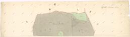
Indikační skica mapy stabilního katastru pro obec Vysoká nad Labem II.
1 : 2880