Maps of Spojil
Mapa porostů Bělobranského hájenství
1 : 2880
Mapa porostů Bělobranského hájenství
1 : 2880
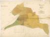
Hospodářská mapa Bělobranské dubiny
1 : 2880
Indikační skica mapy stabilního katastru pro město Pardubice IV.
1 : 2880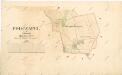
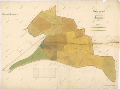
Indikační skica mapy stabilního katastru pro obec Počaply II.
1 : 2880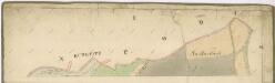
Indikační skica mapy stabilního katastru pro město Pardubice I.
1 : 2880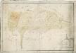
Mapa obecních lesů revíru Koloděje
1 : 2591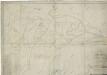
Mapa lesů města Pardubice nacházejících se mezi Spojilem, Kolodějemi, Sezemicemi a Počáply, tzv. Bělobranská dubina (koncept)
1 : 2529
Indikační skica mapy stabilního katastru pro obec Počaply I.-II.
1 : 2880
Podczapel - c5865-1-001 - Kaiserpflichtexemplar der Landkarten des stabilen Katasters
1 : 2880
Podczapel - c5865-1-002 - Kaiserpflichtexemplar der Landkarten des stabilen Katasters
1 : 2880
Porostní mapa Bělobranského hájenství
1 : 2882
Indikační skica mapy stabilního katastru pro město Pardubice V., X., XIV., XV
1 : 2880
Indikační skica mapy stabilního katastru pro město Pardubice V., X.
1 : 2880
Situační plán Labe v soutoku s Loučnou v lokalitě
1 : 1355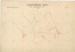
Hospodářská mapa Bělobranské dubiny
1 : 2880
Pardubitz - c5633-1-006 - Kaiserpflichtexemplar der Landkarten des stabilen Katasters
1 : 2880
Pardubitz - c5633-1-007 - Kaiserpflichtexemplar der Landkarten des stabilen Katasters
1 : 2880
Pardubitz - c5633-1-003 - Kaiserpflichtexemplar der Landkarten des stabilen Katasters
1 : 2880
Pardubitz - c5633-1-009 - Kaiserpflichtexemplar der Landkarten des stabilen Katasters
1 : 2880
Pardubitz - c5633-1-011 - Kaiserpflichtexemplar der Landkarten des stabilen Katasters
1 : 2880
Pardubitz - c5633-1-005 - Kaiserpflichtexemplar der Landkarten des stabilen Katasters
1 : 2880
Pardubitz - c5633-1-002 - Kaiserpflichtexemplar der Landkarten des stabilen Katasters
1 : 2880
Pardubitz - c5633-1-004 - Kaiserpflichtexemplar der Landkarten des stabilen Katasters
1 : 2880
Pardubitz - c5633-1-001 - Kaiserpflichtexemplar der Landkarten des stabilen Katasters
1 : 2880
Pardubitz - c5633-1-010 - Kaiserpflichtexemplar der Landkarten des stabilen Katasters
1 : 2880
Pardubitz - c5633-1-008 - Kaiserpflichtexemplar der Landkarten des stabilen Katasters
1 : 2880
Indikační skica mapy stabilního katastru pro město Sezemice I.-VI.
1 : 2880
Spogil - c7177-1-002 - Kaiserpflichtexemplar der Landkarten des stabilen Katasters
1 : 2880