Maps of Val

Porostní mapa polesí Val 1
1 : 10000
Porostní obrysová mapa polesí Val 1
1 : 10000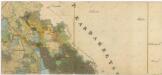
Administrativní mapa třeboňského panství se statky Bzí,Lomnice, Borovany,Hamr a Val 1

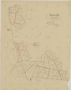
Porostní mapa polesí Val 1
1 : 15000
Wall - c8310-1-001 - Kaiserpflichtexemplar der Landkarten des stabilen Katasters
1 : 2880
Wall - c8310-1-003 - Kaiserpflichtexemplar der Landkarten des stabilen Katasters
1 : 2880
Wall - c8310-1-002 - Kaiserpflichtexemplar der Landkarten des stabilen Katasters
1 : 2880
Wall - c8310-1-008 - Kaiserpflichtexemplar der Landkarten des stabilen Katasters
1 : 2880
Wall - c8310-1-007 - Kaiserpflichtexemplar der Landkarten des stabilen Katasters
1 : 2880
Wall - c8310-1-004 - Kaiserpflichtexemplar der Landkarten des stabilen Katasters
1 : 2880
Wall - c8310-1-006 - Kaiserpflichtexemplar der Landkarten des stabilen Katasters
1 : 2880
Wall - c8310-1-009 - Kaiserpflichtexemplar der Landkarten des stabilen Katasters
1 : 2880
Wall - c8310-1-005 - Kaiserpflichtexemplar der Landkarten des stabilen Katasters
1 : 2880
Mapa výsledků lepících pásů a náletů motýlů v polesí Val 1

Mapa pozemků dvora Val 1

Mapa pozemků dvora Val 1
1 : 5760
Mapa pronajatých pozemků dvora Val 1

Mapa pozemků dvora Dehetník 1

Drahles - c1503-1-006 - Kaiserpflichtexemplar der Landkarten des stabilen Katasters
1 : 2880
Drahles - c1503-1-003 - Kaiserpflichtexemplar der Landkarten des stabilen Katasters
1 : 2880
Drahles - c1503-1-002 - Kaiserpflichtexemplar der Landkarten des stabilen Katasters
1 : 2880
Drahles - c1503-1-005 - Kaiserpflichtexemplar der Landkarten des stabilen Katasters
1 : 2880
Drahles - c1503-1-001 - Kaiserpflichtexemplar der Landkarten des stabilen Katasters
1 : 2880
Drahles - c1503-1-004 - Kaiserpflichtexemplar der Landkarten des stabilen Katasters
1 : 2880
Mapa pozemků dvora Dehetník 1
1 : 5760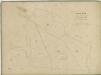
Hospodářská mapa polesí Val 1

Hospodářská mapa polesí Val 1
1 : 2880
Hospodářská mapa polesí Val 1

Hammer - c1766-1-001 - Kaiserpflichtexemplar der Landkarten des stabilen Katasters
1 : 2880