Maps of Modrá Hůrka
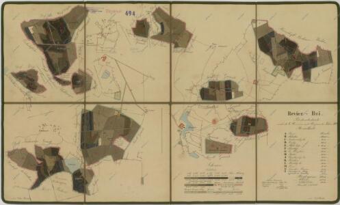
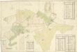
Porostní mapa polesí Bzí 1
1 : 10000
Tuchonitz - c8100-1-004 - Kaiserpflichtexemplar der Landkarten des stabilen Katasters
1 : 2880
Tuchonitz - c8100-1-002 - Kaiserpflichtexemplar der Landkarten des stabilen Katasters
1 : 2880
Tuchonitz - c8100-1-001 - Kaiserpflichtexemplar der Landkarten des stabilen Katasters
1 : 2880
Tuchonitz - c8100-1-003 - Kaiserpflichtexemplar der Landkarten des stabilen Katasters
1 : 2880
Bzí o. České Budějovice 1
1 : 2880
Bzí o. České Budějovice 1
1 : 2880
Bzí o. České Budějovice 1
1 : 2880
Pořežany o. České Budějovice 1
1 : 2880
Tuchonice o. České Budějovice 1
1 : 2880
Mapy činžovních pozemků I. sekce třeboňského velkostatku pro obce: Borkovice, Bošilec, Drahotěšice, Frahelž, Hamr, Horusice, Lhota, Líšnice, Mažice, Mezimostí, Ponědraž, Ponědrážka, Řípec, Val, Vlkov 1
1 : 2880
Bzí o. České Budějovice 1
1 : 2880
Mapy činžovních pozemků sekce Bzí pro obce: Štipoklasy, Tuchovice a Dobšice 1
1 : 2880
Geometrický plán Nového Dvora a statku Bzí, lesa Smrčí, rybníku Kamenný a přilehlých deputátních a činžovních pozemků 1
Bzí o. České Budějovice 1
1 : 2880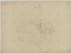
Záměrná mapa Nového dvora na statku Bzí 1
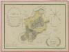
Mapa pozemků Nového dvora 1

Bzy - c0730-1-002 - Kaiserpflichtexemplar der Landkarten des stabilen Katasters
1 : 2880
Bzy - c0730-1-001 - Kaiserpflichtexemplar der Landkarten des stabilen Katasters
1 : 2880
Bzy - c0730-1-006 - Kaiserpflichtexemplar der Landkarten des stabilen Katasters
1 : 2880
Bzy - c0730-1-005 - Kaiserpflichtexemplar der Landkarten des stabilen Katasters
1 : 2880
Bzy - c0730-1-004 - Kaiserpflichtexemplar der Landkarten des stabilen Katasters
1 : 2880
Bzy - c0730-1-003 - Kaiserpflichtexemplar der Landkarten des stabilen Katasters
1 : 2880
Mapa propachtovaných pozemků dvora Bzí v letech 1902-1920 1
Geometrický plán pozemků dvorů na statku Bzí

Líšnice o. České Budějovice 1
1 : 2880
Zwozna - c2453-1-002 - Kaiserpflichtexemplar der Landkarten des stabilen Katasters
1 : 2880
Zwozna - c2453-1-003 - Kaiserpflichtexemplar der Landkarten des stabilen Katasters
1 : 2880
Zwozna - c2453-1-001 - Kaiserpflichtexemplar der Landkarten des stabilen Katasters
1 : 2880