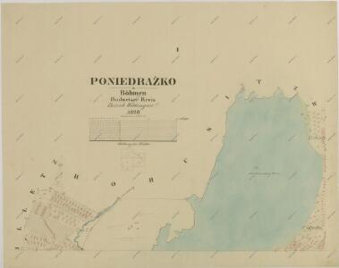
Maps of Ponědrážka

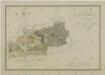
Ponědrážka o. Jindřichův Hradec 1
1 : 2880
Mapy činžovních pozemků I. sekce třeboňského velkostatku pro obce: Borkovice, Bošilec, Drahotěšice, Frahelž, Hamr, Horusice, Lhota, Líšnice, Mažice, Mezimostí, Ponědraž, Ponědrážka, Řípec, Val, Vlkov 1
1 : 2880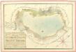
Geometrický plán rybníka Švancenberk s přilehlými pozemky 1

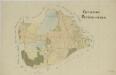
Přehledná mapa polesí Bošilec 1
Ponědrážka o. Jindřichův Hradec 1
1 : 2880
Horusitz - c2195-1-006 - Kaiserpflichtexemplar der Landkarten des stabilen Katasters
1 : 2880
Horusitz - c2195-1-003 - Kaiserpflichtexemplar der Landkarten des stabilen Katasters
1 : 2880
Horusitz - c2195-1-001 - Kaiserpflichtexemplar der Landkarten des stabilen Katasters
1 : 2880
Horusitz - c2195-1-004 - Kaiserpflichtexemplar der Landkarten des stabilen Katasters
1 : 2880
Horusitz - c2195-1-008 - Kaiserpflichtexemplar der Landkarten des stabilen Katasters
1 : 2880
Horusitz - c2195-1-007 - Kaiserpflichtexemplar der Landkarten des stabilen Katasters
1 : 2880
Horusitz - c2195-1-005 - Kaiserpflichtexemplar der Landkarten des stabilen Katasters
1 : 2880
Horusitz - c2195-1-002 - Kaiserpflichtexemplar der Landkarten des stabilen Katasters
1 : 2880
Geometrický plán Horusického rybníka, deputátních a činžovních pozemků 1

Poniedražko - c6007-1-004 - Kaiserpflichtexemplar der Landkarten des stabilen Katasters
1 : 2880
Poniedražko - c6007-1-002 - Kaiserpflichtexemplar der Landkarten des stabilen Katasters
1 : 2880
Poniedražko - c6007-1-001 - Kaiserpflichtexemplar der Landkarten des stabilen Katasters
1 : 2880
Poniedražko - c6007-1-003 - Kaiserpflichtexemplar der Landkarten des stabilen Katasters
1 : 2880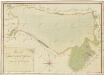
Geometrický plán Horusického rybníka, deputátních a činžovních pozemků 1
Geometrický plán bošileckého lesa, rybníků Linýř, Kvíčadlo a Švambírek, činžovních, deputátních a farních pozemků 1

Wlkow - c8705-1-001 - Kaiserpflichtexemplar der Landkarten des stabilen Katasters
1 : 2880
Wlkow - c8705-1-003 - Kaiserpflichtexemplar der Landkarten des stabilen Katasters
1 : 2880
Wlkow - c8705-1-002 - Kaiserpflichtexemplar der Landkarten des stabilen Katasters
1 : 2880
Wlkow - c8705-1-004 - Kaiserpflichtexemplar der Landkarten des stabilen Katasters
1 : 2880
Bošilec o. České Budějovice 1
1 : 2880
kopie-Mapy činžovních pozemků I. sekce třeboňského velkostatku pro obce: Borkovice, Bošilec, Drahotěšice, Frahelž, Hamr, Horusice, Lhota, Líšnice, Mažice, Mezimostí, Ponědraž, Ponědrážka, Řípec, Val, Vlkov 1
1 : 2880
Generální mapa panství Třeboň a inkorporovaných statků Bzí, Lomnice, Borovany, Třeboň, Hamr a Val 1

Generální mapa panství Třeboň a inkorporovaných statků Bzí, Lomnice, Borovany, Třeboň, Hamr a Val 1
Situační plán statku Hamr-Val a přilehlých pozemků 1