Maps of Klec

Kolence o. Jindřichův Hradec 1
1 : 2880
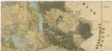
Situační plán kolenecké obory 1

Situační plán kolenecké obory 1
Geometrický plán kolenecké obory 1

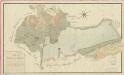
Geometrický plán kolenecké obory, rybníků Prkenný a Mezenský, pastvin a luk 1

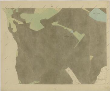
Kollenetz - c3278-1-002 - Kaiserpflichtexemplar der Landkarten des stabilen Katasters
1 : 2880
Kollenetz - c3278-1-001 - Kaiserpflichtexemplar der Landkarten des stabilen Katasters
1 : 2880
Kollenetz - c3278-1-009 - Kaiserpflichtexemplar der Landkarten des stabilen Katasters
1 : 2880
Kollenetz - c3278-1-004 - Kaiserpflichtexemplar der Landkarten des stabilen Katasters
1 : 2880
Kollenetz - c3278-1-005 - Kaiserpflichtexemplar der Landkarten des stabilen Katasters
1 : 2880
Kollenetz - c3278-1-008 - Kaiserpflichtexemplar der Landkarten des stabilen Katasters
1 : 2880
Kollenetz - c3278-1-007 - Kaiserpflichtexemplar der Landkarten des stabilen Katasters
1 : 2880
Kollenetz - c3278-1-006 - Kaiserpflichtexemplar der Landkarten des stabilen Katasters
1 : 2880
Kollenetz - c3278-1-003 - Kaiserpflichtexemplar der Landkarten des stabilen Katasters
1 : 2880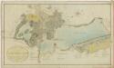
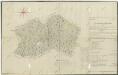
Geometrický plán rybníků Potěšil Klec, Krvavej a přilehlých činžovních pozemků 1
Geometrický plán rybníků Potěšil Klec, Krvavej a přilehlých činžovních pozemků 1
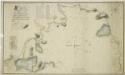
Mapa území mezi třeboňským panstvím a činžovními pozemky vsi Kolence 1

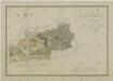
Kletz - c3138-1-001 - Kaiserpflichtexemplar der Landkarten des stabilen Katasters
1 : 2880
Kletz - c3138-1-004 - Kaiserpflichtexemplar der Landkarten des stabilen Katasters
1 : 2880
Kletz - c3138-1-003 - Kaiserpflichtexemplar der Landkarten des stabilen Katasters
1 : 2880
Kletz - c3138-1-002 - Kaiserpflichtexemplar der Landkarten des stabilen Katasters
1 : 2880
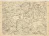
Generální mapa panství Třeboň a inkorporovaných statků Bzí, Lomnice, Borovany, Třeboň, Hamr a Val 1

Porostní mapa polesí Kolence 1
1 : 15000
Porostní mapa polesí Kolence 1
1 : 15000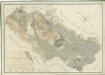
Přehledná mapa pozemků statku Hamr-Val a lesů koleneckého polesí 1

Přehledná mapa polesí Dvořiště 1
Administrativní mapa třeboňského panství se statky Bzí,Lomnice, Borovany,Hamr a Val 1
Situační plán statku Hamr-Val a přilehlých pozemků 1

III. vojenské mapování 4353/4
1 : 25000