Maps of Libín

Zvíkov o. České Budějovice 1
1 : 2880
Wlkowitz - c8708-1-003 - Kaiserpflichtexemplar der Landkarten des stabilen Katasters
1 : 2880
Wlkowitz - c8708-1-001 - Kaiserpflichtexemplar der Landkarten des stabilen Katasters
1 : 2880
Wlkowitz - c8708-1-002 - Kaiserpflichtexemplar der Landkarten des stabilen Katasters
1 : 2880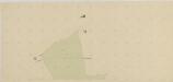
Štěpánovice o. České Budějovice 1
1 : 2880
Zwikow - c9308-1-004 - Kaiserpflichtexemplar der Landkarten des stabilen Katasters
1 : 2880
Zwikow - c9308-1-006 - Kaiserpflichtexemplar der Landkarten des stabilen Katasters
1 : 2880
Zwikow - c9308-1-005 - Kaiserpflichtexemplar der Landkarten des stabilen Katasters
1 : 2880
Zwikow - c9308-1-003 - Kaiserpflichtexemplar der Landkarten des stabilen Katasters
1 : 2880
Zwikow - c9308-1-001 - Kaiserpflichtexemplar der Landkarten des stabilen Katasters
1 : 2880
Zwikow - c9308-1-007 - Kaiserpflichtexemplar der Landkarten des stabilen Katasters
1 : 2880
Zwikow - c9308-1-002 - Kaiserpflichtexemplar der Landkarten des stabilen Katasters
1 : 2880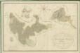
Přehledná mapa polesí Ledenice 1
Přehledná mapa polesí Ledenice 1

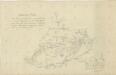
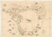
Generální mapa panství Třeboň a inkorporovaných statků Bzí, Lomnice, Borovany, Třeboň, Hamr a Val 1
Záměrná mapa hranic lesů a pozemků v okolí městečka Lišov 1
Přehledná mapa polesí Ledenice 1

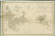
Situační plán erární silnice od dvora Kuna do Ledenic 1

[Mapový list]
1 : 25000 Borovany-oblast (České Budějovice, Česko) Vojenský zeměpisný ústav
III. vojenské mapování 4453/2
1 : 25000
Gradkartenblatt
1 : 25000 Borovany-oblast (České Budějovice, Česko) Gerstner, Eduard von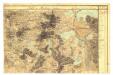

Umgebung von Budweis
1 : 37000 České Budějovice-oblast (Česko) Popper, Filipp L.E. Hansen
Topographische Karte ... Herrschaft Krummau ...

Topographische Karte der in Böhmen budweiser Kreises liegenden

Podrobné mapy zemí Koruny české v měřítku 1:75.000 a mapa vzdáleností všech míst při silnici ležících - České Budějovice - Trhové Sviny. Průvodce statisticko-historický po všech místech na těchto mapách uvedených a rejstřík věcný názvů hor, potoků, řek, rybníků atd. Sešit 33. List 61,
1 : 75000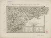
II. vojenské mapování 35
1 : 144000
Podrobné mapy zemí Koruny české v měřítku 1:75.000 a mapy vzdáleností všech míst při silnici ležících
1 : 75000 Trhové Sviny (Česko : oblast) Bělohlav, Josef F. Topič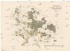
Uibersichts-Karte der hochfürstlich zu Schwarzenbergschen Domaine Frauenberg nach dem Stande im Jahre 1876
1 : 58000 Hluboká nad Vltavou-oblast (Česko) Danesch, Jos. Kreibich, František Jakub Jindřich