Maps of Metropolitan France

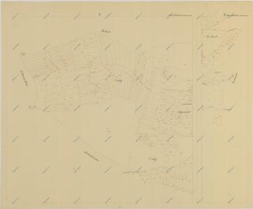
Pořežany o. České Budějovice 1
1 : 2880
Carte de la France protestante / dressée sous la dir. de la Commission des Publications de la Fédération Protestante de France ; dressée par L. Hermann
1 : 1500000 Hermann, L.; Fédération Protestante de France. Commission des Publications Paris : Fischbacher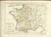
France.
1 : 3000000 Lapie, M. (Pierre), 1779-1850
Le Royaume De France, distingué suivant l'estendue de Toutes Ses Provinces Et Ses Acquisitions, dans l'Espagne, dans l'Italie, dans l'Allemagne [...] [Karte], in: Atlas nouveau, contenant toutes les parties du monde [...], Bd. 1, S. 74.
1 Karte aus Atlas Sanson, Nicolas Jaillot, Alexis Hubert und Mortier, Pieter
La France 843 a 987.
1 : 5800000 Houze, Antoine Philippe
A new and accurate map of France with its aquisitions / composed from the latest surveys assited by the most approved maps & charts & regulated by astrol. Observations by Eman. Bowen
Bowen, Emmanuel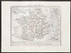
Gallia transalpina
1 : 3300000 Marzolla, Benedetto [Verlag nicht ermittelbar]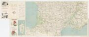
Carte Michelin 99: France - Sud, uit: Carte Michelin au 1:1.000.000e (1 cm = 10 km) : les grandes routes de France
1 : 1000000 Clermont-Ferrand : Michelin
Empire Francais et Royaume d'Italie en 1809.
1 : 6000000 Houze, Antoine Philippe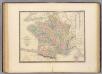
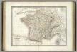
France.
1 : 3000000 Andriveau-Goujon, J.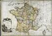
La France
1 Karte : Kupferdruck ; 54 x 77 cm Brion de la Tour; Le Campion; Le Campion chez les Campions freres rue St. Jacques à la ville de Rouen no. 8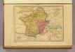
Carte des Gaules.
1 : 6000000 Malte-Brun, Conrad, 1775-1826
La France 1350 a 1364.
1 : 6000000 Houze, Antoine Philippe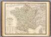
France physique, politique.
1 : 2350000 Andriveau-Goujon, J.
La France 1814 a 1840.
1 : 6000000 Houze, Antoine Philippe
La France 1643 a 1715.
1 : 6000000 Houze, Antoine Philippe
La France 1223 a 1270.
1 : 5800000 Houze, Antoine Philippe
La France 1774 a 1793.
1 : 6000000 Houze, Antoine Philippe
La France 1422 a 1461.
1 : 6000000 Houze, Antoine Philippe
La France 1270 a 1328.
1 : 6000000 Houze, Antoine Philippe
La France 1589 a 1643.
1 : 6000000 Houze, Antoine Philippe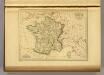
France in 1789.
1 : 5900000 Malte-Brun, Conrad, 1775-1826
La France 1180 a 1223.
1 : 5800000 Houze, Antoine Philippe
Regnum Galliæ
1 Karte : Kupferdruck ; 46 x 58 cm Valck; Valck G. und L. Valck
La France 1715 a 1774
1 : 6000000 Houze, Antoine Philippe
La France 1108 a 1180.
1 : 5800000 Houze, Antoine Philippe
La France 1461 a 1483.
1 : 6000000 Houze, Antoine Philippe
Gallia Vetus, Ad Iul Caesaris Commentaria [Karte], in: Theatrum orbis terrarum, sive, Atlas novus, Bd. 2, S. 187.
1 Karte aus Atlas Blaeu, Joan Blaeu, Willem Janszoon