Maps of Borovany

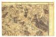
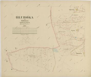
Hluboká o. České Budějovice 1
1 : 2880
Hluboka - c1893-1-007 - Kaiserpflichtexemplar der Landkarten des stabilen Katasters
1 : 2880
Hluboka - c1893-1-008 - Kaiserpflichtexemplar der Landkarten des stabilen Katasters
1 : 2880
Hluboka - c1893-1-004 - Kaiserpflichtexemplar der Landkarten des stabilen Katasters
1 : 2880
Hluboka - c1893-1-006 - Kaiserpflichtexemplar der Landkarten des stabilen Katasters
1 : 2880
Hluboka - c1893-1-001 - Kaiserpflichtexemplar der Landkarten des stabilen Katasters
1 : 2880
Hluboka - c1893-1-005 - Kaiserpflichtexemplar der Landkarten des stabilen Katasters
1 : 2880
Hluboka - c1893-1-003 - Kaiserpflichtexemplar der Landkarten des stabilen Katasters
1 : 2880
Hluboka - c1893-1-002 - Kaiserpflichtexemplar der Landkarten des stabilen Katasters
1 : 2880
Hohendorf - c5583-1-002 - Kaiserpflichtexemplar der Landkarten des stabilen Katasters
1 : 2880
Hohendorf - c5583-1-004 - Kaiserpflichtexemplar der Landkarten des stabilen Katasters
1 : 2880
Hohendorf - c5583-1-005 - Kaiserpflichtexemplar der Landkarten des stabilen Katasters
1 : 2880
Hohendorf - c5583-1-003 - Kaiserpflichtexemplar der Landkarten des stabilen Katasters
1 : 2880
Hohendorf - c5583-1-001 - Kaiserpflichtexemplar der Landkarten des stabilen Katasters
1 : 2880
Forbes - c0390-1-003 - Kaiserpflichtexemplar der Landkarten des stabilen Katasters
1 : 2880
Forbes - c0390-1-001 - Kaiserpflichtexemplar der Landkarten des stabilen Katasters
1 : 2880
Forbes - c0390-1-006 - Kaiserpflichtexemplar der Landkarten des stabilen Katasters
1 : 2880
Forbes - c0390-1-004 - Kaiserpflichtexemplar der Landkarten des stabilen Katasters
1 : 2880
Forbes - c0390-1-005 - Kaiserpflichtexemplar der Landkarten des stabilen Katasters
1 : 2880
Forbes - c0390-1-002 - Kaiserpflichtexemplar der Landkarten des stabilen Katasters
1 : 2880
Triebsch - c8013-1-001 - Kaiserpflichtexemplar der Landkarten des stabilen Katasters
1 : 2880
Triebsch - c8013-1-005 - Kaiserpflichtexemplar der Landkarten des stabilen Katasters
1 : 2880
Triebsch - c8013-1-002 - Kaiserpflichtexemplar der Landkarten des stabilen Katasters
1 : 2880
Triebsch - c8013-1-004 - Kaiserpflichtexemplar der Landkarten des stabilen Katasters
1 : 2880
Triebsch - c8013-1-003 - Kaiserpflichtexemplar der Landkarten des stabilen Katasters
1 : 2880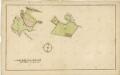
Plán směny pozemků u vsi Hluboká mezi klášterem Borovany a měšťany z Borovan

Generální mapa panství Třeboň a inkorporovaných statků Bzí, Lomnice, Borovany, Třeboň, Hamr a Val 1
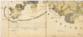
Administrativní mapa třeboňského panství se statky Bzí,Lomnice, Borovany,Hamr a Val 1