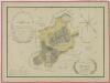
Maps of Žimutice

Hartmanice o. České Budějovice 1
1 : 2880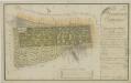
Geometrický plán remizů při žimutické honitbě 1
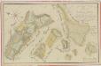
Geometrický plán dvora Korákov na statku Bzí, lesů Rudice a Chrášťanský, rybníka Slabec a přilehlých deputátních pozemků 1
Geometrický plán rybníků u Zálší, Hartmanic, Hvozdna a Sobětic na statku Bzí: Nohavice, Kejhar, Dvorský, Hvězdář, Kobylník, Nový Kamenný a Rohlík 1
Mapa pozemků Nového dvora 1

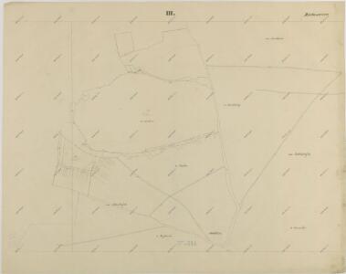
Hartmanitz - c1784-1-006 - Kaiserpflichtexemplar der Landkarten des stabilen Katasters
1 : 2880
Hartmanitz - c1784-1-004 - Kaiserpflichtexemplar der Landkarten des stabilen Katasters
1 : 2880
Hartmanitz - c1784-1-002 - Kaiserpflichtexemplar der Landkarten des stabilen Katasters
1 : 2880
Hartmanitz - c1784-1-003 - Kaiserpflichtexemplar der Landkarten des stabilen Katasters
1 : 2880
Hartmanitz - c1784-1-005 - Kaiserpflichtexemplar der Landkarten des stabilen Katasters
1 : 2880
Hartmanitz - c1784-1-007 - Kaiserpflichtexemplar der Landkarten des stabilen Katasters
1 : 2880
Hartmanitz - c1784-1-001 - Kaiserpflichtexemplar der Landkarten des stabilen Katasters
1 : 2880
Betschitz - c0085-1-001 - Kaiserpflichtexemplar der Landkarten des stabilen Katasters
1 : 2880
Betschitz - c0085-1-004 - Kaiserpflichtexemplar der Landkarten des stabilen Katasters
1 : 2880
Betschitz - c0085-1-002 - Kaiserpflichtexemplar der Landkarten des stabilen Katasters
1 : 2880
Betschitz - c0085-1-003 - Kaiserpflichtexemplar der Landkarten des stabilen Katasters
1 : 2880
Betschitz - c0085-1-007 - Kaiserpflichtexemplar der Landkarten des stabilen Katasters
1 : 2880
Betschitz - c0085-1-006 - Kaiserpflichtexemplar der Landkarten des stabilen Katasters
1 : 2880
Betschitz - c0085-1-008 - Kaiserpflichtexemplar der Landkarten des stabilen Katasters
1 : 2880
Betschitz - c0085-1-005 - Kaiserpflichtexemplar der Landkarten des stabilen Katasters
1 : 2880
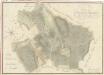
Mapa pozemků dvora Korákov 1
1 : 5760
Záměrná mapa dvora Korákov 1

Mapa dělení pozemků dvora Korákov po 1. pozemkové reformě 1
1 : 5760
Bečice o. České Budějovice 1
1 : 2880
Geometrický plán rybníků u Zálší, Hartmanic, Hvozdna a Sobětic na statku Bzí: Nohavice, Kejhar, Dvorský, Hvězdář, Kobylník, Nový Kamenný a Rohlík 1

Porostní mapa polesí Bzí 1
1 : 15000
Mapa lesních cest v polesí Bzí 1
1 : 15000
Porostní mapa polesí Bzí 1
1 : 15000
Porostní mapa revíru Bzí pro desetiletí 1931/1940 1
1 : 15000