Maps of Lomnice nad Lužnicí

Mapy činžovních pozemků II. sekce třeboňského velkostatku pro obce Dolní Slověnice, Dunajovice, Klec, Kolence, Lomnice, Lužnice, Mláka, Novosedly, Přeseka, Smržov, Stará Hlína 1
1 : 2880
Plán železniční tratě v úseku Gmünd - Veselí nad Lužnicí, list 11 1
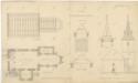
Plán lomnického kostela 1
1 : 100
Geometrický plán odpadních stok z rybníků Tisý, Dubovec a Panenský do řeky Lužnice 1

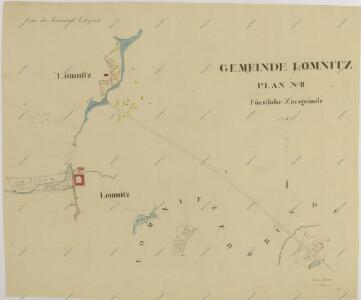
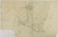
Záměrná mapa-brouillon-Lomnice nad Lužnicí a jejího okolí 1
Lomnice o. Jindřichův Hradec 1
1 : 2880
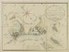
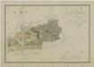
Mapa pozemků dvora Šaloun 1
Geometrický plán odpadních stok z rybníků Tisý, Dubovec a Panenský do řeky Lužnice 1

Mapa pozemků dvora Šaloun 1
Mapa pozemků dvora Šaloun 1

Lomnitz - c4219-1-005 - Kaiserpflichtexemplar der Landkarten des stabilen Katasters
1 : 2880
Lomnitz - c4219-1-006 - Kaiserpflichtexemplar der Landkarten des stabilen Katasters
1 : 2880
Lomnitz - c4219-1-002 - Kaiserpflichtexemplar der Landkarten des stabilen Katasters
1 : 2880
Lomnitz - c4219-1-008 - Kaiserpflichtexemplar der Landkarten des stabilen Katasters
1 : 2880
Lomnitz - c4219-1-011 - Kaiserpflichtexemplar der Landkarten des stabilen Katasters
1 : 2880
Lomnitz - c4219-1-001 - Kaiserpflichtexemplar der Landkarten des stabilen Katasters
1 : 2880
Lomnitz - c4219-1-007 - Kaiserpflichtexemplar der Landkarten des stabilen Katasters
1 : 2880
Lomnitz - c4219-1-003 - Kaiserpflichtexemplar der Landkarten des stabilen Katasters
1 : 2880
Lomnitz - c4219-1-009 - Kaiserpflichtexemplar der Landkarten des stabilen Katasters
1 : 2880
Lomnitz - c4219-1-010 - Kaiserpflichtexemplar der Landkarten des stabilen Katasters
1 : 2880
Lomnitz - c4219-1-012 - Kaiserpflichtexemplar der Landkarten des stabilen Katasters
1 : 2880
Lomnitz - c4219-1-004 - Kaiserpflichtexemplar der Landkarten des stabilen Katasters
1 : 2880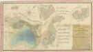
Geometrický plán rybníka Černičný, pozemků jednotáře Zahradníka u Klece a přilehlých činžovních pozemků 1
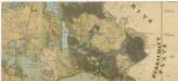
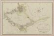
Administrativní mapa třeboňského panství se statky Bzí,Lomnice, Borovany,Hamr a Val 1

Přehledná mapa polesí Dvořiště 1
Situační plán statku Hamr-Val a přilehlých pozemků 1

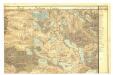
III. vojenské mapování 4353/4
1 : 25000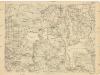
[Gradkartenblatt]
1 : 25000 Třeboň-oblast (Česko)
Gradkartenblatt
1 : 25000 Třeboň-oblast (Česko) Gerstner, Eduard von