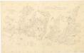
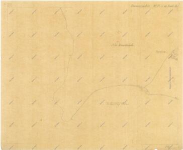
Maps of Kounov

Kopie katastrální mapy obce Domoušice s kolonií Filipov, list IV 1

Kopie katastrální mapy obce Domoušice, list 4 – oblast Rovina 1
1 : 2880
Mapa polesí Rovina, druhý exemplář 1
1 : 2880
Plán služebních pozemků na Rovině 1
1 : 2880
Evidenční mapa polesí Rovina 1
1 : 2880
Hraniční mapa lesních parcel v katastru obce Kounov, list 1 1
1 : 2880
Plán č. 4, obce Domoušice a Pnětluky, lesní činžovní pozemky 1

Konowa (Kaunowa) - c3426-1-002 - Kaiserpflichtexemplar der Landkarten des stabilen Katasters
1 : 2880
Konowa (Kaunowa) - c3426-1-003 - Kaiserpflichtexemplar der Landkarten des stabilen Katasters
1 : 2880
Konowa (Kaunowa) - c3426-1-005 - Kaiserpflichtexemplar der Landkarten des stabilen Katasters
1 : 2880
Konowa (Kaunowa) - c3426-1-001 - Kaiserpflichtexemplar der Landkarten des stabilen Katasters
1 : 2880
Konowa (Kaunowa) - c3426-1-004 - Kaiserpflichtexemplar der Landkarten des stabilen Katasters
1 : 2880
Konowa (Kaunowa) - c3426-1-006 - Kaiserpflichtexemplar der Landkarten des stabilen Katasters
1 : 2880
Domauschitz (Domaussic) - c1442-1-001 - Kaiserpflichtexemplar der Landkarten des stabilen Katasters
1 : 2880
Domauschitz (Domaussic) - c1442-1-003 - Kaiserpflichtexemplar der Landkarten des stabilen Katasters
1 : 2880
Domauschitz (Domaussic) - c1442-1-004 - Kaiserpflichtexemplar der Landkarten des stabilen Katasters
1 : 2880
Domauschitz (Domaussic) - c1442-1-002 - Kaiserpflichtexemplar der Landkarten des stabilen Katasters
1 : 2880
Domauschitz (Domaussic) - c1442-1-005 - Kaiserpflichtexemplar der Landkarten des stabilen Katasters
1 : 2880
Záměrná mapa polesí Domoušice, sekce 6 6

Porostní mapa polesí Rovina 1
1 : 10000
Kopie katastrální mapy obce Kounov, list II 1

Porostní mapa polesí Rovina 1
1 : 10000
Porostní mapa polesí Domoušice 1
1 : 15000
Přehledná mapa polesí Domoušice, Rovina, Selmice, Markvarec 3239
1 : 23000
Porostní mapa pro exkurzi Českého lesnického spolku v domoušickém lesním okrsku v roce 1881 1
1 : 20000
Porostní mapa pro exkurzi Českého lesnického spolku v domoušickém lesním okrsku v roce 1881 1
1 : 20000
Porostní mapa pro exkurzi Českého lesnického spolku v domoušickém lesním okrsku v roce 1881 1
1 : 20000
Porostní mapa pro exkurzi Českého lesnického spolku v domoušickém lesním okrsku v roce 1881 1
1 : 20000
Mapa polesí Třeboc, Obora, Přerubenice se zakreslením cest, lesů a hranic schwarzenberských a cizích polesí 1