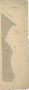
Maps of Obora

Katastrální mapa obce Kaznějov WC-VIII-18 ag
1 : 2880
Záměrná mapa polesí Doubrava
1 : 5000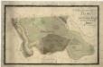
Porostní mapa části kaznějovského polesí - Puchýř
1 : 2918
Wobora - c5347-1-007 - Kaiserpflichtexemplar der Landkarten des stabilen Katasters
1 : 2880
Wobora - c5347-1-006 - Kaiserpflichtexemplar der Landkarten des stabilen Katasters
1 : 2880
Wobora - c5347-1-004 - Kaiserpflichtexemplar der Landkarten des stabilen Katasters
1 : 2880
Wobora - c5347-1-003 - Kaiserpflichtexemplar der Landkarten des stabilen Katasters
1 : 2880
Wobora - c5347-1-005 - Kaiserpflichtexemplar der Landkarten des stabilen Katasters
1 : 2880
Wobora - c5347-1-002 - Kaiserpflichtexemplar der Landkarten des stabilen Katasters
1 : 2880
Wobora - c5347-1-001 - Kaiserpflichtexemplar der Landkarten des stabilen Katasters
1 : 2880
Kasniau (Kaznow) - c3075-1-001 - Kaiserpflichtexemplar der Landkarten des stabilen Katasters
1 : 2880
Kasniau (Kaznow) - c3075-1-006 - Kaiserpflichtexemplar der Landkarten des stabilen Katasters
1 : 2880
Kasniau (Kaznow) - c3075-1-009 - Kaiserpflichtexemplar der Landkarten des stabilen Katasters
1 : 2880
Kasniau (Kaznow) - c3075-1-002 - Kaiserpflichtexemplar der Landkarten des stabilen Katasters
1 : 2880
Kasniau (Kaznow) - c3075-1-003 - Kaiserpflichtexemplar der Landkarten des stabilen Katasters
1 : 2880
Kasniau (Kaznow) - c3075-1-007 - Kaiserpflichtexemplar der Landkarten des stabilen Katasters
1 : 2880
Kasniau (Kaznow) - c3075-1-004 - Kaiserpflichtexemplar der Landkarten des stabilen Katasters
1 : 2880
Kasniau (Kaznow) - c3075-1-005 - Kaiserpflichtexemplar der Landkarten des stabilen Katasters
1 : 2880
Kasniau (Kaznow) - c3075-1-008 - Kaiserpflichtexemplar der Landkarten des stabilen Katasters
1 : 2880
Mapa polesí Doubrava
1 : 5000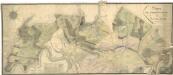
Porostní mapa polesí Plasy
1 : 2918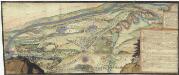
[Plasy]
Plasy-oblast (Česko)
III. vojenské mapování 4051/1
1 : 25000
III. vojenské mapování 4051/1
1 : 25000
Gradkartenblatt
1 : 25000 Kralovice-oblast (Plzeň-sever, Česko) Bulla, Eduard
Generální mapa panství Plasy se statkem Krašov (bez Kaceřova a Horní Bělé)
1 : 11611
Generální mapa lesů velkostatku Plasy
1 : 13186
Zastupitelský okres Plzeňský
Rukopisná mapa zastupitelského okresu Plzeňského. Vyznačeny jednotlivé obce a hranice jejich katastrů. Zaznamenána síť sídel, vodních toků a komunikační. Znázorněny mlýny a rozptýlené jednotlivé stavby. Vlevo dole grafické měřítko.
Situační plán hájoven náležejících k panství Plasy
1 : 25000