Maps of Tři Sekery

Katastrální mapa obce Tři Sekery WC-XV-17 ch
1 : 2880
Záměrná mapa parcel obcí Tři Sekery a Jedlová
1 : 2880
Mapa vrchnostenských lesů a pozemků při obcích Pavlův Studenec a Tachovská Huť
1 : 2671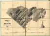
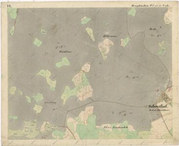
Porostní mapa revíru Tři Sekery
1 : 11520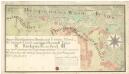
Lesní hraniční mapa mezi revírem Tři Sekery (sekce III) a pozemky obce Tři Sekery
1 : 3612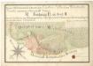
Lesní hraniční mapa mezi revírem Tři Sekery a pozemky obce Krásné
1 : 3612
Dreyhacken - c8080-1-010 - Kaiserpflichtexemplar der Landkarten des stabilen Katasters
1 : 2880
Dreyhacken - c8080-1-005 - Kaiserpflichtexemplar der Landkarten des stabilen Katasters
1 : 2880
Dreyhacken - c8080-1-017 - Kaiserpflichtexemplar der Landkarten des stabilen Katasters
1 : 2880
Dreyhacken - c8080-1-002 - Kaiserpflichtexemplar der Landkarten des stabilen Katasters
1 : 2880
Dreyhacken - c8080-1-004 - Kaiserpflichtexemplar der Landkarten des stabilen Katasters
1 : 2880
Dreyhacken - c8080-1-011 - Kaiserpflichtexemplar der Landkarten des stabilen Katasters
1 : 2880
Dreyhacken - c8080-1-015 - Kaiserpflichtexemplar der Landkarten des stabilen Katasters
1 : 2880
Dreyhacken - c8080-1-001 - Kaiserpflichtexemplar der Landkarten des stabilen Katasters
1 : 2880
Dreyhacken - c8080-1-006 - Kaiserpflichtexemplar der Landkarten des stabilen Katasters
1 : 2880
Dreyhacken - c8080-1-007 - Kaiserpflichtexemplar der Landkarten des stabilen Katasters
1 : 2880
Dreyhacken - c8080-1-016 - Kaiserpflichtexemplar der Landkarten des stabilen Katasters
1 : 2880
Dreyhacken - c8080-1-012 - Kaiserpflichtexemplar der Landkarten des stabilen Katasters
1 : 2880
Dreyhacken - c8080-1-018 - Kaiserpflichtexemplar der Landkarten des stabilen Katasters
1 : 2880
Dreyhacken - c8080-1-014 - Kaiserpflichtexemplar der Landkarten des stabilen Katasters
1 : 2880
Dreyhacken - c8080-1-008 - Kaiserpflichtexemplar der Landkarten des stabilen Katasters
1 : 2880
Dreyhacken - c8080-1-013 - Kaiserpflichtexemplar der Landkarten des stabilen Katasters
1 : 2880
Dreyhacken - c8080-1-003 - Kaiserpflichtexemplar der Landkarten des stabilen Katasters
1 : 2880
Dreyhacken - c8080-1-009 - Kaiserpflichtexemplar der Landkarten des stabilen Katasters
1 : 2880
Porostní mapa revíru Tři Sekery-Lohhäuser
1 : 11520
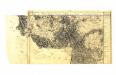
[Umgebung von Dreihacken]
Dolní Žandov-oblast (Česko) Kreibich, František Jakub Jindřich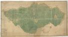
Plán revíru Tři Sekery
1 : 4742
Gradkartenblatt
1 : 25000 Čechy (Česko) Böhm, Karl