Maps of Dlouhý Újezd
Katastrální mapa obce Pořejov
1 : 2880
Hospodářská mapa revíru Pořejov
1 : 5760
Přehledová mapa velkostatku Tachov
1 : 5747
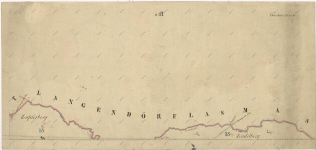
Langendörflas - c1151-1-002 - Kaiserpflichtexemplar der Landkarten des stabilen Katasters
1 : 2880
Langendörflas - c1151-1-001 - Kaiserpflichtexemplar der Landkarten des stabilen Katasters
1 : 2880
Langendörflas - c1151-1-003 - Kaiserpflichtexemplar der Landkarten des stabilen Katasters
1 : 2880
Langendörflas - c1151-1-005 - Kaiserpflichtexemplar der Landkarten des stabilen Katasters
1 : 2880
Langendörflas - c1151-1-004 - Kaiserpflichtexemplar der Landkarten des stabilen Katasters
1 : 2880
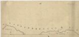
Porostní mapa revíru Pořejov-Dörflas
1 : 11520
Porostní mapa revíru Pořejov-Dörflas
1 : 11520
Porostní mapa revíru Pořejov, oddělení Dörflas
1 : 9726
Porostní mapa revíru Pořejov-Dörflas
1 : 11520
Gradkartenblatt
1 : 25000 Rozvadov-oblast (Česko) Bulla, Eduard


Bestandeskarte des Hauptcomplexes der Domaine Tachau
1 : 29000 Tachov-oblast (Česko) Anderlik, Otto Verlag des böhm. Forstvereins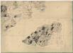
Přehledová mapa velkostatku Tachov
1 : 17280
Uibersichtskarte der Herrschaft Tachau
Tachov-oblast (Česko) Waraus, E. André Verlag des böhm. Forstvereins
Hayder Vicariat
Bor-oblast (Tachov, Česko)
Přehledová mapa velkostatku Tachov
1 : 17280
Mariánské Lázně
1 : 75000 Mariánské Lázně (Česko : oblast) Vojenský zeměpisný ústav
Mariánské Lázně
1 : 75000 Mariánské Lázně-oblast (Česko) Vojenský zeměpisný ústav
III. vojenské mapování 4049
1 : 75000
III. vojenské mapování 4149
1 : 75000
Politický okres Tachov
1 : 75000 Tachov (Česko : okres : 1960-) Vojenský zeměpisný ústav
Politický okres Tachov

Podrobná mapa Království českého
1 : 100000 Planá (Tachov, Česko : oblast) Srp, Jan Jaroslav Bursík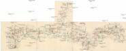
Böhmerwald-Verbindungsbahn
1 : 75000 Domažlice-Planá u Mariánských Lázní (Česko : železniční trať) Technisches Bureau Ing. Max Picha
Vilímkovy místopisné mapy zemí Koruny české
1 : 100000 Chodová Planá (Česko : oblast) Srp, Jan Jos. R. Vilímek