Maps of Kralovice

Katastrální mapa obce Trojany WC-VII- 17 dh
1 : 2880
Záměrná mapa polesí Olšany
1 : 5000
Mapa části polesí Olšany
1 : 5000
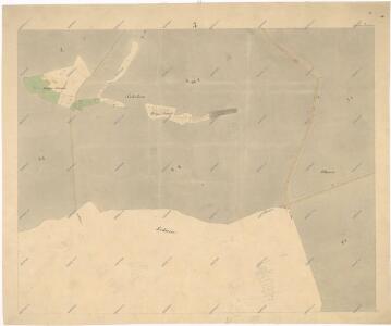
Trojan (Trojani) - c7985-1-001 - Kaiserpflichtexemplar der Landkarten des stabilen Katasters
1 : 2880
Trojan (Trojani) - c7985-1-004 - Kaiserpflichtexemplar der Landkarten des stabilen Katasters
1 : 2880
Trojan (Trojani) - c7985-1-002 - Kaiserpflichtexemplar der Landkarten des stabilen Katasters
1 : 2880
Trojan (Trojani) - c7985-1-005 - Kaiserpflichtexemplar der Landkarten des stabilen Katasters
1 : 2880
Trojan (Trojani) - c7985-1-003 - Kaiserpflichtexemplar der Landkarten des stabilen Katasters
1 : 2880
Porostní mapa polesí Olšany
1 : 10000
Porostní mapa polesí Olšany
1 : 10000
Hospodářská mapa polesí Olšany
1 : 10000
Pantogram polesí Olšany
1 : 10000
Porostní mapa polesí Olšany
1 : 2918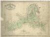
Hospodářská mapa polesí Olšany
1 : 11853
Záměrná mapa polesí Olšany
1 : 5000
Zebnitz (Zebnice) - c9374-1-003 - Kaiserpflichtexemplar der Landkarten des stabilen Katasters
1 : 2880
Zebnitz (Zebnice) - c9374-1-002 - Kaiserpflichtexemplar der Landkarten des stabilen Katasters
1 : 2880
Zebnitz (Zebnice) - c9374-1-001 - Kaiserpflichtexemplar der Landkarten des stabilen Katasters
1 : 2880
Mapa části polesí Olšany
1 : 5000
Mapa pozemků dvora Sechutice v katastru obce Výrov
1 : 5760
Mapa části polesí Olšany
1 : 5000
Porostní mapa polesí Olšany
1 : 2880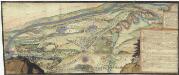
[Plasy]
Plasy-oblast (Česko)
III. vojenské mapování 4051/1
1 : 25000
III. vojenské mapování 4051/1
1 : 25000
Gradkartenblatt
1 : 25000 Kralovice-oblast (Plzeň-sever, Česko) Bulla, Eduard
Generální mapa panství Plasy se statkem Krašov (bez Kaceřova a Horní Bělé)
1 : 11611
Přehledná mapa velkostatku Manětín podle stavu k roku 1905
1 : 37500