Maps of Bílov

Katastrální mapa obce Sedlec WC-VII- 17 de
1 : 2880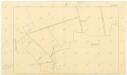
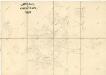
Katastrální mapa obce Bílov
1 : 2880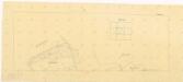
Katastrální mapa obce Bukovina
1 : 2880
Katastrální mapa obce Bílov
1 : 2880
Situační plán katastrálního území Potvorov
1 : 2880
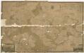
Bilow - c0229-1-003 - Kaiserpflichtexemplar der Landkarten des stabilen Katasters
1 : 2880
Bilow - c0229-1-002 - Kaiserpflichtexemplar der Landkarten des stabilen Katasters
1 : 2880
Bilow - c0229-1-001 - Kaiserpflichtexemplar der Landkarten des stabilen Katasters
1 : 2880
Bilow - c0229-1-004 - Kaiserpflichtexemplar der Landkarten des stabilen Katasters
1 : 2880
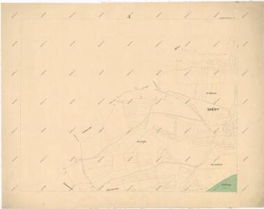
Sedletz (Sedlice) - c6774-1-002 - Kaiserpflichtexemplar der Landkarten des stabilen Katasters
1 : 2880
Sedletz (Sedlice) - c6774-1-004 - Kaiserpflichtexemplar der Landkarten des stabilen Katasters
1 : 2880
Sedletz (Sedlice) - c6774-1-001 - Kaiserpflichtexemplar der Landkarten des stabilen Katasters
1 : 2880
Sedletz (Sedlice) - c6774-1-003 - Kaiserpflichtexemplar der Landkarten des stabilen Katasters
1 : 2880
Potworow - c6051-1-003 - Kaiserpflichtexemplar der Landkarten des stabilen Katasters
1 : 2880
Potworow - c6051-1-004 - Kaiserpflichtexemplar der Landkarten des stabilen Katasters
1 : 2880
Potworow - c6051-1-001 - Kaiserpflichtexemplar der Landkarten des stabilen Katasters
1 : 2880
Potworow - c6051-1-002 - Kaiserpflichtexemplar der Landkarten des stabilen Katasters
1 : 2880
Bukowina - c0670-1-001 - Kaiserpflichtexemplar der Landkarten des stabilen Katasters
1 : 2880
Bukowina - c0670-1-002 - Kaiserpflichtexemplar der Landkarten des stabilen Katasters
1 : 2880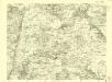
III. vojenské mapování 3951/3
1 : 25000
Gradkartenblatt
1 : 25000 Jesenice-oblast (Rakovník, Česko) Bulla, Eduard
Generální mapa panství Plasy se statkem Krašov (bez Kaceřova a Horní Bělé)
1 : 11611
Generální mapa lesů velkostatku Plasy
1 : 13186
Situační plán hájoven náležejících k panství Plasy
1 : 25000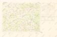
Mapy plánování ČSR

III. vojenské mapování 3951
1 : 75000
Rakovník
1 : 75000 Rakovník-oblast (Česko) Vojenský zeměpisný ústav