Maps of Plasy

Katastrální mapa obce Plasy
1 : 2880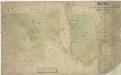
Mapa dvou částí plaského polesí - Hinter dem Kalzhofen a Bor
1 : 2918
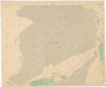
Plass - c5817-1-001 - Kaiserpflichtexemplar der Landkarten des stabilen Katasters
1 : 2880
Plass - c5817-1-003 - Kaiserpflichtexemplar der Landkarten des stabilen Katasters
1 : 2880
Plass - c5817-1-005 - Kaiserpflichtexemplar der Landkarten des stabilen Katasters
1 : 2880
Plass - c5817-1-002 - Kaiserpflichtexemplar der Landkarten des stabilen Katasters
1 : 2880
Plass - c5817-1-007 - Kaiserpflichtexemplar der Landkarten des stabilen Katasters
1 : 2880
Plass - c5817-1-004 - Kaiserpflichtexemplar der Landkarten des stabilen Katasters
1 : 2880
Plass - c5817-1-006 - Kaiserpflichtexemplar der Landkarten des stabilen Katasters
1 : 2880
Porostní mapa polesí Lomany
1 : 2918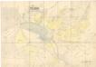
Situační plán katastrálního území Plasy
1 : 2880
Mapa pozemků dvora Plasy v katastru obce Plasy
1 : 5760
Záměrná mapa polesí Plasy
1 : 5000
Ober Hradischt (Horni Hradisste) - c2048-1-003 - Kaiserpflichtexemplar der Landkarten des stabilen Katasters
1 : 2880
Ober Hradischt (Horni Hradisste) - c2048-1-002 - Kaiserpflichtexemplar der Landkarten des stabilen Katasters
1 : 2880
Ober Hradischt (Horni Hradisste) - c2048-1-001 - Kaiserpflichtexemplar der Landkarten des stabilen Katasters
1 : 2880
Koreytko - c3350-1-001 - Kaiserpflichtexemplar der Landkarten des stabilen Katasters
1 : 2880
Koreytko - c3350-1-002 - Kaiserpflichtexemplar der Landkarten des stabilen Katasters
1 : 2880
Wražno (Wrazen) - c8815-1-003 - Kaiserpflichtexemplar der Landkarten des stabilen Katasters
1 : 2880
Wražno (Wrazen) - c8815-1-002 - Kaiserpflichtexemplar der Landkarten des stabilen Katasters
1 : 2880
Wražno (Wrazen) - c8815-1-001 - Kaiserpflichtexemplar der Landkarten des stabilen Katasters
1 : 2880
Katastrální mapa obce Lomnička
1 : 2880
Katastrální mapa obce Horní Hradiště
1 : 2880
Mapa polesí Lomany
1 : 5000
Mapa části polesí Plasy
1 : 5000
Porostní mapa polesí Plasy
1 : 2918
III. vojenské mapování 4051/1
1 : 25000
III. vojenské mapování 4051/1
1 : 25000
Gradkartenblatt
1 : 25000 Kralovice-oblast (Plzeň-sever, Česko) Bulla, Eduard