Maps of Tři Sekery

Výsek katastrální mapy obce Plánská Huť
1 : 2880
Planer-Schmelzthal - c5810-2-003 - Kaiserpflichtexemplar der Landkarten des stabilen Katasters
1 : 2880
Planer-Schmelzthal - c5810-2-002 - Kaiserpflichtexemplar der Landkarten des stabilen Katasters
1 : 2880
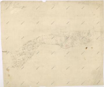
Planer-Schmelzthal - c5810-2-001 - Kaiserpflichtexemplar der Landkarten des stabilen Katasters
1 : 2880
Hospodářská a porostní mapa revíru Plánská Huť
1 : 2880
Hospodářská a porostní mapa revíru Plánská Huť
1 : 2880
Katastrální mapa obce Tři Sekery WC-XV-18 de
1 : 2880
Hospodářská mapa revíru Plánská Huť
1 : 8640
Brouillon hospodářské mapy revíru Plánská Huť
1 : 2880
Hospodářská mapa revíru Plánská Huť
1 : 4377
Hospodářská a porostní mapa revíru Plánská Huť
1 : 4350
Hospodářská mapa revíru Plánská Huť
1 : 8640
Katastrální mapa obce Tři Sekery WC-XV-18 ce
1 : 2880
Výsek katastrální mapy obce Plánská Huť
1 : 2880
Porostní mapa revíru Tři Sekery-Lohhäuser
1 : 11520
[Umgebung von Dreihacken]
Dolní Žandov-oblast (Česko) Kreibich, František Jakub Jindřich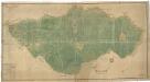
Plán revíru Tři Sekery
1 : 4742
Gradkartenblatt
1 : 25000 Čechy (Česko) Böhm, Karl
[Kartenblatt]
1 : 25000 Mähring (Německo) Reichsamt für Landesaufnahme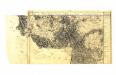

Umgebungskarte von Marienbad
1 : 25000 Mariánské Lázně (Česko : oblast) R. Lechner's k. u. k. Hof.- u. Univ.- Buchhandl. (Wilhelm Müller)
Umgebungskarte von Marienbad
1 : 25000 Mariánské Lázně (Česko : oblast) Franz Gschihay
Umgebungskarte der Curstadt Marienbad
1 : 60000 Mariánské Lázně-oblast (Česko) E.A. Götz
Umgebungskarte der Kurstadt Marienbad
1 : 50000 Mariánské Lázně-oblast (Česko) E.A. Götz
Hayder Vicariat
Bor-oblast (Tachov, Česko)
Marienbad und Tachau
1 : 75000 Mariánské Lázně (Česko : oblast) Höller, K. K. u. k. Militärgeographisches Institut
Marienbad und Tachau
1 : 75000 Mariánské Lázně (Česko : oblast) K. u. k. Militärgeographisches Institut
Přehledová mapa velkostatku Tachov
1 : 17280
Mariánské Lázně
1 : 75000 Chodová Planá (Česko : oblast) Vojenský zeměpisný ústav
Mariánské Lázně
1 : 75000 Mariánské Lázně (Česko : oblast) Vojenský zeměpisný ústav