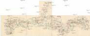
Maps of Bor

Katastrální mapa obce Lhota
1 : 2880
Katastrální mapa obce Lhota ZSL-XIV-20 dg
1 : 2880
Katastrální mapa obce Lhota ZSL-XIII-20 cg
1 : 2880
Ellhotten - c3924-1-001 - Kaiserpflichtexemplar der Landkarten des stabilen Katasters
1 : 2880
Ellhotten - c3924-1-003 - Kaiserpflichtexemplar der Landkarten des stabilen Katasters
1 : 2880
Ellhotten - c3924-1-002 - Kaiserpflichtexemplar der Landkarten des stabilen Katasters
1 : 2880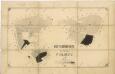
Porostní mapa revíru Pavlovice
1 : 5760
Katastrální mapa obce Damnov ZS-XIII-20 df
1 : 2880
Wesigau - c0153-1-002 - Kaiserpflichtexemplar der Landkarten des stabilen Katasters
1 : 2880
Wesigau - c0153-1-003 - Kaiserpflichtexemplar der Landkarten des stabilen Katasters
1 : 2880
Wesigau - c0153-1-001 - Kaiserpflichtexemplar der Landkarten des stabilen Katasters
1 : 2880
Katastrální mapa obce Velká Ves ZS-XIII-20 cg
1 : 2880
Sinzendorf - c8417-1-002 - Kaiserpflichtexemplar der Landkarten des stabilen Katasters
1 : 2880
Sinzendorf - c8417-1-001 - Kaiserpflichtexemplar der Landkarten des stabilen Katasters
1 : 2880
[Kartenblatt]
1 : 25000 Planá (Tachov, Česko : oblast) Reichsamt für Landesaufnahme
III. vojenské mapování 4049/4
1 : 25000

Gradkartenblatt
1 : 25000 Tachov-oblast (Česko) Bulla, Eduard
Hospodářská mapa revíru Kočov
1 : 4350

Hayder Vicariat
Bor-oblast (Tachov, Česko)
Stříbro a okolí
1 : 75000 Stříbro (Česko : oblast) Vojenský zeměpisný ústav
Mariánské Lázně
1 : 75000 Chodová Planá (Česko : oblast) Vojenský zeměpisný ústav
Mariánské Lázně
1 : 75000 Mariánské Lázně (Česko : oblast) Vojenský zeměpisný ústav
Mariánské Lázně
1 : 75000 Mariánské Lázně-oblast (Česko) Vojenský zeměpisný ústav
III. vojenské mapování 4049
1 : 75000
Politický okres Tachov
1 : 75000 Tachov (Česko : okres : 1960-) Vojenský zeměpisný ústav
Politický okres Tachov

Podrobná mapa Království českého
1 : 100000 Planá (Tachov, Česko : oblast) Srp, Jan Jaroslav Bursík