Maps of Pec
Hospodářská mapa revíru Pec
1 : 5790
Hospodářská mapa revíru Pec
1 : 6069
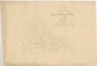
Porostní mapa revíru Pec
1 : 11520
Mapy lesních porostů velkostatku Kout - revír Pec
1 : 11670
Porostní mapa revíru Pec
1 : 11250
Hospodářská mapa revíru Pec
1 : 5760
Hospodářská mapa revíru Pec
1 : 5760
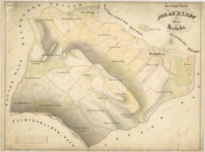
Porostní mapa revíru Rudolfův les
1 : 5760
Katastrální mapa obce Chodov
1 : 2880
Katastrální mapa obce Trhanov
1 : 2880
Chodenschloss - c7957-1-014 - Kaiserpflichtexemplar der Landkarten des stabilen Katasters
1 : 2880
Chodenschloss - c7957-1-011 - Kaiserpflichtexemplar der Landkarten des stabilen Katasters
1 : 2880
Chodenschloss - c7957-1-001 - Kaiserpflichtexemplar der Landkarten des stabilen Katasters
1 : 2880
Chodenschloss - c7957-1-003 - Kaiserpflichtexemplar der Landkarten des stabilen Katasters
1 : 2880
Chodenschloss - c7957-1-013 - Kaiserpflichtexemplar der Landkarten des stabilen Katasters
1 : 2880
Chodenschloss - c7957-1-005 - Kaiserpflichtexemplar der Landkarten des stabilen Katasters
1 : 2880
Chodenschloss - c7957-1-009 - Kaiserpflichtexemplar der Landkarten des stabilen Katasters
1 : 2880
Chodenschloss - c7957-1-010 - Kaiserpflichtexemplar der Landkarten des stabilen Katasters
1 : 2880
Chodenschloss - c7957-1-012 - Kaiserpflichtexemplar der Landkarten des stabilen Katasters
1 : 2880
Chodenschloss - c7957-1-006 - Kaiserpflichtexemplar der Landkarten des stabilen Katasters
1 : 2880
Chodenschloss - c7957-1-004 - Kaiserpflichtexemplar der Landkarten des stabilen Katasters
1 : 2880
Chodenschloss - c7957-1-002 - Kaiserpflichtexemplar der Landkarten des stabilen Katasters
1 : 2880
Chodenschloss - c7957-1-008 - Kaiserpflichtexemplar der Landkarten des stabilen Katasters
1 : 2880
Chodenschloss - c7957-1-007 - Kaiserpflichtexemplar der Landkarten des stabilen Katasters
1 : 2880
Plán silnice
1 : 25000
Katastrální mapa obce Pec ZSL-XIII-25 de
1 : 2880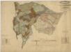
Porostní mapa revírů Folmava a Pasečnice a revíru Pec
1 : 11520
Katastrální mapa obce Chodov
1 : 2880
Porostní mapa revíru hospodářského celku Smrčno
1 : 10000