Maps of Kout na Šumavě
Výsek katastrální mapy obce Kout
1 : 2880
Plán dvora Kout
1 : 12000
Mapa pozemků dvora Kout
1 : 2880
Katastrální mapa obcí Kout a Podzámčí, Nový a Starý Dvůr
1 : 2880
Katastrální mapa obcí Kout a Podzámčí, Nový a Starý Dvůr
1 : 2880
Katastrální mapa obce Kout
1 : 2880
Katastrální mapa obcí Kout a Podzámčí, Nový a Starý Dvůr
1 : 2880
Přehledná mapa luk panství Kout
1 : 11257
Mapa pozemků dvorů Kout a Starý Dvůr
1 : 5760
Situační plán dvorů Kout, Starý a Nový Dvůr
1 : 7480
Situační plán Nového a Starého Dvora
1 : 11520
Kauth (Kauto) - c3429-1-006 - Kaiserpflichtexemplar der Landkarten des stabilen Katasters
1 : 2880
Kauth (Kauto) - c3429-1-002 - Kaiserpflichtexemplar der Landkarten des stabilen Katasters
1 : 2880
Kauth (Kauto) - c3429-1-004 - Kaiserpflichtexemplar der Landkarten des stabilen Katasters
1 : 2880
Kauth (Kauto) - c3429-1-003 - Kaiserpflichtexemplar der Landkarten des stabilen Katasters
1 : 2880
Kauth (Kauto) - c3429-1-008 - Kaiserpflichtexemplar der Landkarten des stabilen Katasters
1 : 2880
Kauth (Kauto) - c3429-1-005 - Kaiserpflichtexemplar der Landkarten des stabilen Katasters
1 : 2880
Kauth (Kauto) - c3429-1-007 - Kaiserpflichtexemplar der Landkarten des stabilen Katasters
1 : 2880
Kauth (Kauto) - c3429-1-001 - Kaiserpflichtexemplar der Landkarten des stabilen Katasters
1 : 2880
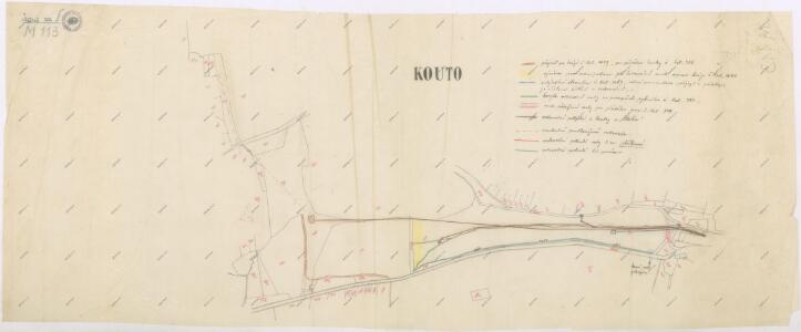
Situační plán nových vodních nádrží v Koutě na Starém potoce
1 : 2880
Výsek katastrální mapy obce Kout
1 : 2880
III. vojenské mapování 4250/1
1 : 25000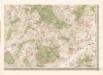
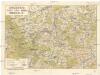
Mapa politického okresu Domažlického

III. vojenské mapování 4250/1
1 : 25000
[Kartenblatt]
1 : 25000 Domažlice (Česko : oblast) Reichsamt für Landesaufnahme
III. vojenské mapování 4250/1
1 : 25000
Gradkartenblatt
1 : 25000 Domažlice-oblast (Česko) Bulla, Eduard
Přehledová mapa panství Kout
1 : 14400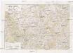
Chodsko
1 : 100000 Chodsko (Česko) Klub českých turistů