Maps of Kout na Šumavě
Katastrální mapa obcí Kout a Podzámčí, Nový a Starý Dvůr
1 : 2880
Katastrální mapa obce Kout
1 : 2880
Katastrální mapa části Kdyně a Kouta
1 : 2880
Katastrální mapa města Kdyně WC-XI-26 ci, af, bf
1 : 2880
Plán panských pozemků dvora Starý Dvůr
1 : 6250
Situační plán dvorů Kout, Starý a Nový Dvůr
1 : 7480
Situační plán Nového a Starého Dvora
1 : 11520
Přehledná mapa luk panství Kout
1 : 11257
Neugedein (Nowakdyne) - c3085-1-003 - Kaiserpflichtexemplar der Landkarten des stabilen Katasters
1 : 2880
Neugedein (Nowakdyne) - c3085-1-001 - Kaiserpflichtexemplar der Landkarten des stabilen Katasters
1 : 2880
Neugedein (Nowakdyne) - c3085-1-004 - Kaiserpflichtexemplar der Landkarten des stabilen Katasters
1 : 2880
Neugedein (Nowakdyne) - c3085-1-002 - Kaiserpflichtexemplar der Landkarten des stabilen Katasters
1 : 2880
Neugedein (Nowakdyne) - c3085-1-005 - Kaiserpflichtexemplar der Landkarten des stabilen Katasters
1 : 2880
Mapa pozemků dvorů Kout a Starý Dvůr
1 : 5760
Hospodářská mapa revíru Podzámčí
1 : 13916
Mapa lesů velkostatku Kout a obce Kdyně
1 : 5760
Hospodářská mapa revíru Podzámčí
1 : 4909
Porostní mapa revíru Podzámčí
1 : 11520
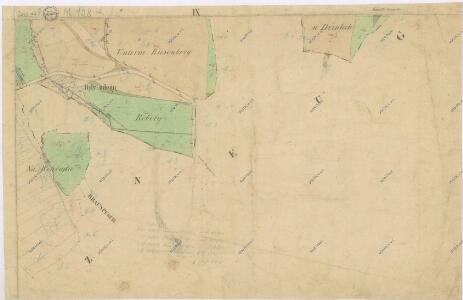
Kauth (Kauto) - c3429-1-006 - Kaiserpflichtexemplar der Landkarten des stabilen Katasters
1 : 2880
Kauth (Kauto) - c3429-1-002 - Kaiserpflichtexemplar der Landkarten des stabilen Katasters
1 : 2880
Kauth (Kauto) - c3429-1-004 - Kaiserpflichtexemplar der Landkarten des stabilen Katasters
1 : 2880
Kauth (Kauto) - c3429-1-003 - Kaiserpflichtexemplar der Landkarten des stabilen Katasters
1 : 2880
Kauth (Kauto) - c3429-1-008 - Kaiserpflichtexemplar der Landkarten des stabilen Katasters
1 : 2880
Kauth (Kauto) - c3429-1-005 - Kaiserpflichtexemplar der Landkarten des stabilen Katasters
1 : 2880
Kauth (Kauto) - c3429-1-007 - Kaiserpflichtexemplar der Landkarten des stabilen Katasters
1 : 2880
Kauth (Kauto) - c3429-1-001 - Kaiserpflichtexemplar der Landkarten des stabilen Katasters
1 : 2880
III. vojenské mapování 4250/1
1 : 25000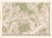
Mapa politického okresu Domažlického

III. vojenské mapování 4250/1
1 : 25000