Maps of Mrákov

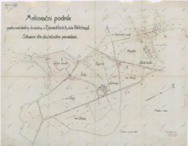
Plán meliorace pozemků dvora Bělohrad
1 : 2000
Katastrální mapa obce Klíčov
1 : 2880
Hospodářský plán statku Bělohrad
1 : 2833
Katastrální mapa obcí Kout a Podzámčí, Nový a Starý Dvůr
1 : 2880
Katastrální mapa obcí Kout a Podzámčí, Nový a Starý Dvůr
1 : 2880
Hospodářská mapa revíru Mlýneček
1 : 5835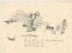
Porostní mapa revíru Filipova Hora
1 : 23040
Hospodářská mapa revíru Mlýneček
1 : 2875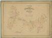
Hospodářská mapa revíru Mlýneček
1 : 5835
Mapy lesních porostů velkostatku Kout - revír Mlýneček
1 : 11670
Alt und Neu-Klitschau - c3160-1-005 - Kaiserpflichtexemplar der Landkarten des stabilen Katasters
1 : 2880
Alt und Neu-Klitschau - c3160-1-008 - Kaiserpflichtexemplar der Landkarten des stabilen Katasters
1 : 2880
Alt und Neu-Klitschau - c3160-1-004 - Kaiserpflichtexemplar der Landkarten des stabilen Katasters
1 : 2880
Alt und Neu-Klitschau - c3160-1-006 - Kaiserpflichtexemplar der Landkarten des stabilen Katasters
1 : 2880
Alt und Neu-Klitschau - c3160-1-003 - Kaiserpflichtexemplar der Landkarten des stabilen Katasters
1 : 2880
Alt und Neu-Klitschau - c3160-1-002 - Kaiserpflichtexemplar der Landkarten des stabilen Katasters
1 : 2880
Alt und Neu-Klitschau - c3160-1-001 - Kaiserpflichtexemplar der Landkarten des stabilen Katasters
1 : 2880
Alt und Neu-Klitschau - c3160-1-009 - Kaiserpflichtexemplar der Landkarten des stabilen Katasters
1 : 2880
Alt und Neu-Klitschau - c3160-1-007 - Kaiserpflichtexemplar der Landkarten des stabilen Katasters
1 : 2880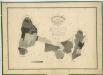
Hospodářská mapa revírů Filipova Hora a Mlýneček
1 : 5760
Starz (Starec) - c7256-1-002 - Kaiserpflichtexemplar der Landkarten des stabilen Katasters
1 : 2880
Starz (Starec) - c7256-1-001 - Kaiserpflichtexemplar der Landkarten des stabilen Katasters
1 : 2880
Katastrální mapa obce Klíčov
1 : 2880
Katastrální mapa obce Klíčov
1 : 2880
Meßtischblatt 6643 : Furth i. Wald, 1942
1 : 250000 Furth i. Wald. - Aufn. 1926, erkund. 1938 u. 1940, bericht. 1941, Ausg. 1942. - 1:25000. - München: Hauptvermessungsabt. XIII, 1942. - 1 Kt.
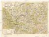
Mapa politického okresu Domažlického

Přehledová mapa panství Kout
1 : 14400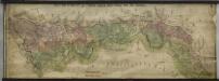
Hraniční mapa-zemská hranice mezi Folmavou a Fleky
1 : 12753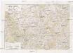
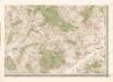
Chodsko
1 : 100000 Chodsko (Česko) Klub českých turistů