Maps of Všeruby

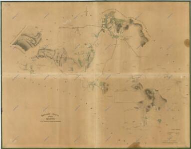
Přehledová mapa panství Kout
1 : 14400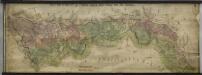
Hraniční mapa-zemská hranice mezi Folmavou a Fleky
1 : 12753
III. vojenské mapování 4250/1, 4250/3
1 : 25000
III. vojenské mapování 4250/1, 4250/3
1 : 25000
Gradkartenblatt
1 : 25000 Všeruby-oblast (Domažlice, Česko) Bulla, Eduard
III. vojenské mapování 4250/1, 4250/3
1 : 25000
[Kartenblatt]
1 : 25000 Furth im Wald (Německo) Reichsamt für Landesaufnahme
Meßtischblatt 6643 : Furth i. Wald, 1942
1 : 250000 Furth i. Wald. - Aufn. 1926, erkund. 1938 u. 1940, bericht. 1941, Ausg. 1942. - 1:25000. - München: Hauptvermessungsabt. XIII, 1942. - 1 Kt.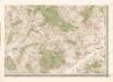
Mapa politického okresu Domažlického


Mapy lesních porostů velkostatku Kout - revíry Orlovice, Chalupy a Liščí
1 : 11670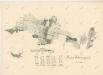
Porostní mapa revíru Filipova Hora
1 : 23040
Hospodářská mapa revíru Stříbrnice
1 : 5935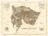
Mapa porostů revírů
1 : 11520 Folmava (Česká Kubice, Česko) Brož, Jaroslav Krejčí, Jan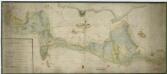
Mapa lesů panství Kout a Trhanov
1 : 5319
Kauth (Kauto) - c3429-1-006 - Kaiserpflichtexemplar der Landkarten des stabilen Katasters
1 : 2880
Kauth (Kauto) - c3429-1-002 - Kaiserpflichtexemplar der Landkarten des stabilen Katasters
1 : 2880
Kauth (Kauto) - c3429-1-004 - Kaiserpflichtexemplar der Landkarten des stabilen Katasters
1 : 2880
Kauth (Kauto) - c3429-1-003 - Kaiserpflichtexemplar der Landkarten des stabilen Katasters
1 : 2880
Kauth (Kauto) - c3429-1-008 - Kaiserpflichtexemplar der Landkarten des stabilen Katasters
1 : 2880
Kauth (Kauto) - c3429-1-005 - Kaiserpflichtexemplar der Landkarten des stabilen Katasters
1 : 2880
Kauth (Kauto) - c3429-1-007 - Kaiserpflichtexemplar der Landkarten des stabilen Katasters
1 : 2880
Kauth (Kauto) - c3429-1-001 - Kaiserpflichtexemplar der Landkarten des stabilen Katasters
1 : 2880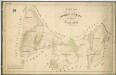
Hospodářská mapa revíru Mlýneček
1 : 5835
Porostní mapa revíru Podzámčí
1 : 11520
Tillmitschau (Tumaczow) - c7927-1-008 - Kaiserpflichtexemplar der Landkarten des stabilen Katasters
1 : 2880
Tillmitschau (Tumaczow) - c7927-1-007 - Kaiserpflichtexemplar der Landkarten des stabilen Katasters
1 : 2880
Tillmitschau (Tumaczow) - c7927-1-005 - Kaiserpflichtexemplar der Landkarten des stabilen Katasters
1 : 2880
Tillmitschau (Tumaczow) - c7927-1-009 - Kaiserpflichtexemplar der Landkarten des stabilen Katasters
1 : 2880
Tillmitschau (Tumaczow) - c7927-1-003 - Kaiserpflichtexemplar der Landkarten des stabilen Katasters
1 : 2880
Tillmitschau (Tumaczow) - c7927-1-002 - Kaiserpflichtexemplar der Landkarten des stabilen Katasters
1 : 2880
Tillmitschau (Tumaczow) - c7927-1-001 - Kaiserpflichtexemplar der Landkarten des stabilen Katasters
1 : 2880
Tillmitschau (Tumaczow) - c7927-1-006 - Kaiserpflichtexemplar der Landkarten des stabilen Katasters
1 : 2880