Mappa catalogata
Meßtischblatt 252 : Brodersby, 1879


Titolo completo:Meßtischblatt 252 : Brodersby, 1879
Anno di illustrazione:1879
Data di pubblicazione:1879
Dimensione fisica:20 x 30 cm
Scala della mappa:1:250 000
Meßtischblatt 252 : Brodersby, 1879
1879
1:250k
Meßtischblatt 302 : Hütten, 1904
1904
1:250k
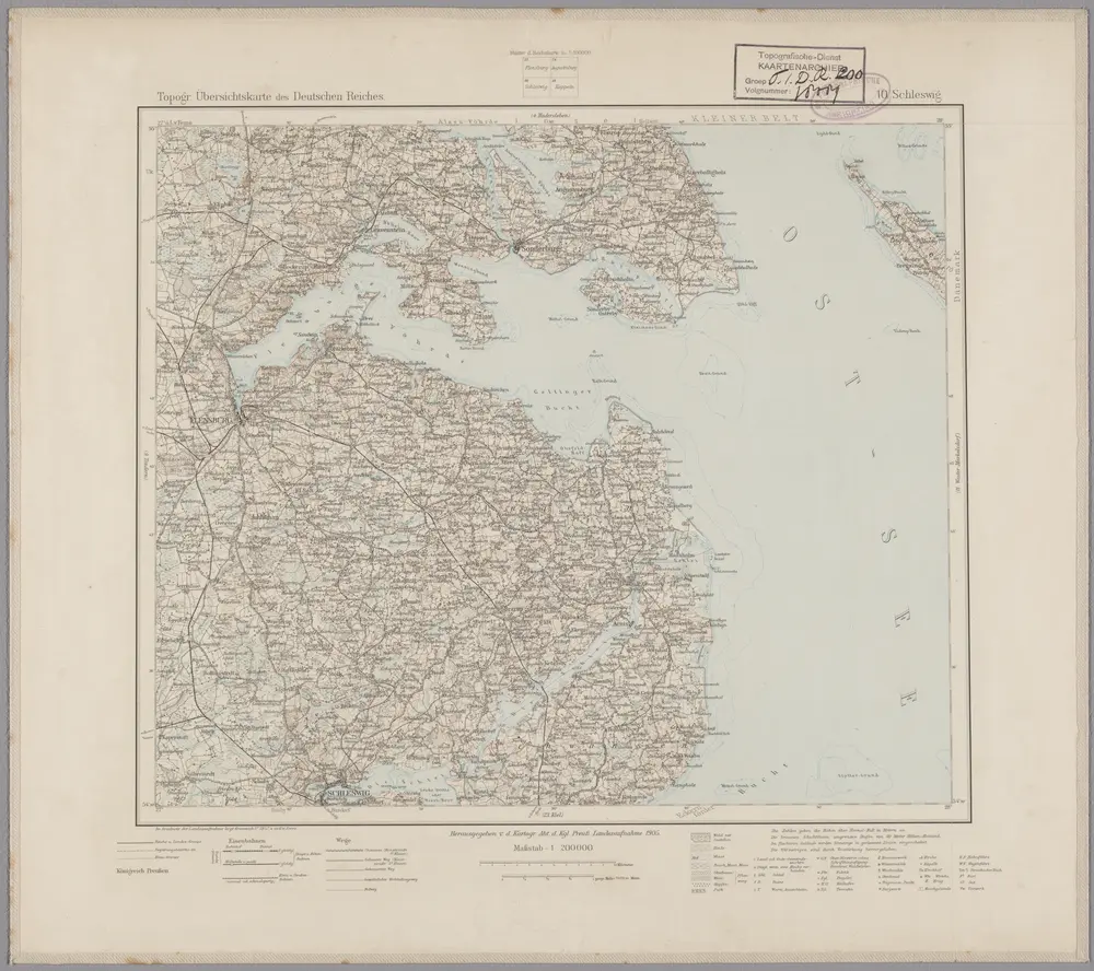
10. Schleswig, uit: Topographische Uebersichtskarte des Deutschen Reiches / herausgegeben v. d. Kartogr. Abt. d. Königl. Preuß. Landesaufnahme
1899
Königlich Preußische Landesaufnahme. Kartographische Abtheilung
1:200k
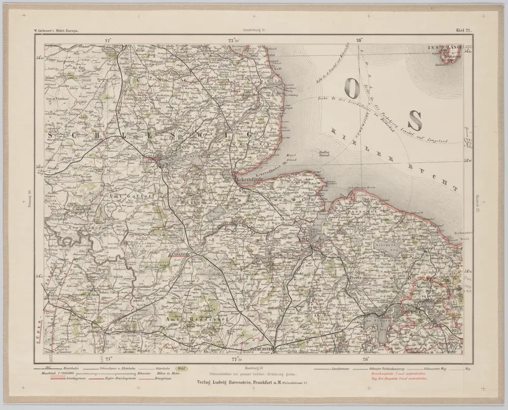
Kiel 21, uit: Special-Karte von Mittel-Europa / nach amtlichen Quellen bearbeitet von W. Liebenow
1899
Johannes Wilhelm Liebenow 1822-1897
1:300k
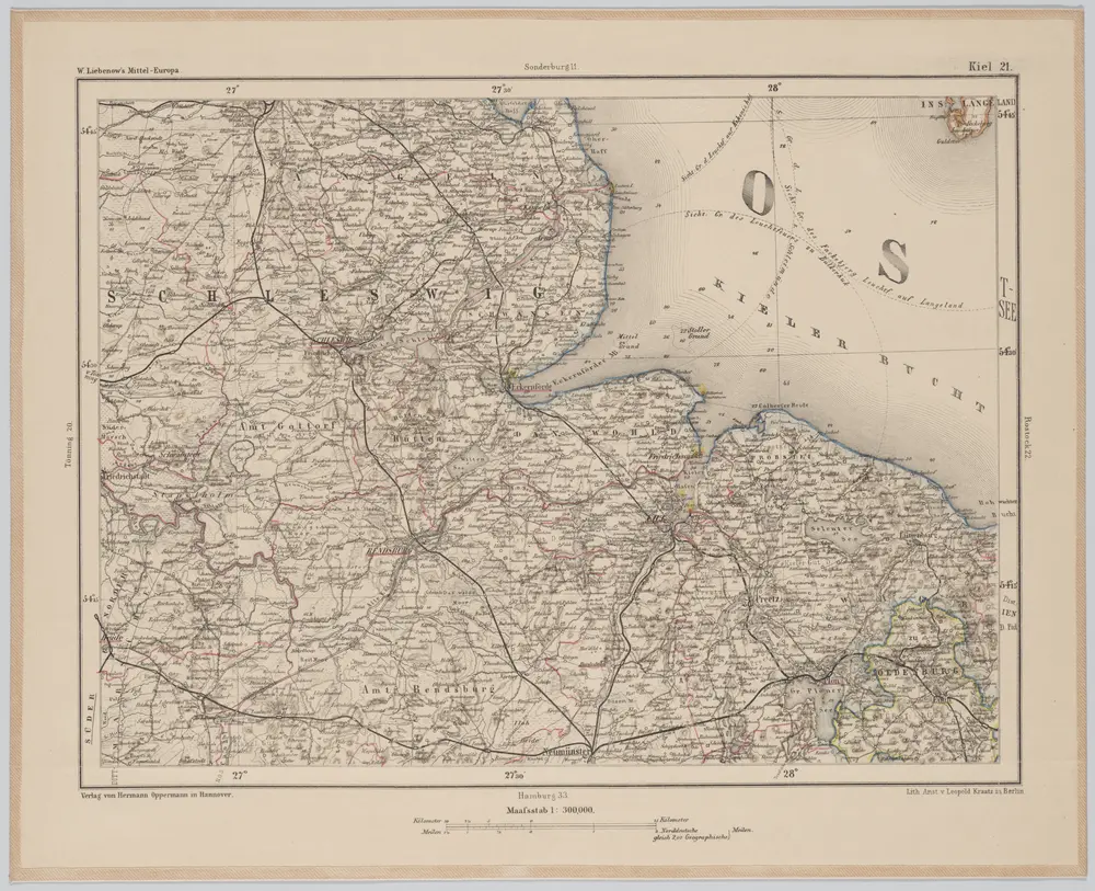
Kiel 21, uit: [W. Liebenow's Special-Karte von Mittel-Europa]
1870
Johannes Wilhelm Liebenow 1822-1897
1:300k
n/a
1791
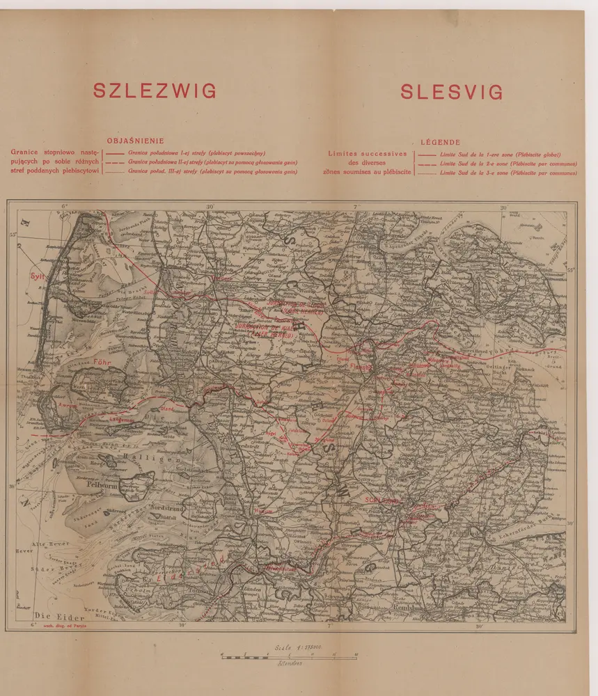
Szleswig
1919
Wierzbicki, B.
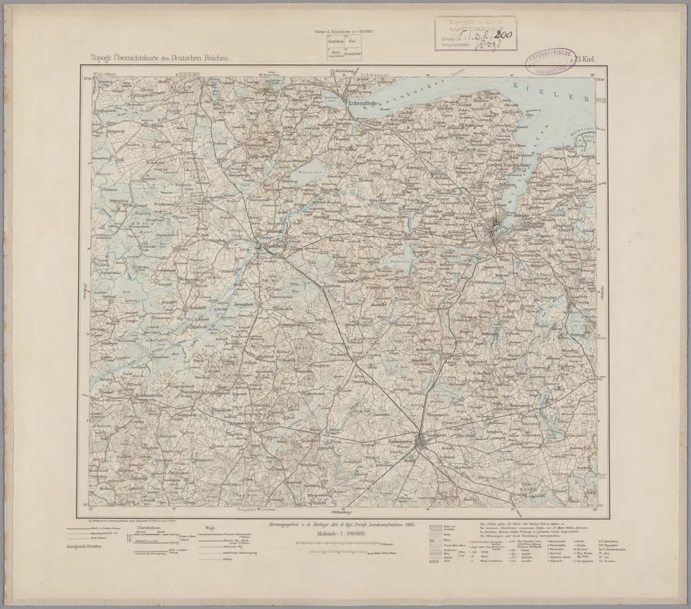
23. Kiel, uit: Topographische Uebersichtskarte des Deutschen Reiches / herausgegeben v. d. Kartogr. Abt. d. Königl. Preuß. Landesaufnahme
1899
Königlich Preußische Landesaufnahme. Kartographische Abtheilung
1:200k
n/a
1791
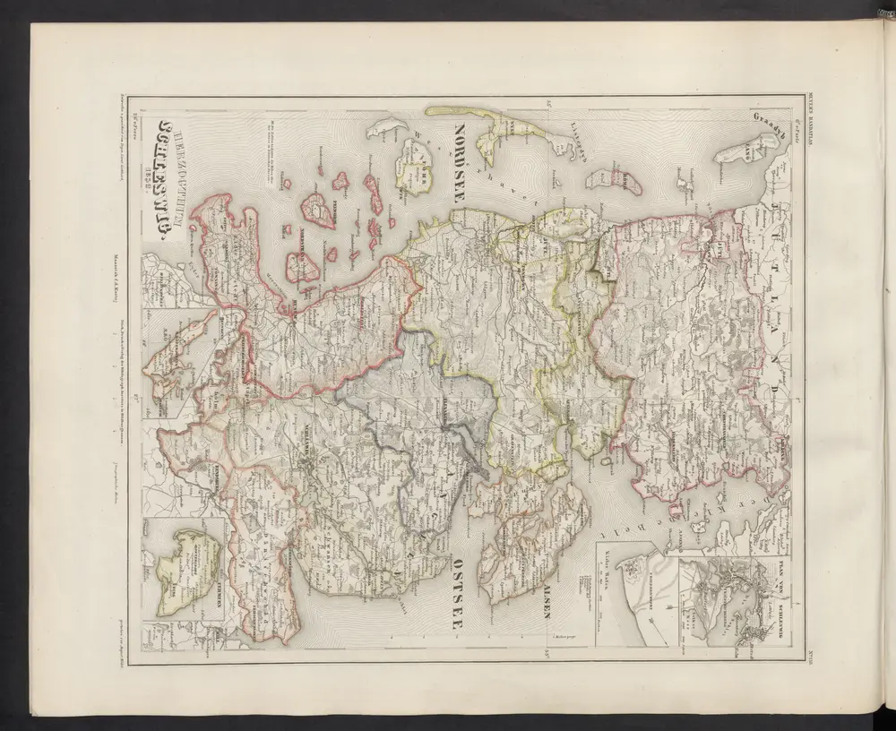
Herzogthum Schleswig
1860
Meyer, J.