Maps of Fehmarn

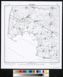
Meßtischblatt 307 : Petersdorf (Insel Fehmarn), 1905
1 : 250000 Petersdorf (Insel Fehmarn). - Aufn. 1877, hrsg. 1879, einz. Nachtr. 1905. - 1:25000. - [Berlin]: Reichsamt für Landesaufnahme, 1905. - 1 Kt.
FIMBRIÆ, | Vulgo | FEMEREN | DELINEATIO | GEOMETRICA.
[Amsterdam : Joan Blaeu]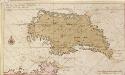
Afteekening vant eijland Femeren geleegen aen de zuijtwal in de Belt
Germany Gerard van Keulen
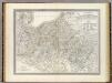
60. Oldenburg i/Holst. (Germany)
1 : 100000 Reichsamt fur Landesaufnahme
Composite: 60. Oldenburg i/Holst. (Germany)
1 : 100000 Reichsamt fur Landesaufnahme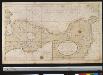
Een gedeelte van de kust van Holsteijn van Kijll of Kielerford tot Femere of New Stadt in de Belt Oost Zee
Germany Gerard van Keulen
24. Eutin, uit: Topographische Uebersichtskarte des Deutschen Reiches / herausgegeben v. d. Kartogr. Abt. d. Königl. Preuß. Landesaufnahme
1 : 200000 titelvariant: Topogr. Übersichtskarte des Deutschen Reiches; Annotatie: Titel boven bladen ook: Topogr. Übersichtskarte des Deutschen Reiches; Annotatie geografische gegevens: Op elk blad twee maatstokken: 10 Kilometer = 5,5 cm; 1 geogr. Meile = 3,6 cm; Legenda onder op elk blad Königlich Preußische Landesaufnahme. Kartographische Abtheilung [S.l : Königlich Preußische Landesaufnahme, Kartographische Abtheilung]
WAGRIÆ | PARS SEPTENTRIONALIS | cum præfectura | CISMAR et OLDENBVRGH.
Christian Lorensen | Rodtgiesser sculps. [Amsterdam : Joan Blaeu]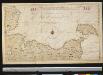
Het Zuijdelijkste gedeelte van de Beld, van de Riv. Sleeswijk tot t eijl. Femeren
Germany Gerard van Keulen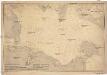
Ostsee
1 : 100000 Dánsko Reichs-Marine-Amt
Rostock 22, uit: Special-Karte von Mittel-Europa / nach amtlichen Quellen bearbeitet von W. Liebenow
1 : 300000 titelvariant: W. Liebenow's Mittel-Europa; Annotatie: Titel boven de bladen: W. Liebenow's Mittel-Europa Johannes Wilhelm Liebenow 1822-1897 Frankfurt a. M. : Ludwig Ravenstein
Mappa Ducatus Megalopolitani Nova :
1 : 190000 Mollova mapová sbírka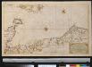
Nieuwe afteekening van een gedeelte van de Belt Zee vervattende de zeekusten van Holsteijn en Mekelenburg van het eijlant Femeren tot aan Mardorp in Pomeren
Germany Johannes van Keulen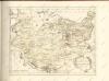

Holsatia ducatus
1 Karte : Kupferdruck ; 33 x 46 cm Mercator; Hondius Henricus Hondius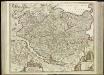
[45][45] Holsatiae tabula generalis ..., uit: Atlas sive Descriptio terrarum orbis
Annotatie: Gedigitaliseerde versie. Amsterdam. Heiloo : Picturae (vervaardiger), 2015. tiff-bestand. Gedigitaliseerd: 07-01-2015; Origineel: Universiteitsbibliotheek Vrije Universiteit (XL.05127.-) ; Netherlands; Titelpagina ontbreekt Wit, Frederik de Amsterdam : Frederick de Wit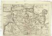
Dvcatvs Holsatiae
Holštýnsko Bouttats, Gaspar

Mecklenburg-Schwerin, Mecklenburg-Strelitz.
1 : 360000 Weiland, C. F. (Carl Ferdinand), d. 1847
Charte von dem Gross-Herzogthümern Mecklenburg-Schwerin, und Mecklenburg-Strelitz
1 : 359000 Meklenbursko (Německo) Streit, Friedrich Wilhelm Friedrich Campe
Mecklenburg.
1 : 595000 Flemming, Carl
Holsatia ducatus [Karte], in: Atlas, sive, Cosmographicae meditationes de fabrica mundi et fabricati figura, S. 141.
1 Karte aus Atlas Mercator, Gerhard
Holsatia ducatus [Karte], in: Gerardi Mercatoris Atlas, sive, Cosmographicae meditationes de fabrica mundi et fabricati figura, S. 146.
1 Karte aus Atlas Mercator, Gerhard Montanus, Petrus
Nationalitäten- und Sprachenkarte des Herzogthums Schleswig
1 : 480000 Jutský poloostrov (Dánsko a Německo) Biernatzki, Hermann Berendsohn, Bernhard S. B.S. Berendsohn
Sect. 2: Stralsund, uit: Geologische Karte des Deutschen Reichs in 27 Blaettern / [von] Richard Lepsius ; Red. von C. Vogel
1 : 500000 Annotatie: Blad 18 ontbreekt; Een aantal bladen op linnen; Een aantal bladen gereviseerd 1913-1914; Annotatie geografische gegevens: Met schaalstokken o.a. in kilometers; Legenda Carl Vogel 1828-1897 Gotha : Justus Perthes
Ducatus Meklenburgicus
1 : 460000 Mollova mapová sbírka Ottens, Reinier Ottens, Josua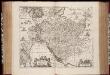
Ducatus Holsatiæ descriptio novissima / excudebant Janssonio-Waesbergii et Moses Pitt
1 : 365000 Annotatie: Origineel is Blad 82 in atlas factice; Annotatie geografische gegevens: Schaalstok: Die Maße der Teutsche Meilln, 3=5,9 cm; Rechtsboven: XLI Johannes Janssonius van Waesberge -1681?; Moses Pitt ca. 1654-1696 [Amstelodami : apud Ioannem Ianssonium]
Ducatus Meklenburgicus
1 : 460000 Mollova mapová sbírka Wit, Frederik de Covens, Johannes I