Maps of Kellinghusen

Maps of Kellinghusen

$title$

Meßtischblatt 655 : Kellinghusen, 1896

1 : 250000 Kellinghusen. - Aufn. 1878, hrsg. 1880, bericht. 1896. - 1:25000. - [Berlin]: Reichsamt für Landesaufnahme, 1896. - 1 Kt.
$title$

Composite: 112. Itzehoe. (Germany)

1 : 100000 Reichsamt fur Landesaufnahme
$title$

112. Itzehoe. (Germany)

1 : 100000 Reichsamt fur Landesaufnahme
$title$

COMITATVS | PINNEN BERG

Andres Lorensen | Rodtgießer Husum | sculps. [Amsterdam : Joan Blaeu]
$title$

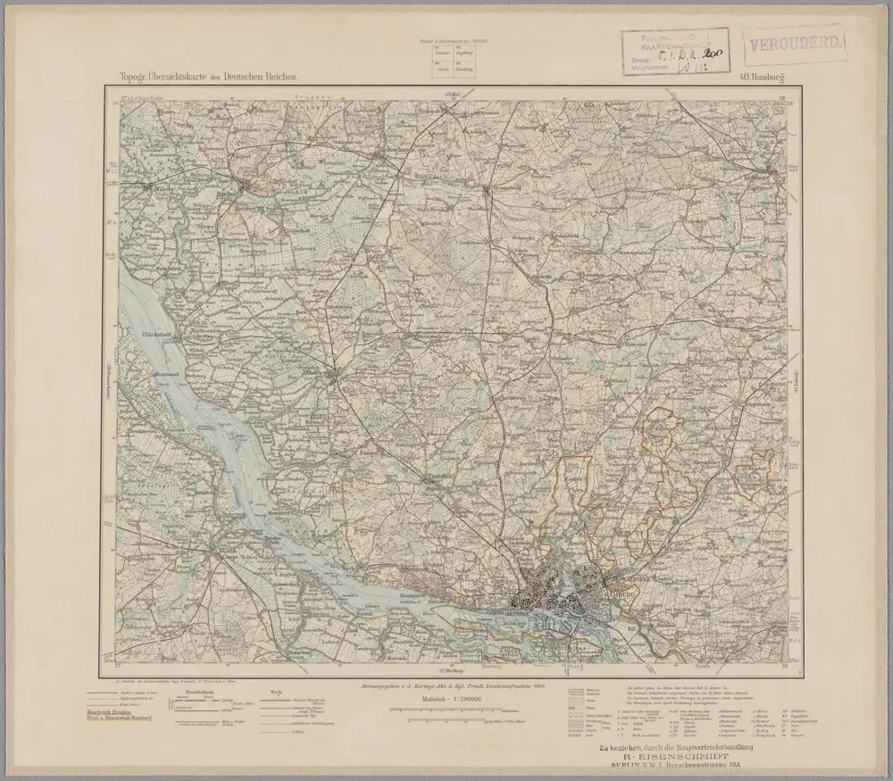
40. Hamburg, uit: Topographische Uebersichtskarte des Deutschen Reiches / herausgegeben v. d. Kartogr. Abt. d. Königl. Preuß. Landesaufnahme

1 : 200000 titelvariant: Topogr. Übersichtskarte des Deutschen Reiches; Annotatie: Titel boven bladen ook: Topogr. Übersichtskarte des Deutschen Reiches; Annotatie geografische gegevens: Op elk blad twee maatstokken: 10 Kilometer = 5,5 cm; 1 geogr. Meile = 3,6 cm; Legenda onder op elk blad Königlich Preußische Landesaufnahme. Kartographische Abtheilung [S.l : Königlich Preußische Landesaufnahme, Kartographische Abtheilung]
$title$

RENDSBVRGVM, | CHILONVM et BORDESHOLMA, | sive | HOLSATIA PROPRIA.

Christian Lorensen | Rodtgiesser Husum | sculpsit [Amsterdam : Joan Blaeu]
$title$

Landtcarte Uom Süderntheil des Wagerland's

1 : 130000 Mollova mapová sbírka Mejer, Johannes Rothgiesser, Andreas Lorenzen
$title$

$title$

Schleswig-Holstein

1 : 50000 Šlesvicko-Holštýnsko (Německo) Reichs-Marine-Amt
$title$

$title$

Tabula geographica novissima ducatus Stormariae in meridionali parte Holsatiae

1 : 209000 Holštýnsko Schenk, Pieter Valk, Gerhard apud P. Schenk et G. Valk
$title$

STORMARIA | DVCATVS

Auctore Joh: Meyer Husumensi. Matthias & Nicolaus Peters | Goldtschmide gebr. Hus. sculp. [Amsterdam : Joan Blaeu]
$title$

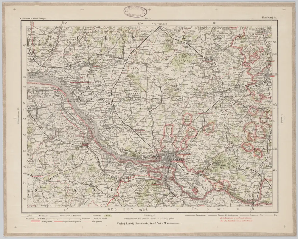
Hamburg 33, uit: Special-Karte von Mittel-Europa / nach amtlichen Quellen bearbeitet von W. Liebenow

1 : 300000 titelvariant: W. Liebenow's Mittel-Europa; Annotatie: Titel boven de bladen: W. Liebenow's Mittel-Europa Johannes Wilhelm Liebenow 1822-1897 Frankfurt a. M. : Ludwig Ravenstein
$title$

Typus Geographicus Ducat. Lauenburgici Novus

1 : 270000 Mollova mapová sbírka Homann, Johann Christoph Schneider, Ruprecht Adam Homann, Johann Baptista - dědici
$title$

Tabula Geographica novissima Ducatus Stormariae, in Meridionali parte Holsatiae. [Karte], in: Novus atlas absolutissimus, Bd. 1, S. 152.

1 Karte aus Atlas Janssonius Offizin
$title$

Das oestliche Holstein

$title$

Dithmarsia Rendesburgum Kiel et Bordesholm in Occidentali parte Holsatiae

1 : 210000 Mollova mapová sbírka Schenk, Pieter Schenk, Peter I
$title$

$title$

Dithmarsia, Rendesburgum, Kiel et Bordesholm, in Occidentali parte Holsatiae. [Karte], in: Novus atlas absolutissimus, Bd. 1, S. 146.

1 Karte aus Atlas Janssonius Offizin
$title$

Paskaart vande Iade, Weser en Elve :

1 : 250000 Mollova mapová sbírka Keulen, Johannes van Keulen, Johannes van
$title$

$title$

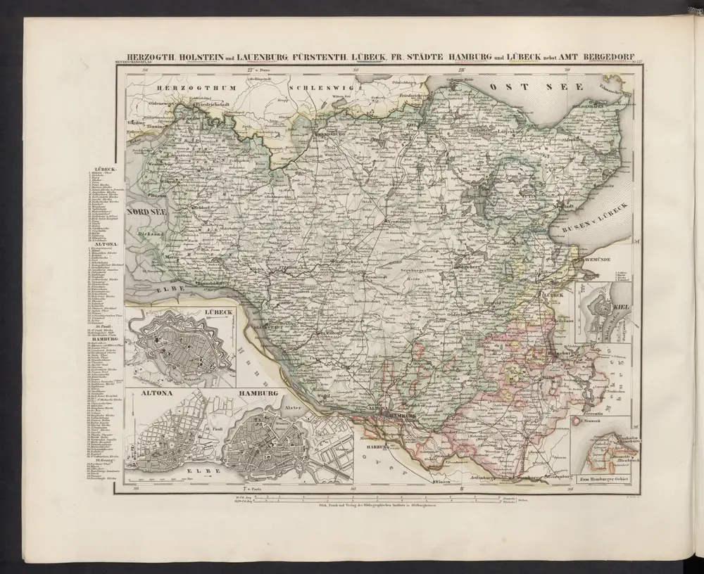
[Herzogthum Holstein und Lauenburg, Fürstenthum Lübeck, Fr. Städte Hamburg und Lübeck nebst Amt Bergedorf]

Grosser Hand-Atlas über alle Theile der Erde in 170 Karten Meyer, J. Verlag des Bibliographischen Instituts
$title$

$title$

Holstein, Lauenburg, Lubeck, Hamburg.

1 : 440000 Meyer, Joseph, 1796-1856
$title$

Ducatus Bremae & Ferdae maximaeque partis fluminis Visurgis descriptio

1 : 320000 per Fredericum de Witt Amstelodami uytgegeven door Reinier & Josua Ottens, voor aen op den Nieuwendyck in de Warelt [Amsterdam] : ex officina R. & J. Ottens
$title$

Holstein, Lauenburg, Hamburg, Lubeck.

1 : 435000 Flemming, Carl
$title$

$title$

Ducatus olim episcopatus Bremensis et ostiorum Albis et Visurgis fluviorum, novissima descriptio

1 : 308000 Brémy (Německo : spolková země) Graaf, Cornelius de Ioannes Ianßonius
$title$

Tabvla Generalis Holsatiae complectens Holsatiae Dithmarsiae Stormariae et Vagriae Dvcatvs

1 : 310000 Mollova mapová sbírka Homann, Johann Baptist Homann, Johann Baptista
$title$

Tabvla Generalis Holsatiae complectens Holsatiae Dithmarsiae Stormariae et Vagriae Dvcatvs

1 : 310000 Mollova mapová sbírka Homann, Johann Baptist Homann, Johann Baptista
© MapTiler © OpenStreetMap contributors
How does it work?
These instructions will show you how to find historical maps online.
Getting started
Type the place name in the search box to find the exact location. You can further adjust the search by zooming in and out.
Zoom
Zoom in and out with the buttons or use your mouse or touchpad natively.
Exact Area tool
Click here and draw a rectangle over the map to precisely define the search area.
Set filters
Narrow your search with advanced settings, such as Years (from/to), Fulltext, Publisher, etc.
Results
See the results of your search on the right side. You can scroll down to find more maps of this location.
?

Download OldMapsOnline Mobile