Maps of Samtgemeinde Hage

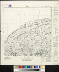
Meßtischblatt 917 : Hage, 1933
1 : 250000 Hage. - Aufn. 1891, Nachtr. 1925. - 1:25000. - [Berlin]: Reichsamt für Landesaufnahme, 1933. - 1 Kt.
Composite: 140. Norden. (Germany)
1 : 100000 Reichsamt fur Landesaufnahme
140. Norden. (Germany)
1 : 100000 Reichsamt fur Landesaufnahme
2, uit: Topografische atlas van het Koninkrijk der Nederlanden
Annotatie: Map met 19 losse krt. schaal 1:200.000 en 1 bladwijzer schaal 1:1.000.000 ['s-Gravenhage : Ministerie van Oorlog, Topografisch Bureau]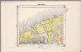
4. Hunsingoo, uit: Geologische kaart van Nederland / door W.C.H. Staring ; bew. aan de Topographische Inrichting
1 : 200000 Winand Carel Hugo Staring 1808-1877; Topographische Inrichting, 's-Gravenhage 's-Gravenhage : Belinfante
37. Norden, uit: Topographische Uebersichtskarte des Deutschen Reiches / herausgegeben v. d. Kartogr. Abt. d. Königl. Preuß. Landesaufnahme
1 : 200000 titelvariant: Topogr. Übersichtskarte des Deutschen Reiches; Annotatie: Titel boven bladen ook: Topogr. Übersichtskarte des Deutschen Reiches; Annotatie geografische gegevens: Op elk blad twee maatstokken: 10 Kilometer = 5,5 cm; 1 geogr. Meile = 3,6 cm; Legenda onder op elk blad Königlich Preußische Landesaufnahme. Kartographische Abtheilung [S.l : Königlich Preußische Landesaufnahme, Kartographische Abtheilung]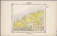
4. Hunsingoo, uit: Geologische kaart van Nederland / door W.C.H. Staring ; bew. aan de Topographische Inrichting
1 : 200000 Winand Carel Hugo Staring 1808-1877; Topographische Inrichting, 's-Gravenhage 's-Gravenhage : Belinfante
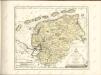
Typvs Frisiae Orientalis à Dullarto sinu atque Amasi ostio ad Iada usque fl. singulari studio ac industria concinnat. et vivum expresso
1 : 200000 Mollova mapová sbírka Visscher, Claes Jansz. Visscher, Claes Janszoon
Groninga dominium
1 : 175000 auctore Bartholdo Wicheringe sculpserunt Everardus Sim. Hamers-veldt et Sal. Rogeri. Amstelodami : excudebat Joannes Janssonius
GRONINGA | DOMINIVM
Auctore | Bartholdo Wicheringe [Amsterdam : Joan Blaeu]
GRONINGA | DOMINIVM
Auctore | Bartholdo Wicheringe [Amsterdam : Joan Blaeu]
[Recto], uit: Groninga dominium / auctore Bartholdo Wicheringe ; sculpserunt Everardus Sim. Hamers-veldt, et Sal. Rogeri
1 : 175000 Annotatie: Uit: Gerardi Mercatoris et I. Hondii Atlas ofte Afbeeldinghe vande gantsche Weerldt ... - Amsterdam : Ian Ianssen, 1634 Wicheringe, Bartholdus; Hamersveldt, Everard Symonsz. van; Rogiers, Salomon Amstelodami : excudebat Ioannes Ianssonius
Geographische beschrivinge vande Pr: Stadt Gr. en Oml. : vervattende in sich alle heerlyckheden, fortressen, dorpen, adelycke ende considerabele huysen : met de wapens van de voornaemste ende gequalificeerste adeldom der opgemelte provincie
1 : 90000 naet leven afgeteeckent door de gebroederen W. en F. Conders van Helpen Cornelius Appeus sculpsit. [S.l.] : [s.n.]

Tabula Frisiae, Groninghae et Territory, Embdensis
1 : 460000 Mollova mapová sbírka Visscher, Nicolaes Goos, Abraham Visscher, Nicolaus I.
Groninga Dominium. [Karte], in: Novus Atlas, das ist, Weltbeschreibung, Bd. 1, S. 414.
1 Karte aus Atlas Blaeu, Joan Blaeu, Willem Janszoon
Groninga Dominium. [Karte], in: Theatrum orbis terrarum, sive, Atlas novus, Bd. 1, S. 450.
1 Karte aus Atlas Blaeu, Joan Blaeu, Willem Janszoon
Emden 31, uit: Special-Karte von Mittel-Europa / nach amtlichen Quellen bearbeitet von W. Liebenow
1 : 300000 titelvariant: W. Liebenow's Mittel-Europa; Annotatie: Titel boven de bladen: W. Liebenow's Mittel-Europa Johannes Wilhelm Liebenow 1822-1897 Frankfurt a. M. : Ludwig Ravenstein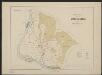
Groninga Dominium. [Karte], in: Gerardi Mercatoris et I. Hondii Newer Atlas, oder, Grosses Weltbuch, Bd. 1, S. 475.
1 Karte aus Atlas Mercator, Gerhard und Hondius, Jodocus Jansson, Jan
Groninga Dominium. [Karte], in: Le théâtre du monde, ou, Nouvel atlas contenant les chartes et descriptions de tous les païs de la terre, Bd. 1, S. 447.
1 Karte aus Atlas Blaeu, Willem Janszoon und Blaeu, Joan Blaeu, Willem Janszoon
Groninga Dominium. [Karte], in: Novus atlas absolutissimus, Bd. 3, S. 226.
1 Karte aus Atlas Janssonius Offizin
Frisia orientalis
1 : 213000 Frísko Allard, Carel Covens et Mortier
Frisia orientalis
1 : 200000 Carolus Allard excudit Amstelodami : [Allard]
Emden 31, uit: [W. Liebenow's Special-Karte von Mittel-Europa]
1 : 300000 titelvariant: W. Liebenow's Mittel-Europa; Annotatie: Titel boven de bladen: W. Liebenow's Mittel-Europa Johannes Wilhelm Liebenow 1822-1897 Hannover : Hermann Oppermann
Frisia Orientalis
1 : 210000 Mollova mapová sbírka Allard, Carel Allard, Carel

Neue geographische Charte von den Furstenthum Ostfries und Harrlingerland : nach geometrischen und trigonometrischen vermessungen, welche auf die astronomischen observationen des Herren Schrötter und Olbers im Herzogthum Bremen gegründet, und unter landsherrlicher Approbation, von den ostfriesischen Landes-Staenden bewerckstelliget worden / aufgenommen und bearbeitet in Jahren 1798, 1799, 1800, 1801, und 1802 durch den vormaligen hollandischen Artillerie Capitain W. Camp ; (buiten kader) C. van Baarsel sculp
1 : 300000 Annotatie geografische gegevens: Met 3 schaalstokken; Legenda Willem Petrus del Campo gen. Camp 1761-1855; Cornelis van Baarsel 1761-1826 [S.l. : s.n.]
Typvs Frisiae Orientalis
1 : 250000 Mollova mapová sbírka Emmius, Ubbo Rogiers, Salomon Schenk, Peter I