Katalogisierte Karte
Meßtischblatt 1106 : Aurich, 1933


Vollständiger Titel:Meßtischblatt 1106 : Aurich, 1933
Jahr der Abbildung:1933
Datum der Veröffentlichung:1933
Physische Größe:20 x 30 cm
Maßstab der Karte:1:250 000
Meßtischblatt 1106 : Aurich, 1933
1933
1:250k
Meßtischblatt 1107 : Holtrop, 1917
1917
1:250k
Meßtischblatt 1196 : Emden, 1893
1893
1:250k
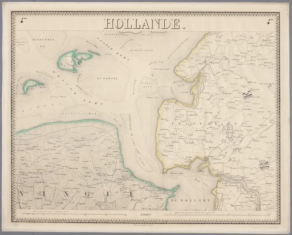
4me Emden, uit: Nouvelle carte de la Hollande, d'après Kraijenhoff et les meilleures cartes connues / Établissement Géographique de Bruxelles, fondé par Ph. Vander Maelen
1830
Philippe Marie Guillaume Vander Maelen 1795-1869; Établissement Géographique de Bruxelles
1:117k
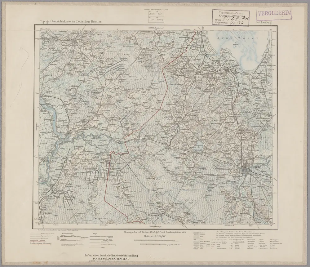
55. Oldenburg, uit: Topographische Uebersichtskarte des Deutschen Reiches / herausgegeben v. d. Kartogr. Abt. d. Königl. Preuß. Landesaufnahme
1899
Königlich Preußische Landesaufnahme. Kartographische Abtheilung
1:200k
n/a
1791
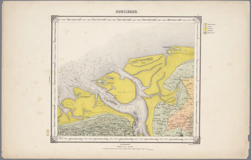
4. Hunsingoo, uit: Geologische kaart van Nederland / door W.C.H. Staring ; bew. aan de Topographische Inrichting
1889
Winand Carel Hugo Staring 1808-1877; Topographische Inrichting, 's-Gravenhage
1:200k
n/a
1791
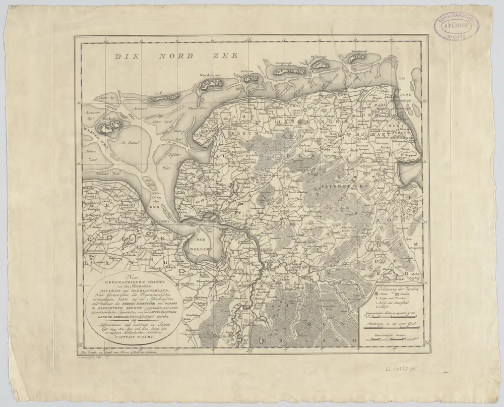
Neue geographische Charte von den Furstenthum Ostfries und Harrlingerland : nach geometrischen und trigonometrischen vermessungen, welche auf die astronomischen observationen des Herren Schrötter und Olbers im Herzogthum Bremen gegründet, und unter landsherrlicher Approbation, von den ostfriesischen Landes-Staenden bewerckstelliget worden / aufgenommen und bearbeitet in Jahren 1798, 1799, 1800, 1801, und 1802 durch den vormaligen hollandischen Artillerie Capitain W. Camp ; (buiten kader) C. van Baarsel sculp
1802
Willem Petrus del Campo gen. Camp 1761-1855; Cornelis van Baarsel 1761-1826
1:300k
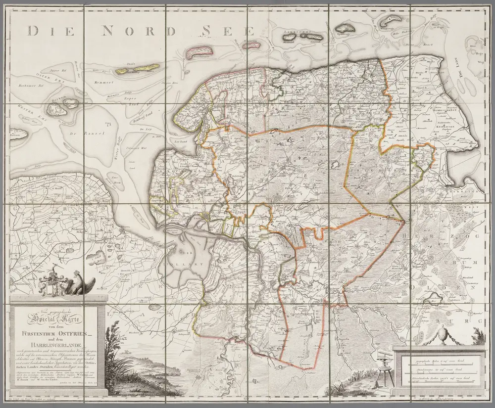
Neue geographische Special Karte von dem Fürstenthum Ostfries- und dem Harrlingerlande : nach geometrischen und trigonometrischen Vermessungen ... / aufgenommen und bearb. ... durch W. Camp und dessen beiden Gehülfen ... H. Bunnik und W. van der Linden ; gestochen von Carl Jättnig in Berlin 1804
1804
Willem Petrus del Campo gen. Camp 1761-1855; Bunnik, H.; Linden, W. van der (fl. 1804); Carl Jaettnig 1795-1835 fl.
1:120k