Mapa catalogado
Meßtischblatt Stolpe


Título completo:Meßtischblatt Stolpe
Año de ilustración:1942
Fecha de publicación:1942
Tamaño físico:20 x 30 cm
Escala del mapa:1:250 000
Meßtischblatt Stolpe
1942
1:250k
Meßtischblatt 1556 : Stolpe in der Mark, 1912
1912
1:250k
Meßtischblatt 3150 : Oderberg, 1941
1941
1:250k
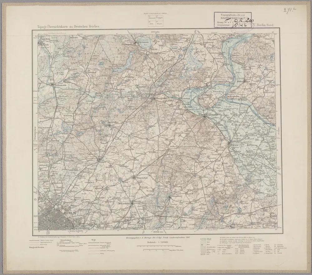
77. Berlin (Nord), uit: Topographische Uebersichtskarte des Deutschen Reiches / herausgegeben v. d. Kartogr. Abt. d. Königl. Preuß. Landesaufnahme
1899
Königlich Preußische Landesaufnahme. Kartographische Abtheilung
1:200k
n/a
1791
n/a
1791
n/a
1791
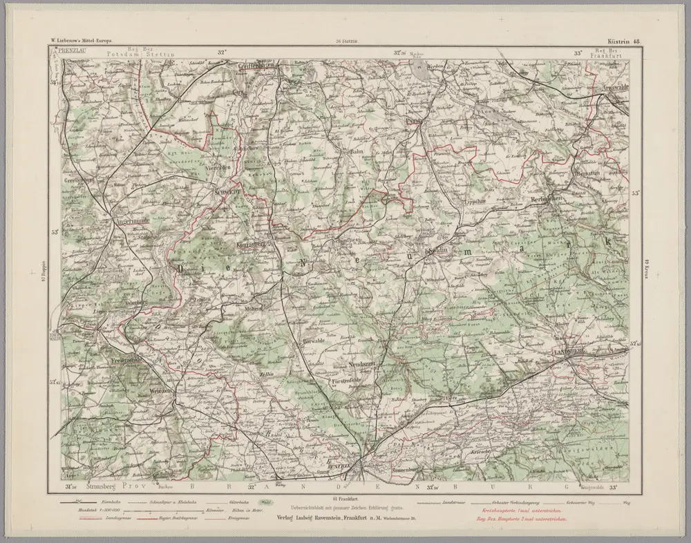
Küstrin 48, uit: Special-Karte von Mittel-Europa / nach amtlichen Quellen bearbeitet von W. Liebenow
1899
Johannes Wilhelm Liebenow 1822-1897
1:300k
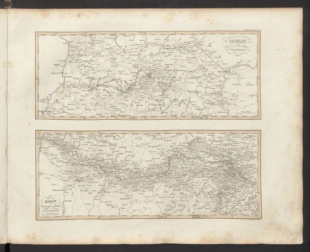
[Berlin und Umgebung; Die Donau von Paussau bis Wien mit Umgebung]
1833
Stieler, Adolf
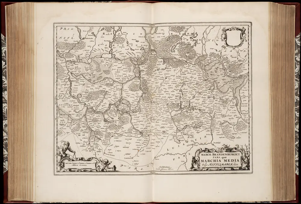
March. Brandenburgici pars, quae Marchia Media vulgo Mittelmarck audit
1662
Joan Blaeu 1597/98-1673
1:400k