Cataloged map
Messtischblatt 1597 : Hoya, 1936 Hoya


Full title:Messtischblatt 1597 : Hoya, 1936 Hoya
Depicted:1936
Pubdate:1936
Physical Size:20 x 30 cm
Map scale:1:250 000
Messtischblatt 1597 : Hoya, 1936 Hoya
1936
1:250k
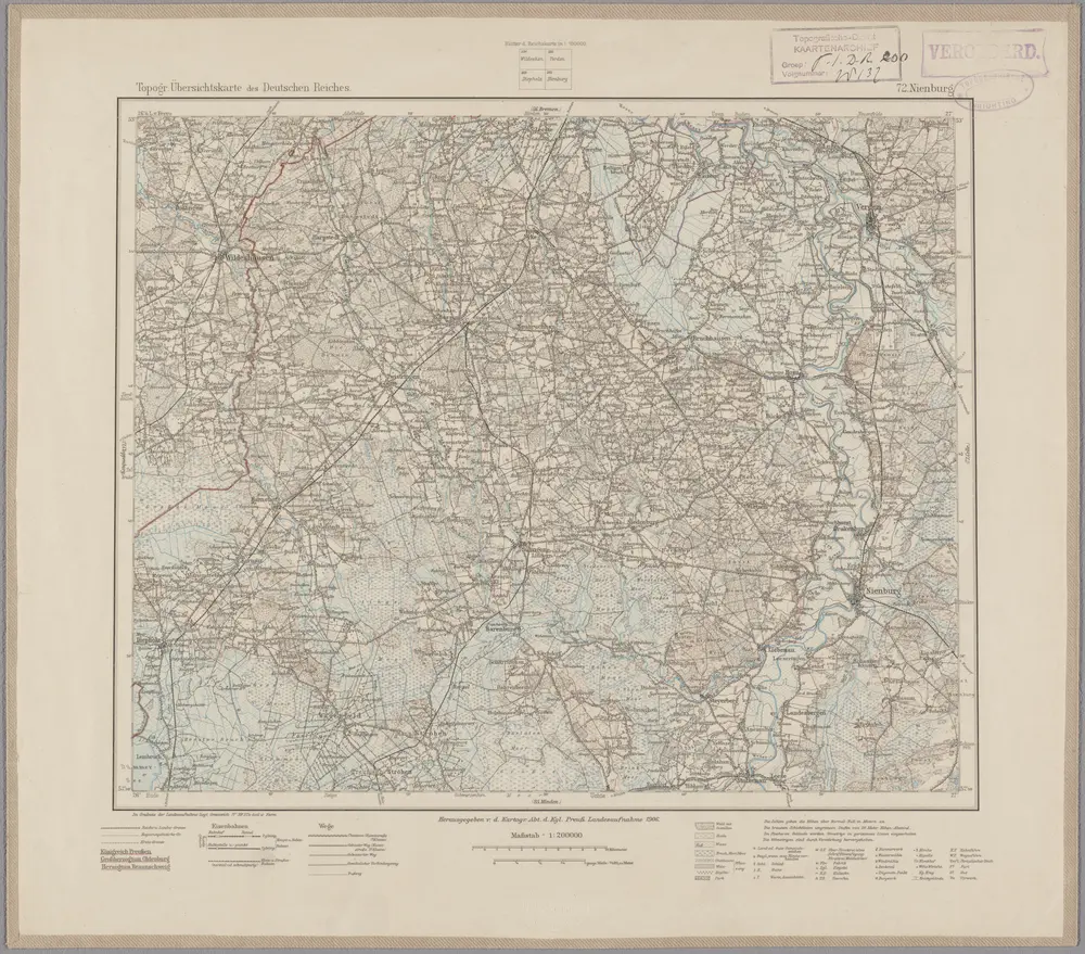
72. Nienburg, uit: Topographische Uebersichtskarte des Deutschen Reiches / herausgegeben v. d. Kartogr. Abt. d. Königl. Preuß. Landesaufnahme
1899
Königlich Preußische Landesaufnahme. Kartographische Abtheilung
1:200k
Meßtischblatt 1667 : Bücken. Flecken, 1934
1934
1:250k
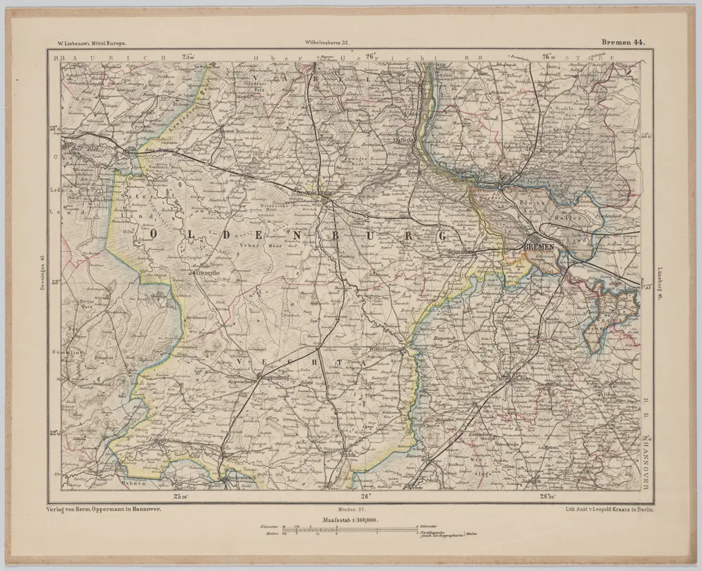
Bremen 44, uit: [W. Liebenow's Special-Karte von Mittel-Europa]
1870
Johannes Wilhelm Liebenow 1822-1897
1:300k
n/a
1791
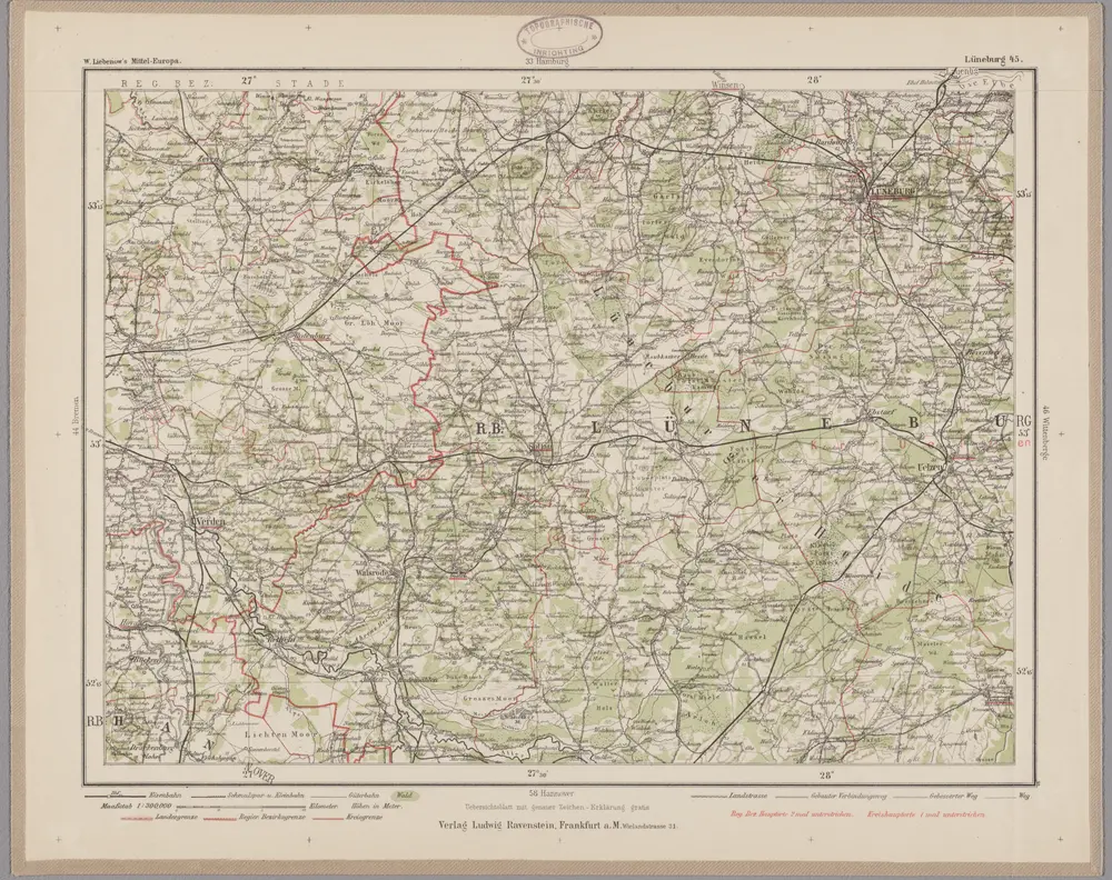
Lüneburg 45, uit: Special-Karte von Mittel-Europa / nach amtlichen Quellen bearbeitet von W. Liebenow
1899
Johannes Wilhelm Liebenow 1822-1897
1:300k
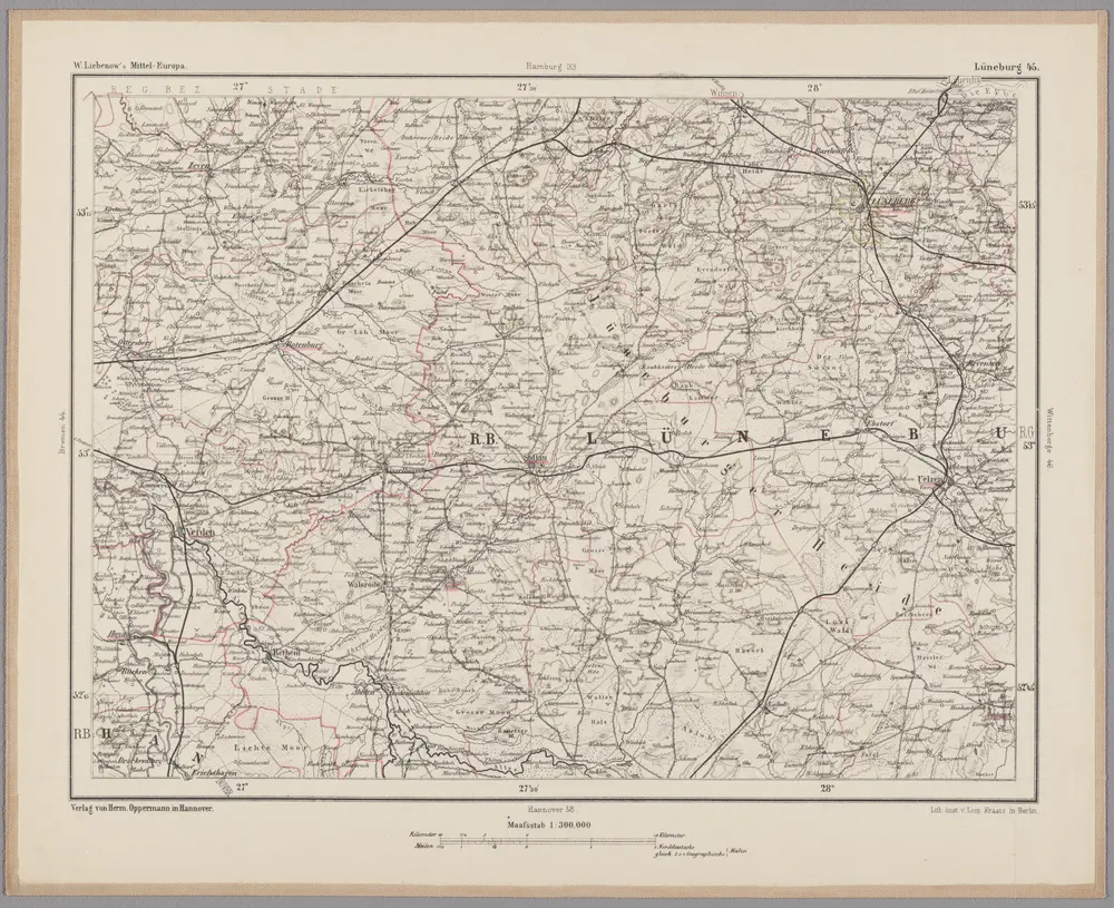
Lüneburg 45, uit: [W. Liebenow's Special-Karte von Mittel-Europa]
1870
Johannes Wilhelm Liebenow 1822-1897
1:300k
n/a
1791
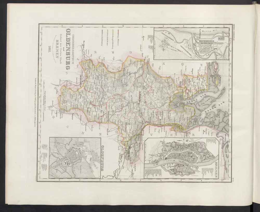
Grossherzogthum Oldenburg und Gebiet der freien Stadt Bremen
1860
Meyer, J.
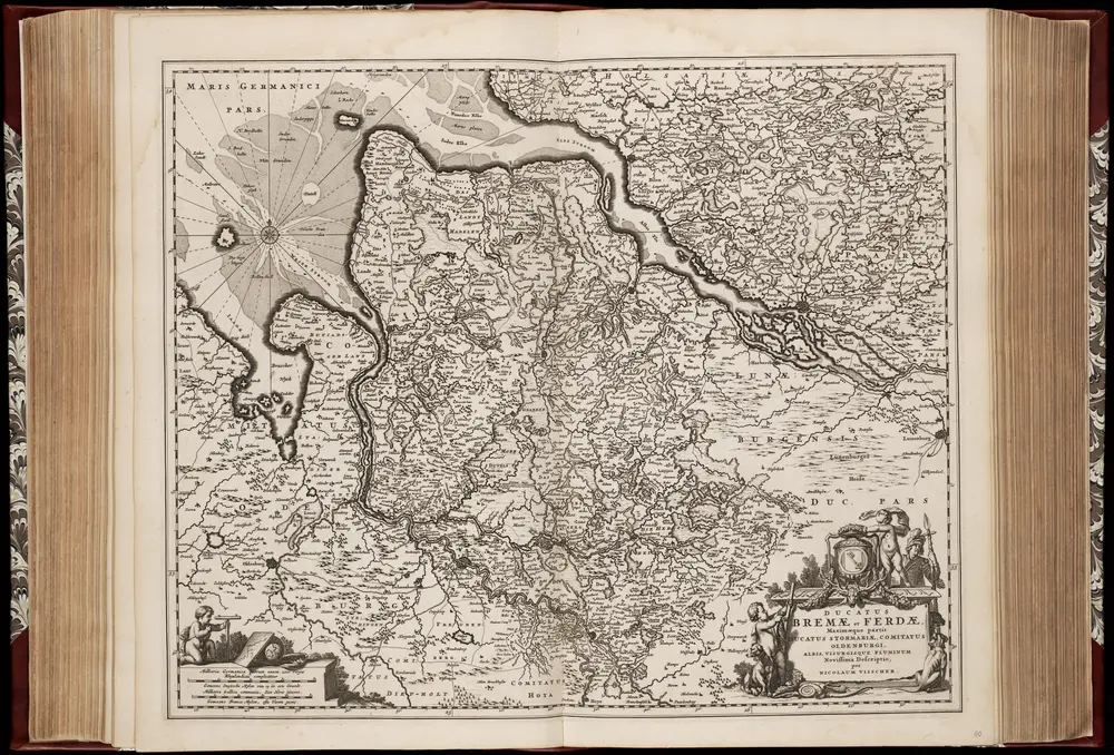
Ducatus Bremae et Ferdae, maximaeque partis ducatus Stormariae, comitatus Oldenburgi, Albis, Visurgisque fluminum novissima descriptio / per Nicolaum Visscher
1670
Nicolaes Jansz Visscher sr 1618-1679
1:350k